Taungdwingyi elevation
Taungdwingyi (Magway, Magway District), Myanmar elevation is 143 meters and Taungdwingyi elevation in feet is 469 ft above sea level [src 1]. Taungdwingyi is a populated place (feature code) with elevation that is 36 meters (118 ft) smaller than average city elevation in Myanmar.
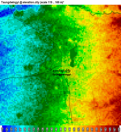
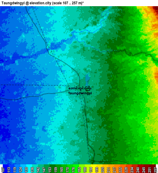
Below is the Elevation map of Taungdwingyi, which displays elevation range with different colors. Scale of the first map is from 119 to 169 m (390 to 554 ft) with average elevation of 140.9 meters (=462 ft) [note 1]
These maps also provides idea of topography and contour of this city, they are displayed at different zoom levels. More info about maps, scale and edge coordinates you can find below images.
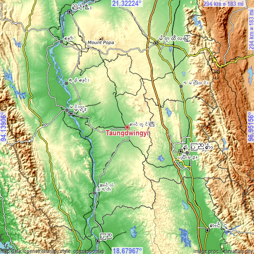
| \ | Map #1 | Map #2 | Topo.Map |
| Scale [m] | 119..169 m | 107..257 m | × |
| Scale [ft] | 390..554 ft | 351..843 ft | × |
| Average | 140.9 m = 462 ft | 144.3 m = 473 ft | × |
| Width | 9.18 km = 5.7 mi | 18.37 km = 11.4 mi | 293.8 km = 182.6 mi |
| Height | 9.18 km = 5.7 mi | 18.37 km = 11.4 mi | 293.8 km = 182.6 mi |
| ↑Max Latitude | 20.047788° | 20.089065° | 21.32224° |
| Latitude at center | 20.0065° | 20.0065° | 20.0065° |
| ↓Min Latitude | 19.965201° | 19.923892° | 18.67967° |
| ← Min Longitude | 95.501365° | 95.457419° | 94.13906° |
| Longitude center | 95.54531° | 95.54531° | 95.54531° |
| →Max Longitude | 95.589255° | 95.633201° | 96.95156° |
Nearby cities:
Cities around Taungdwingyi sort by population:
• Nay Pyi Taw elevation 122 m
67.7 km,  115°
115°
• Meiktila 244 m
102.2 km,  18°
18°
• Pyay 32 m
135.7 km,  194°
194°
• Yenangyaung 56 m
86.9 km,  305°
305°
• Taungoo 56 m
150.6 km,  141°
141°
• Thayetmyo 47 m
85.2 km,  206°
206°
• Pyinmana 101 m
75.4 km,  113°
113°
• Magway 60 m
65.9 km,  283°
283°
• Chauk 59 m
124.9 km,  322°
322°
• Yamethin 203 m
77.9 km,  52°
52°
• Myaydo 48 m
78.9 km, 205°
• Minbu 49 m
72.5 km,  285°
285°
Multilingual:
 En español:
Taungdwingyi elevación 143 m.
 En France:
Taungdwingyi élévation 143 m.
 Auf Deutsch:
Taungdwingyi höhe über dem Meeresspiegel ist 143 m.

Sources and notes:
- [note 1] Map square and city borders are not equal. Map elevation data is calculated only from area inside that square.
- [src 1] Elevation data from geonames database provided with same terms of usage.
- [src 2] The elevation map of Taungdwingyi is generated using elevation data from NASA's 3 arcsec (90m) resolution SRTM data.
- [src 3] Base (background) map © OpenStreetMap contributors tiles are generated by Geofabrik and OpenTopoMap.
Copyright & License:
This Taungdwingyi Elevation Map is licensed under CC BY-SA. You may reuse any part from this page, if you give a proper credit by linking to this URL:
 More info on terms of use page.