Goundam elevation
Goundam (Tombouctou), Mali elevation is 259 meters and Goundam elevation in feet is 850 ft above sea level [src 1]. Goundam is a seat of a second-order administrative division (feature code) with elevation that is 49 meters (161 ft) smaller than average city elevation in Mali.
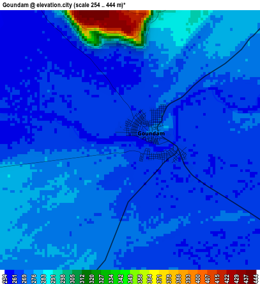
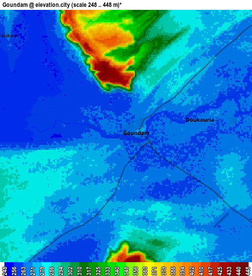
Below is the Elevation map of Goundam, which displays elevation range with different colors. Scale of the first map is from 254 to 444 m (833 to 1457 ft) with average elevation of 271.8 meters (=892 ft) [note 1]
These maps also provides idea of topography and contour of this city, they are displayed at different zoom levels. More info about maps, scale and edge coordinates you can find below images.
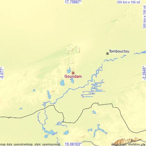
| \ | Map #1 | Map #2 | Topo.Map |
| Scale [m] | 254..444 m | 248..448 m | × |
| Scale [ft] | 833..1457 ft | 814..1470 ft | × |
| Average | 271.8 m = 892 ft | 279.5 m = 917 ft | × |
| Width | 9.37 km = 5.8 mi | 18.75 km = 11.7 mi | 299.9 km = 186.3 mi |
| Height | 9.37 km = 5.8 mi | 18.75 km = 11.7 mi | 300 km = 186.4 mi |
| ↑Max Latitude | 16.45668° | 16.49882° | 17.75867° |
| Latitude at center | 16.41453° | 16.41453° | 16.41453° |
| ↓Min Latitude | 16.372371° | 16.330203° | 15.06103° |
| ← Min Longitude | -3.714695° | -3.758641° | -5.077° |
| Longitude center | -3.67075° | -3.67075° | -3.67075° |
| →Max Longitude | -3.626805° | -3.582859° | -2.2645° |
Nearby cities:
Cities around Goundam sort by population:
• Mopti elevation 268 m
221.5 km,  194°
194°
• Timbuktu 274 m
81.2 km,  60°
60°
• Douentza 303 m
175 km,  153°
153°
• Ténenkou 273 m
255.3 km,  211°
211°
• Niafunké 269 m
63.6 km, 212°
• Bandiagara 388 m
229.6 km,  178°
178°
• Araouane 285 m
277.3 km,  3°
3°
• Koro 260 m
269 km,  166°
166°
• Bankass 301 m
260.4 km, 176°
• Gourma Rharous 263 m
193.2 km,  74°
74°
• Youwarou 268 m
132.4 km, 208°
• Diré 272 m
33.7 km,  121°
121°
Multilingual:
 En español:
Goundam elevación 259 m.
 En France:
Goundam élévation 259 m.


Sources and notes:
- [note 1] Map square and city borders are not equal. Map elevation data is calculated only from area inside that square.
- [src 1] Elevation data from geonames database provided with same terms of usage.
- [src 2] The elevation map of Goundam is generated using elevation data from NASA's 3 arcsec (90m) resolution SRTM data.
- [src 3] Base (background) map © OpenStreetMap contributors tiles are generated by Geofabrik and OpenTopoMap.
Copyright & License:
This Goundam Elevation Map is licensed under CC BY-SA. You may reuse any part from this page, if you give a proper credit by linking to this URL:
 More info on terms of use page.