Kolondiéba elevation
Kolondiéba (Sikasso), Mali elevation is 332 meters and Kolondiéba elevation in feet is 1089 ft above sea level [src 1]. Kolondiéba is a seat of a second-order administrative division (feature code) with elevation that is 24 meters (79 ft) bigger than average city elevation in Mali.
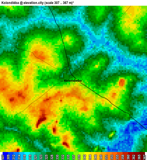
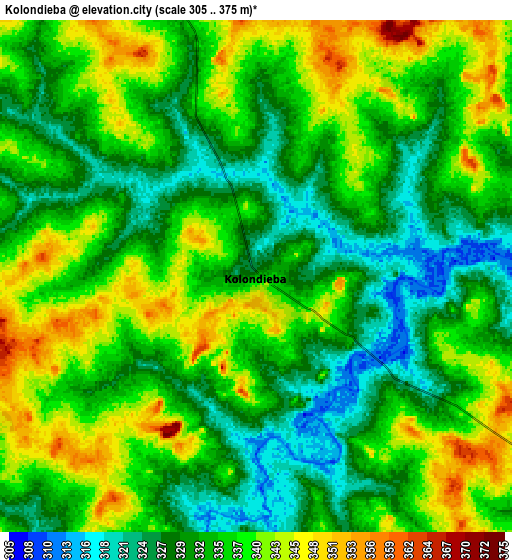
Below is the Elevation map of Kolondiéba, which displays elevation range with different colors. Scale of the first map is from 307 to 367 m (1007 to 1204 ft) with average elevation of 331.5 meters (=1088 ft) [note 1]
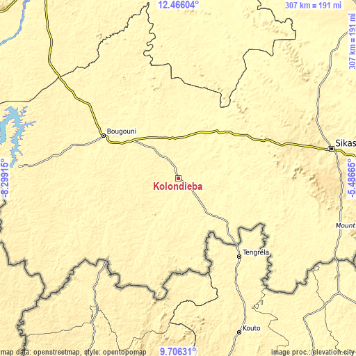
These maps also provides idea of topography and contour of this city, they are displayed at different zoom levels. More info about maps, scale and edge coordinates you can find below images.
| \ | Map #1 | Map #2 | Topo.Map |
| Scale [m] | 307..367 m | 305..375 m | × |
| Scale [ft] | 1007..1204 ft | 1001..1230 ft | × |
| Average | 331.5 m = 1088 ft | 334.8 m = 1098 ft | × |
| Width | 9.59 km = 6 mi | 19.18 km = 11.9 mi | 306.9 km = 190.7 mi |
| Height | 9.59 km = 6 mi | 19.18 km = 11.9 mi | 306.9 km = 190.7 mi |
| ↑Max Latitude | 11.132552° | 11.175667° | 12.46604° |
| Latitude at center | 11.08943° | 11.08943° | 11.08943° |
| ↓Min Latitude | 11.046302° | 11.003168° | 9.70631° |
| ← Min Longitude | -6.936845° | -6.980791° | -8.29915° |
| Longitude center | -6.8929° | -6.8929° | -6.8929° |
| →Max Longitude | -6.848955° | -6.805009° | -5.48665° |
Nearby cities:
Cities around Kolondiéba sort by population:
• Bamako elevation 338 m
211.2 km,  325°
325°
• Sikasso 368 m
136.1 km,  79°
79°
• Koutiala 351 m
212.5 km,  47°
47°
• Bougouni 349 m
74 km,  299°
299°
• Koulikoro 320 m
210.1 km,  339°
339°
• Kangaba 343 m
190.7 km, 299°
• Ntossoni 325 m
201.5 km,  37°
37°
• Barouéli 314 m
221.1 km,  1°
1°
• Figuira-Toma 339 m
185.1 km, 299°
• Dioila 305 m
155.3 km, 4°
• Yanfolila 363 m
137.5 km,  274°
274°
• Kadiolo 345 m
136.8 km,  115°
115°
Multilingual:
 En español:
Kolondiéba elevación 332 m.
 En France:
Kolondiéba élévation 332 m.
 Auf Deutsch:
Kolondiéba höhe über dem Meeresspiegel ist 332 m.

Sources and notes:
- [note 1] Map square and city borders are not equal. Map elevation data is calculated only from area inside that square.
- [src 1] Elevation data from geonames database provided with same terms of usage.
- [src 2] The elevation map of Kolondiéba is generated using elevation data from NASA's 3 arcsec (90m) resolution SRTM data.
- [src 3] Base (background) map © OpenStreetMap contributors tiles are generated by Geofabrik and OpenTopoMap.
Copyright & License:
This Kolondiéba Elevation Map is licensed under CC BY-SA. You may reuse any part from this page, if you give a proper credit by linking to this URL:
 More info on terms of use page.