Ntossoni elevation
Ntossoni (Sikasso, Koutiala Cercle), Mali elevation is 325 meters and Ntossoni elevation in feet is 1066 ft above sea level [src 1]. Ntossoni is a populated place (feature code) with elevation that is 17 meters (56 ft) bigger than average city elevation in Mali.
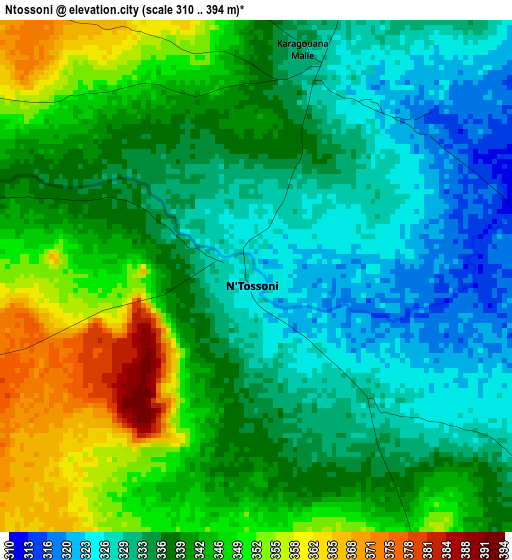
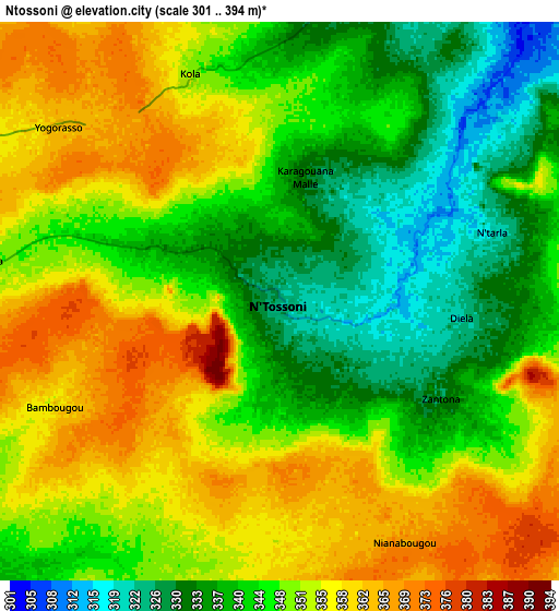
Below is the Elevation map of Ntossoni, which displays elevation range with different colors. Scale of the first map is from 310 to 394 m (1017 to 1293 ft) with average elevation of 339.1 meters (=1113 ft) [note 1]
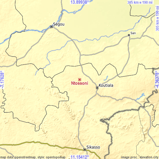
These maps also provides idea of topography and contour of this city, they are displayed at different zoom levels. More info about maps, scale and edge coordinates you can find below images.
| \ | Map #1 | Map #2 | Topo.Map |
| Scale [m] | 310..394 m | 301..394 m | × |
| Scale [ft] | 1017..1293 ft | 988..1293 ft | × |
| Average | 339.1 m = 1113 ft | 347.7 m = 1141 ft | × |
| Width | 9.54 km = 5.9 mi | 19.08 km = 11.9 mi | 305.2 km = 189.6 mi |
| Height | 9.54 km = 5.9 mi | 19.08 km = 11.9 mi | 305.3 km = 189.7 mi |
| ↑Max Latitude | 12.573295° | 12.616183° | 13.89938° |
| Latitude at center | 12.5304° | 12.5304° | 12.5304° |
| ↓Min Latitude | 12.487498° | 12.444589° | 11.15412° |
| ← Min Longitude | -5.813975° | -5.857921° | -7.17628° |
| Longitude center | -5.77003° | -5.77003° | -5.77003° |
| →Max Longitude | -5.726085° | -5.682139° | -4.36378° |
Nearby cities:
Cities around Ntossoni sort by population:
• Sikasso elevation 368 m
135.3 km,  175°
175°
• Koutiala 351 m
36.6 km,  114°
114°
• Ségou 288 m
111.2 km,  334°
334°
• Markala 292 m
134.2 km,  346°
346°
• San 285 m
127.9 km,  47°
47°
• Yorosso 418 m
109.5 km,  100°
100°
• Kinmparana 306 m
98.1 km,  69°
69°
• Tominian 301 m
152.8 km,  56°
56°
• Barouéli 314 m
130.1 km,  297°
297°
• Dioila 305 m
111 km,  267°
267°
• Leleni 341 m
59.1 km, 105°
• Bla 290 m
46.7 km,  1°
1°
Multilingual:
 En español:
Ntossoni elevación 325 m.
 En France:
Ntossoni élévation 325 m.
 Auf Deutsch:
Ntossoni höhe über dem Meeresspiegel ist 325 m.

Sources and notes:
- [note 1] Map square and city borders are not equal. Map elevation data is calculated only from area inside that square.
- [src 1] Elevation data from geonames database provided with same terms of usage.
- [src 2] The elevation map of Ntossoni is generated using elevation data from NASA's 3 arcsec (90m) resolution SRTM data.
- [src 3] Base (background) map © OpenStreetMap contributors tiles are generated by Geofabrik and OpenTopoMap.
Copyright & License:
This Ntossoni Elevation Map is licensed under CC BY-SA. You may reuse any part from this page, if you give a proper credit by linking to this URL:
 More info on terms of use page.