Ségou elevation
Ségou, Mali elevation is 288 meters and Ségou elevation in feet is 945 ft above sea level [src 1]. Ségou is a seat of a first-order administrative division (feature code) with elevation that is 20 meters (66 ft) smaller than average city elevation in Mali.
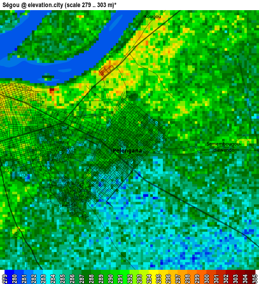
Below is the Elevation map of Ségou, which displays elevation range with different colors. Scale of the first map is from 279 to 303 m (915 to 994 ft) with average elevation of 287.1 meters (=942 ft) [note 1]
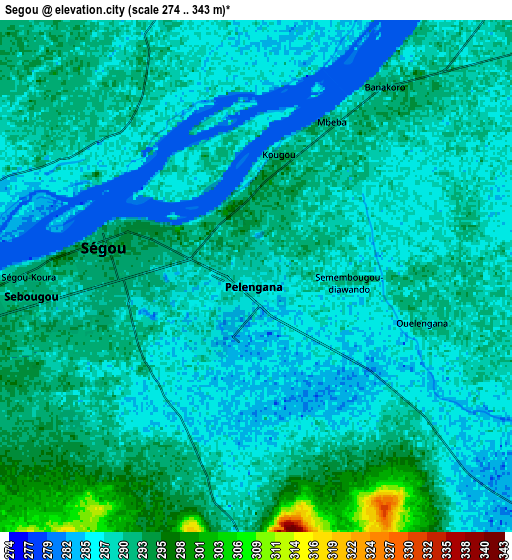
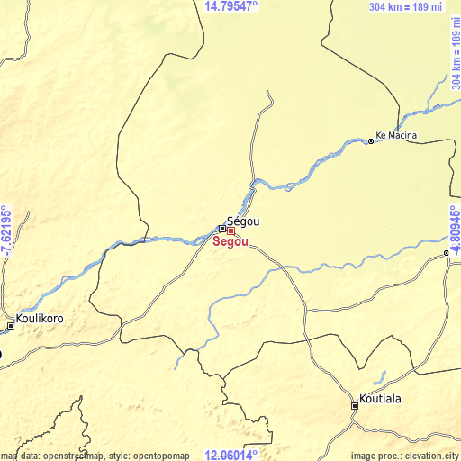
These maps also provides idea of topography and contour of this city, they are displayed at different zoom levels. More info about maps, scale and edge coordinates you can find below images.
| \ | Map #1 | Map #2 | Topo.Map |
| Scale [m] | 279..303 m | 274..343 m | × |
| Scale [ft] | 915..994 ft | 899..1125 ft | × |
| Average | 287.1 m = 942 ft | 289 m = 948 ft | × |
| Width | 9.51 km = 5.9 mi | 19.01 km = 11.8 mi | 304.1 km = 189 mi |
| Height | 9.51 km = 5.9 mi | 19.01 km = 11.8 mi | 304.2 km = 189 mi |
| ↑Max Latitude | 13.474439° | 13.517171° | 14.79547° |
| Latitude at center | 13.4317° | 13.4317° | 13.4317° |
| ↓Min Latitude | 13.388953° | 13.346198° | 12.06014° |
| ← Min Longitude | -6.259645° | -6.303591° | -7.62195° |
| Longitude center | -6.2157° | -6.2157° | -6.2157° |
| →Max Longitude | -6.171755° | -6.127809° | -4.80945° |
Nearby cities:
Cities around Ségou sort by population:
• Koutiala elevation 351 m
141.4 km,  144°
144°
• Markala 292 m
34.1 km,  28°
28°
• Banamba 378 m
133.9 km,  275°
275°
• San 285 m
143.5 km,  95°
95°
• Ké-Macina 283 m
110 km,  57°
57°
• Ntossoni 325 m
111.2 km,  154°
154°
• Sokolo 274 m
145 km,  3°
3°
• Dioila 305 m
122.6 km,  210°
210°
• Niono 290 m
94.4 km,  14°
14°
• Séguéla 288 m
93.8 km,  323°
323°
• Barouéli 314 m
77.4 km,  239°
239°
• Bla 290 m
72.8 km, 137°
Multilingual:
 En español:
Segú elevación 288 m.
 En France:
Ségou élévation 288 m.


Sources and notes:
- [note 1] Map square and city borders are not equal. Map elevation data is calculated only from area inside that square.
- [src 1] Elevation data from geonames database provided with same terms of usage.
- [src 2] The elevation map of Ségou is generated using elevation data from NASA's 3 arcsec (90m) resolution SRTM data.
- [src 3] Base (background) map © OpenStreetMap contributors tiles are generated by Geofabrik and OpenTopoMap.
Copyright & License:
This Ségou Elevation Map is licensed under CC BY-SA. You may reuse any part from this page, if you give a proper credit by linking to this URL:
 More info on terms of use page.