Delogožda elevation
Delogožda (Struga), North Macedonia elevation is 773 meters and Delogožda elevation in feet is 2536 ft above sea level [src 1]. Delogožda is a populated place (feature code) with elevation that is 274 meters (899 ft) bigger than average city elevation in North Macedonia.
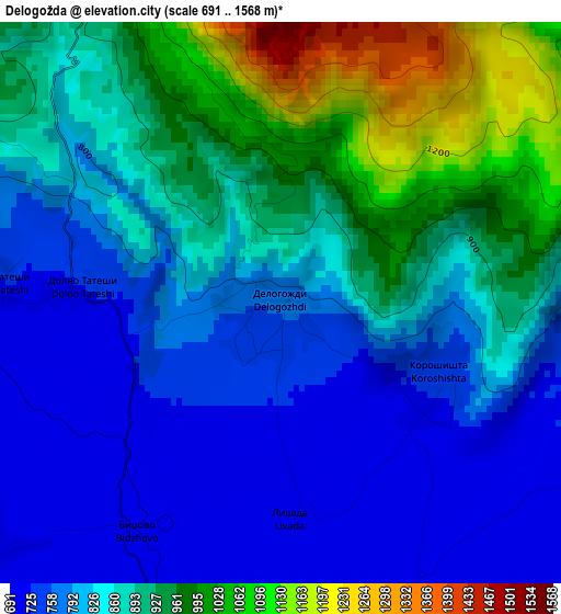
Below is the Elevation map of Delogožda, which displays elevation range with different colors. Scale of the first map is from 691 to 1568 m (2267 to 5144 ft) with average elevation of 861.9 meters (=2828 ft) [note 1]
These maps also provides idea of topography and contour of this city, they are displayed at different zoom levels. More info about maps, scale and edge coordinates you can find below images.
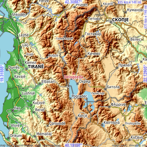
| \ | Map #1 | Map #2 | Topo.Map |
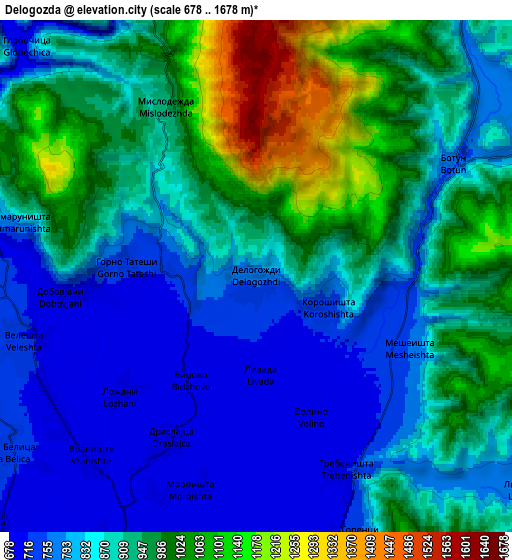
| Scale [m] | 691..1568 m | 678..1678 m | × |
| Scale [ft] | 2267..5144 ft | 2224..5505 ft | × |
| Average | 861.9 m = 2828 ft | 893.1 m = 2930 ft | × |
| Width | 7.35 km = 4.6 mi | 14.69 km = 9.1 mi | 235.1 km = 146.1 mi |
| Height | 7.35 km = 4.6 mi | 14.69 km = 9.1 mi | 235.1 km = 146.1 mi |
| ↑Max Latitude | 41.290308° | 41.323319° | 42.30587° |
| Latitude at center | 41.25728° | 41.25728° | 41.25728° |
| ↓Min Latitude | 41.224235° | 41.191174° | 40.19158° |
| ← Min Longitude | 20.677855° | 20.633909° | 19.31555° |
| Longitude center | 20.7218° | 20.7218° | 20.7218° |
| →Max Longitude | 20.765745° | 20.809691° | 22.12805° |
Nearby cities:
Cities around Delogožda sort by population:
• Ohrid elevation 701 m
17 km,  156°
156°
• Struga 696 m
9.6 km,  202°
202°
• Labunista 865 m
10.6 km,  276°
276°
• Velesta 716 m
6.8 km,  254°
254°
• Radolista 741 m
13.2 km,  218°
218°
• Belčišta 770 m
10.4 km,  60°
60°
• Oktisi 796 m
10 km, 253°
• Mešeišta 757 m
4.9 km,  115°
115°
• Vevčani 867 m
10.9 km,  260°
260°
• Mislesevo 695 m
8.1 km,  187°
187°
• Lukovo 681 m
14.4 km,  317°
317°
• Kosel 747 m
13.2 km,  134°
134°
Multilingual:
 En español:
Delogožda elevación 773 m.
 En France:
Delogožda élévation 773 m.
 Auf Deutsch:
Delogožda höhe über dem Meeresspiegel ist 773 m.

Sources and notes:
- [note 1] Map square and city borders are not equal. Map elevation data is calculated only from area inside that square.
- [src 1] Elevation data from geonames database provided with same terms of usage.
- [src 2] The elevation map of Delogožda is generated using elevation data from NASA's 3 arcsec (90m) resolution SRTM data.
- [src 3] Base (background) map © OpenStreetMap contributors tiles are generated by Geofabrik and OpenTopoMap.
Copyright & License:
This Delogožda Elevation Map is licensed under CC BY-SA. You may reuse any part from this page, if you give a proper credit by linking to this URL:
 More info on terms of use page.