Krivogashtani elevation
Krivogashtani, North Macedonia elevation is 607 meters and Krivogashtani elevation in feet is 1991 ft above sea level [src 1]. Krivogashtani is a seat of a first-order administrative division (feature code) with elevation that is 108 meters (354 ft) bigger than average city elevation in North Macedonia.
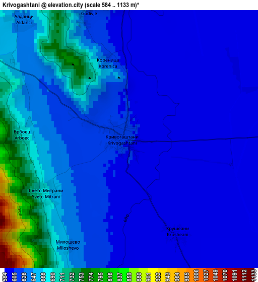
Below is the Elevation map of Krivogashtani, which displays elevation range with different colors. Scale of the first map is from 584 to 1133 m (1916 to 3717 ft) with average elevation of 636.3 meters (=2088 ft) [note 1]
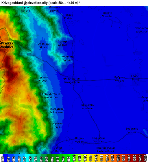
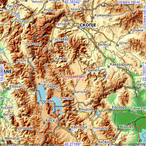
These maps also provides idea of topography and contour of this city, they are displayed at different zoom levels. More info about maps, scale and edge coordinates you can find below images.
| \ | Map #1 | Map #2 | Topo.Map |
| Scale [m] | 584..1133 m | 584..1446 m | × |
| Scale [ft] | 1916..3717 ft | 1916..4744 ft | × |
| Average | 636.3 m = 2088 ft | 732.7 m = 2404 ft | × |
| Width | 7.34 km = 4.6 mi | 14.68 km = 9.1 mi | 234.8 km = 145.9 mi |
| Height | 7.34 km = 4.6 mi | 14.68 km = 9.1 mi | 234.8 km = 145.9 mi |
| ↑Max Latitude | 41.369098° | 41.402069° | 42.38342° |
| Latitude at center | 41.33611° | 41.33611° | 41.33611° |
| ↓Min Latitude | 41.303105° | 41.270084° | 40.27169° |
| ← Min Longitude | 21.289115° | 21.245169° | 19.92681° |
| Longitude center | 21.33306° | 21.33306° | 21.33306° |
| →Max Longitude | 21.377005° | 21.420951° | 22.73931° |
Nearby cities:
Cities around Krivogashtani sort by population:
• Dolneni elevation 620 m
14.2 km,  45°
45°
• Krusevo 1207 m
7.9 km,  297°
297°
• Markov Grad 690 m
16.8 km,  81°
81°
• Topolčani 594 m
14.6 km,  145°
145°
• Demir Hisar 644 m
16.8 km,  220°
220°
• Žitoše 640 m
10 km,  339°
339°
• Sopotnica 663 m
15.6 km,  253°
253°
• Lažani 614 m
11.9 km,  353°
353°
• Dolno Srpci 636 m
18.1 km,  171°
171°
• Bučin 604 m
7.1 km,  191°
191°
• Obršani 597 m
6.5 km,  158°
158°
• Slepče 672 m
17.5 km,  229°
229°
Multilingual:
 En español:
Krivogashtani elevación 607 m.
 En France:
Krivogashtani élévation 607 m.
 Auf Deutsch:
Krivogashtani höhe über dem Meeresspiegel ist 607 m.

Sources and notes:
- [note 1] Map square and city borders are not equal. Map elevation data is calculated only from area inside that square.
- [src 1] Elevation data from geonames database provided with same terms of usage.
- [src 2] The elevation map of Krivogashtani is generated using elevation data from NASA's 3 arcsec (90m) resolution SRTM data.
- [src 3] Base (background) map © OpenStreetMap contributors tiles are generated by Geofabrik and OpenTopoMap.
Copyright & License:
This Krivogashtani Elevation Map is licensed under CC BY-SA. You may reuse any part from this page, if you give a proper credit by linking to this URL:
 More info on terms of use page.