Vrutok elevation
Vrutok (Gostivar), North Macedonia elevation is 677 meters and Vrutok elevation in feet is 2221 ft above sea level [src 1]. Vrutok is a populated place (feature code) with elevation that is 178 meters (584 ft) bigger than average city elevation in North Macedonia.
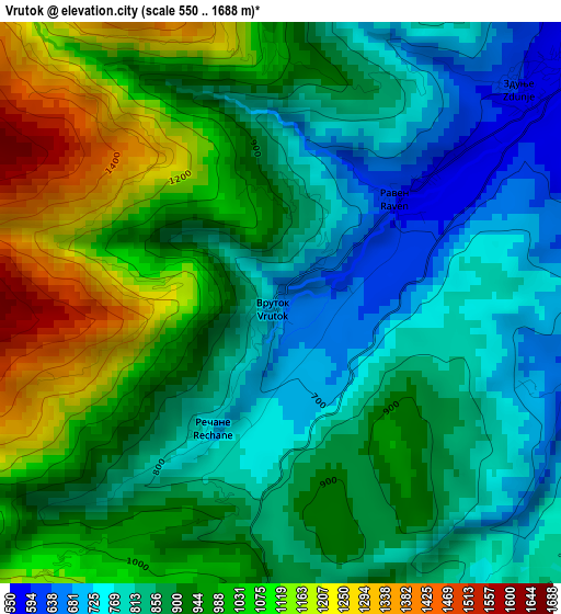
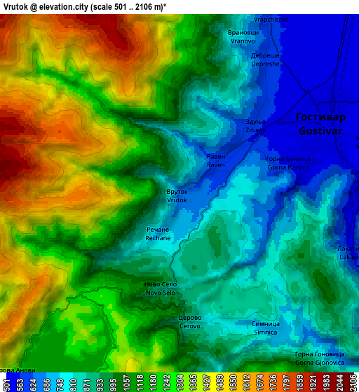
Below is the Elevation map of Vrutok, which displays elevation range with different colors. Scale of the first map is from 550 to 1688 m (1804 to 5538 ft) with average elevation of 920 meters (=3018 ft) [note 1]
These maps also provides idea of topography and contour of this city, they are displayed at different zoom levels. More info about maps, scale and edge coordinates you can find below images.
| \ | Map #1 | Map #2 | Topo.Map |
| Scale [m] | 550..1688 m | 501..2106 m | × |
| Scale [ft] | 1804..5538 ft | 1644..6909 ft | × |
| Average | 920 m = 3018 ft | 1055.4 m = 3463 ft | × |
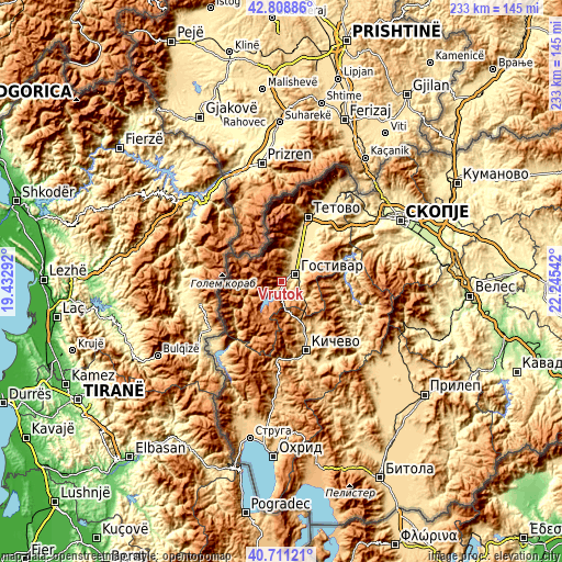
| Width | 7.29 km = 4.5 mi | 14.58 km = 9.1 mi | 233.2 km = 144.9 mi |
| Height | 7.29 km = 4.5 mi | 14.58 km = 9.1 mi | 233.2 km = 144.9 mi |
| ↑Max Latitude | 41.801378° | 41.834129° | 42.80886° |
| Latitude at center | 41.76861° | 41.76861° | 41.76861° |
| ↓Min Latitude | 41.735825° | 41.703024° | 40.71121° |
| ← Min Longitude | 20.795225° | 20.751279° | 19.43292° |
| Longitude center | 20.83917° | 20.83917° | 20.83917° |
| →Max Longitude | 20.883115° | 20.927061° | 22.24542° |
Nearby cities:
Cities around Vrutok sort by population:
• Gostivar elevation 535 m
6.5 km,  61°
61°
• Negotino 576 m
12.7 km,  16°
16°
• Bogovinje 539 m
18.3 km, 19°
• Cegrane 488 m
13.8 km, 55°
• Zajas 748 m
19.7 km,  155°
155°
• Dolna Banjica 540 m
5.9 km,  70°
70°
• Vrapčište 571 m
8.3 km,  27°
27°
• Dobri Dol 555 m
11.5 km, 21°
• Pirok 517 m
16.9 km, 20°
• Gradec 538 m
15.2 km, 20°
• Forino 491 m
11.8 km, 59°
• Srbinovo 655 m
12.1 km,  125°
125°
Multilingual:
 En español:
Vrutok elevación 677 m.
 En France:
Vrutok élévation 677 m.


Sources and notes:
- [note 1] Map square and city borders are not equal. Map elevation data is calculated only from area inside that square.
- [src 1] Elevation data from geonames database provided with same terms of usage.
- [src 2] The elevation map of Vrutok is generated using elevation data from NASA's 3 arcsec (90m) resolution SRTM data.
- [src 3] Base (background) map © OpenStreetMap contributors tiles are generated by Geofabrik and OpenTopoMap.
Copyright & License:
This Vrutok Elevation Map is licensed under CC BY-SA. You may reuse any part from this page, if you give a proper credit by linking to this URL:
 More info on terms of use page.