Zajas elevation
Zajas (Kichevo), North Macedonia elevation is 748 meters and Zajas elevation in feet is 2454 ft above sea level [src 1]. Zajas is a populated place (feature code) with elevation that is 249 meters (817 ft) bigger than average city elevation in North Macedonia.
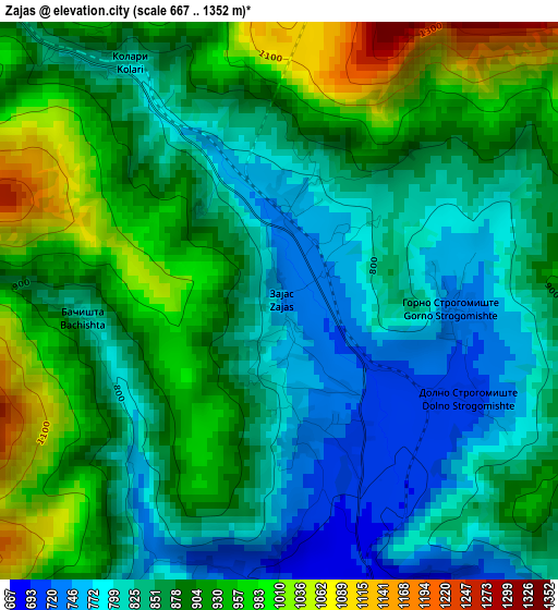
Below is the Elevation map of Zajas, which displays elevation range with different colors. Scale of the first map is from 667 to 1352 m (2188 to 4436 ft) with average elevation of 877.2 meters (=2878 ft) [note 1]
These maps also provides idea of topography and contour of this city, they are displayed at different zoom levels. More info about maps, scale and edge coordinates you can find below images.
| \ | Map #1 | Map #2 | Topo.Map |
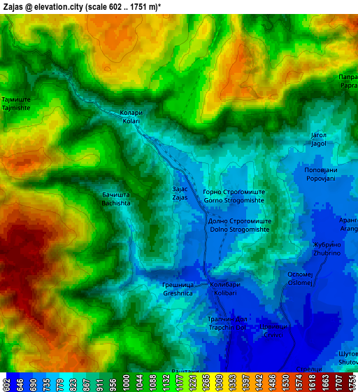
| Scale [m] | 667..1352 m | 602..1751 m | × |
| Scale [ft] | 2188..4436 ft | 1975..5745 ft | × |
| Average | 877.2 m = 2878 ft | 1020.9 m = 3349 ft | × |
| Width | 7.31 km = 4.5 mi | 14.61 km = 9.1 mi | 233.8 km = 145.3 mi |
| Height | 7.31 km = 4.5 mi | 14.61 km = 9.1 mi | 233.8 km = 145.3 mi |
| ↑Max Latitude | 41.64007° | 41.672904° | 42.65011° |
| Latitude at center | 41.60722° | 41.60722° | 41.60722° |
| ↓Min Latitude | 41.574353° | 41.541469° | 40.54719° |
| ← Min Longitude | 20.894385° | 20.850439° | 19.53208° |
| Longitude center | 20.93833° | 20.93833° | 20.93833° |
| →Max Longitude | 20.982275° | 21.026221° | 22.34458° |
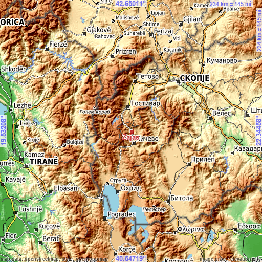
Nearby cities:
Cities around Zajas sort by population:
• Gostivar elevation 535 m
21.1 km,  353°
353°
• Kičevo 615 m
10.7 km,  170°
170°
• Dolna Banjica 540 m
20.1 km, 352°
• Vrutok 677 m
19.7 km,  335°
335°
• Srbinovo 655 m
11.1 km,  8°
8°
• Drugovo 632 m
13.6 km,  184°
184°
• Strelci 677 m
9.3 km,  142°
142°
• Srbica 748 m
8 km,  106°
106°
• Samokov 587 m
19.2 km,  63°
63°
• Tuin 793 m
9 km,  81°
81°
• Vraneštica 661 m
19.5 km,  157°
157°
• Lisičani 597 m
18.9 km,  149°
149°
Multilingual:
 En español:
Zajas elevación 748 m.
 En France:
Zajas élévation 748 m.


Sources and notes:
- [note 1] Map square and city borders are not equal. Map elevation data is calculated only from area inside that square.
- [src 1] Elevation data from geonames database provided with same terms of usage.
- [src 2] The elevation map of Zajas is generated using elevation data from NASA's 3 arcsec (90m) resolution SRTM data.
- [src 3] Base (background) map © OpenStreetMap contributors tiles are generated by Geofabrik and OpenTopoMap.
Copyright & License:
This Zajas Elevation Map is licensed under CC BY-SA. You may reuse any part from this page, if you give a proper credit by linking to this URL:
 More info on terms of use page.