Bar elevation
Bar, Montenegro elevation is 4 meters and Bar elevation in feet is 13 ft above sea level [src 1]. Bar is a seat of a first-order administrative division (feature code) with elevation that is 339 meters (1112 ft) smaller than average city elevation in Montenegro.
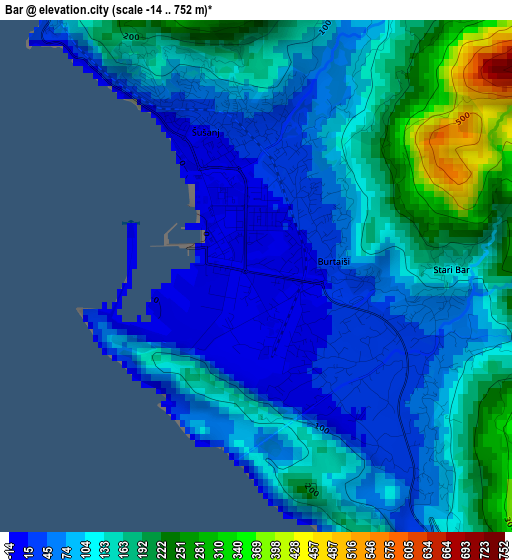
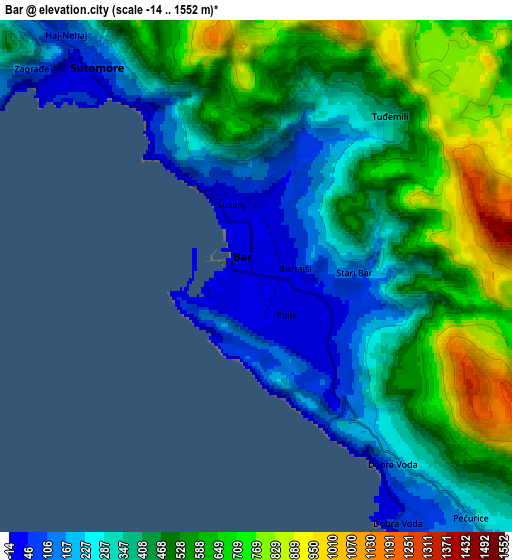
Below is the Elevation map of Bar, which displays elevation range with different colors. Scale of the first map is from -14 to 752 m (-46 to 2467 ft) with average elevation of 120.1 meters (=394 ft) [note 1]
These maps also provides idea of topography and contour of this city, they are displayed at different zoom levels. More info about maps, scale and edge coordinates you can find below images.
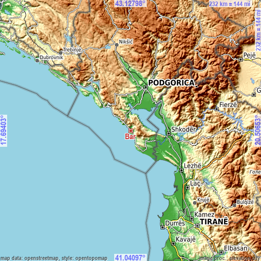
| \ | Map #1 | Map #2 | Topo.Map |
| Scale [m] | -14..752 m | -14..1552 m | × |
| Scale [ft] | -46..2467 ft | -46..5092 ft | × |
| Average | 120.1 m = 394 ft | 444 m = 1457 ft | × |
| Width | 7.25 km = 4.5 mi | 14.5 km = 9 mi | 232.1 km = 144.2 mi |
| Height | 7.25 km = 4.5 mi | 14.5 km = 9 mi | 232 km = 144.2 mi |
| ↑Max Latitude | 42.125662° | 42.158246° | 43.12798° |
| Latitude at center | 42.09306° | 42.09306° | 42.09306° |
| ↓Min Latitude | 42.060442° | 42.027807° | 41.04097° |
| ← Min Longitude | 19.056335° | 19.012389° | 17.69403° |
| Longitude center | 19.10028° | 19.10028° | 19.10028° |
| →Max Longitude | 19.144225° | 19.188171° | 20.50653° |
Nearby cities:
Cities around Bar sort by population:
• Budva elevation 7 m
30.4 km,  315°
315°
• Cetinje 686 m
36.5 km,  335°
335°
• Ulcinj 8 m
20.9 km,  150°
150°
• Tuzi 48 m
35.8 km,  32°
32°
• Šušanj 45 m
2.7 km, 338°
• Sutomore 30 m
7.1 km, 321°
• Mojanovići 11 m
29.4 km,  19°
19°
• Stari Bar 184 m
3 km,  81°
81°
• Petrovac na Moru 9 m
18 km,  313°
313°
• Goričani 11 m
28.1 km, 19°
• Mataguži 16 m
29.3 km, 28°
• Golubovci 12 m
29 km, 21°


Sources and notes:
- [note 1] Map square and city borders are not equal. Map elevation data is calculated only from area inside that square.
- [src 1] Elevation data from geonames database provided with same terms of usage.
- [src 2] The elevation map of Bar is generated using elevation data from NASA's 3 arcsec (90m) resolution SRTM data.
- [src 3] Base (background) map © OpenStreetMap contributors tiles are generated by Geofabrik and OpenTopoMap.
Copyright & License:
This Bar Elevation Map is licensed under CC BY-SA. You may reuse any part from this page, if you give a proper credit by linking to this URL:
 More info on terms of use page.