Cocieri elevation
Cocieri (Dubăsari), Moldova elevation is 89 meters and Cocieri elevation in feet is 292 ft above sea level [src 1]. Cocieri is a seat of a first-order administrative division (feature code) with elevation that is 4 meters (13 ft) smaller than average city elevation in Moldova.
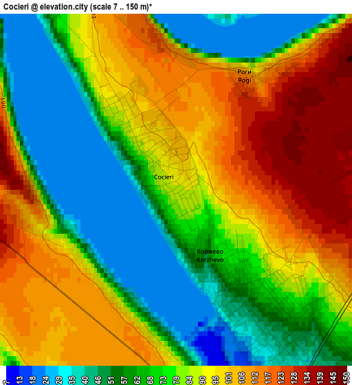
Below is the Elevation map of Cocieri, which displays elevation range with different colors. Scale of the first map is from 7 to 150 m (23 to 492 ft) with average elevation of 80.9 meters (=265 ft) [note 1]
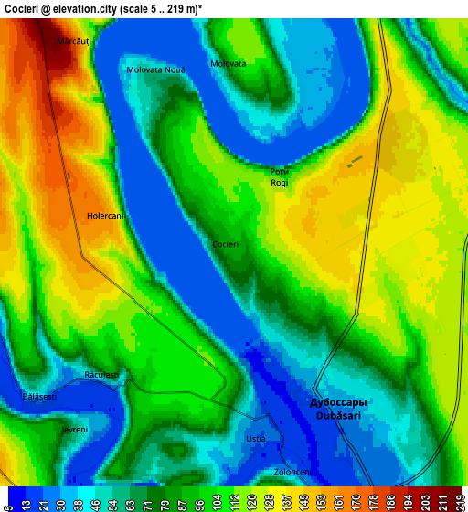
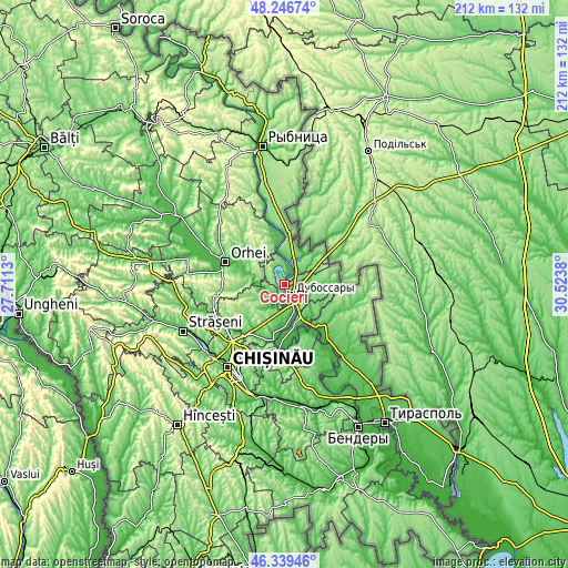
These maps also provides idea of topography and contour of this city, they are displayed at different zoom levels. More info about maps, scale and edge coordinates you can find below images.
| \ | Map #1 | Map #2 | Topo.Map |
| Scale [m] | 7..150 m | 5..219 m | × |
| Scale [ft] | 23..492 ft | 16..719 ft | × |
| Average | 80.9 m = 265 ft | 87.5 m = 287 ft | × |
| Width | 6.63 km = 4.1 mi | 13.25 km = 8.2 mi | 212.1 km = 131.8 mi |
| Height | 6.63 km = 4.1 mi | 13.25 km = 8.2 mi | 212.1 km = 131.8 mi |
| ↑Max Latitude | 47.331493° | 47.361268° | 48.24674° |
| Latitude at center | 47.3017° | 47.3017° | 47.3017° |
| ↓Min Latitude | 47.271891° | 47.242064° | 46.33946° |
| ← Min Longitude | 29.073605° | 29.029659° | 27.7113° |
| Longitude center | 29.11755° | 29.11755° | 29.11755° |
| →Max Longitude | 29.161495° | 29.205441° | 30.5238° |
Nearby cities:
Cities around Cocieri sort by population:
• Chisinau elevation 55 m
38.4 km,  210°
210°
• Orhei 86 m
23.9 km,  292°
292°
• Dubăsari 39 m
5.5 km,  137°
137°
• Hryhoriopol 21 m
21.4 km, 139°
• Cricova 134 m
26.5 km,  226°
226°
• Criuleni 31 m
10.3 km,  162°
162°
• Ciorescu 105 m
25.7 km,  222°
222°
• Stăuceni 188 m
29.6 km, 219°
• Vadul lui Vodă 47 m
23.7 km,  187°
187°
• Vatra 67 m
38.3 km, 228°
• Ustia 25 m
5.2 km,  174°
174°
• Maiac 161 m
21.4 km,  109°
109°
Multilingual:
 En español:
Cocieri elevación 89 m.
 En France:
Cocieri élévation 89 m.


Sources and notes:
- [note 1] Map square and city borders are not equal. Map elevation data is calculated only from area inside that square.
- [src 1] Elevation data from geonames database provided with same terms of usage.
- [src 2] The elevation map of Cocieri is generated using elevation data from NASA's 3 arcsec (90m) resolution SRTM data.
- [src 3] Base (background) map © OpenStreetMap contributors tiles are generated by Geofabrik and OpenTopoMap.
Copyright & License:
This Cocieri Elevation Map is licensed under CC BY-SA. You may reuse any part from this page, if you give a proper credit by linking to this URL:
 More info on terms of use page.