Nālūt elevation
Nālūt, Libya elevation is 637 meters and Nālūt elevation in feet is 2090 ft above sea level [src 1]. Nālūt is a seat of a first-order administrative division (feature code) with elevation that is 405 meters (1329 ft) bigger than average city elevation in Libya.
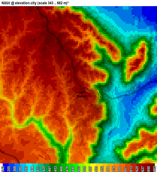
Below is the Elevation map of Nālūt, which displays elevation range with different colors. Scale of the first map is from 343 to 662 m (1125 to 2172 ft) with average elevation of 542.7 meters (=1781 ft) [note 1]
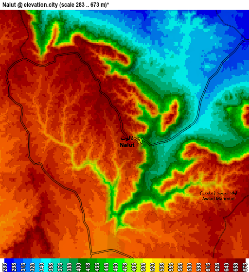
These maps also provides idea of topography and contour of this city, they are displayed at different zoom levels. More info about maps, scale and edge coordinates you can find below images.
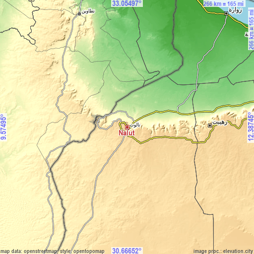
| \ | Map #1 | Map #2 | Topo.Map |
| Scale [m] | 343..662 m | 283..673 m | × |
| Scale [ft] | 1125..2172 ft | 928..2208 ft | × |
| Average | 542.7 m = 1781 ft | 526.6 m = 1728 ft | × |
| Width | 8.3 km = 5.2 mi | 16.6 km = 10.3 mi | 265.6 km = 165 mi |
| Height | 8.3 km = 5.2 mi | 16.6 km = 10.3 mi | 265.6 km = 165 mi |
| ↑Max Latitude | 31.905794° | 31.943092° | 33.05497° |
| Latitude at center | 31.86848° | 31.86848° | 31.86848° |
| ↓Min Latitude | 31.831151° | 31.793808° | 30.66652° |
| ← Min Longitude | 10.937255° | 10.893309° | 9.57495° |
| Longitude center | 10.9812° | 10.9812° | 10.9812° |
| →Max Longitude | 11.025145° | 11.069091° | 12.38745° |
Nearby cities:
Cities around Nālūt sort by population:
• Az Zāwīyah elevation 18 m
191.6 km,  58°
58°
• Zawiya 21 m
191.3 km, 59°
• Al Ajaylat 19 m
164.2 km,  52°
52°
• Şabrātah 17 m
175 km, 54°
• Gharyan 704 m
195.2 km,  80°
80°
• Yafran 681 m
147.6 km, 81°
• Zuwārah 5 m
157 km,  41°
41°
• Zintan 700 m
120.2 km,  86°
86°
• Mizdah 458 m
195.3 km,  103°
103°
• Şurmān 8 m
179.1 km, 56°
• Zalţan 4 m
145.9 km,  34°
34°
• Giado 693 m
99.4 km, 84°
Multilingual:
 En español:
Nālūt elevación 637 m.
 En France:
Nālūt élévation 637 m.


Sources and notes:
- [note 1] Map square and city borders are not equal. Map elevation data is calculated only from area inside that square.
- [src 1] Elevation data from geonames database provided with same terms of usage.
- [src 2] The elevation map of Nālūt is generated using elevation data from NASA's 3 arcsec (90m) resolution SRTM data.
- [src 3] Base (background) map © OpenStreetMap contributors tiles are generated by Geofabrik and OpenTopoMap.
Copyright & License:
This Nālūt Elevation Map is licensed under CC BY-SA. You may reuse any part from this page, if you give a proper credit by linking to this URL:
 More info on terms of use page.