Līvāni elevation
Līvāni, Latvia elevation is 92 meters and Līvāni elevation in feet is 302 ft above sea level [src 1]. Līvāni is a seat of a first-order administrative division (feature code) with elevation that is 26 meters (85 ft) bigger than average city elevation in Latvia.
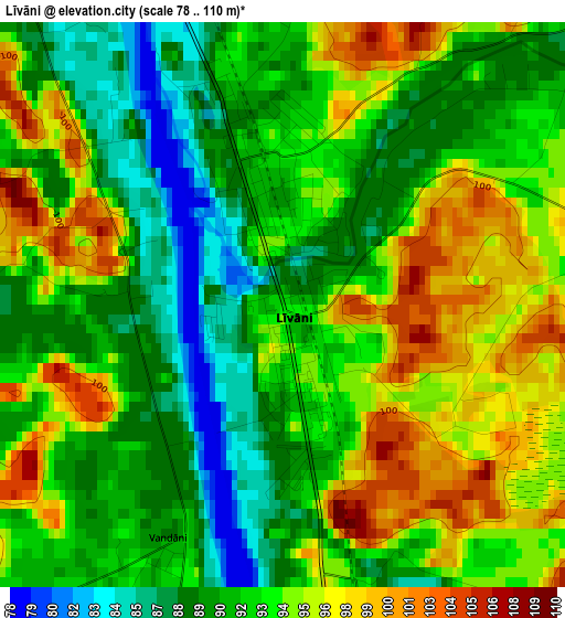
Below is the Elevation map of Līvāni, which displays elevation range with different colors. Scale of the first map is from 78 to 110 m (256 to 361 ft) with average elevation of 92.6 meters (=304 ft) [note 1]
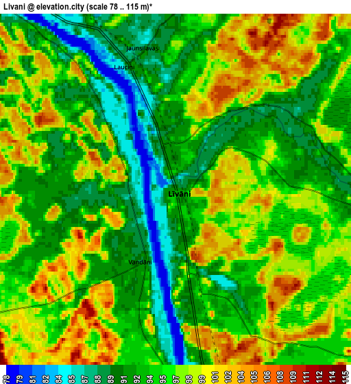
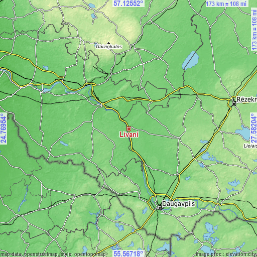
These maps also provides idea of topography and contour of this city, they are displayed at different zoom levels. More info about maps, scale and edge coordinates you can find below images.
| \ | Map #1 | Map #2 | Topo.Map |
| Scale [m] | 78..110 m | 78..115 m | × |
| Scale [ft] | 256..361 ft | 256..377 ft | × |
| Average | 92.6 m = 304 ft | 95 m = 312 ft | × |
| Width | 5.41 km = 3.4 mi | 10.83 km = 6.7 mi | 173.3 km = 107.7 mi |
| Height | 5.41 km = 3.4 mi | 10.83 km = 6.7 mi | 173.3 km = 107.7 mi |
| ↑Max Latitude | 56.37865° | 56.402975° | 57.12552° |
| Latitude at center | 56.35431° | 56.35431° | 56.35431° |
| ↓Min Latitude | 56.329954° | 56.305583° | 55.56718° |
| ← Min Longitude | 26.131845° | 26.087899° | 24.76954° |
| Longitude center | 26.17579° | 26.17579° | 26.17579° |
| →Max Longitude | 26.219735° | 26.263681° | 27.58204° |
Nearby cities:
Cities around Līvāni sort by population:
• Jēkabpils elevation 83 m
25.3 km,  309°
309°
• Preiļi 127 m
34.5 km,  101°
101°
• Krustpils 91 m
26 km, 311°
• Viļāni 116 m
51 km,  64°
64°
• Pļaviņas 75 m
40.3 km,  316°
316°
• Ilūkste 99 m
42.6 km,  169°
169°
• Viesīte 117 m
38.2 km,  268°
268°
• Varakļāni 100 m
45.4 km,  51°
51°
• Aknīste 91 m
34 km,  230°
230°
• Riebiņi 139 m
38.5 km,  91°
91°
• Sala 83 m
30.5 km,  303°
303°
• Vecvārkava 98 m
26.9 km,  130°
130°
Multilingual:
 En español:
Līvāni elevación 92 m.
 En France:
Līvāni élévation 92 m.


Sources and notes:
- [note 1] Map square and city borders are not equal. Map elevation data is calculated only from area inside that square.
- [src 1] Elevation data from geonames database provided with same terms of usage.
- [src 2] The elevation map of Līvāni is generated using elevation data from NASA's 3 arcsec (90m) resolution SRTM data.
- [src 3] Base (background) map © OpenStreetMap contributors tiles are generated by Geofabrik and OpenTopoMap.
Copyright & License:
This Līvāni Elevation Map is licensed under CC BY-SA. You may reuse any part from this page, if you give a proper credit by linking to this URL:
 More info on terms of use page.