Mamer elevation
Mamer (Capellen), Luxembourg elevation is 294 meters and Mamer elevation in feet is 965 ft above sea level [src 1]. Mamer is a seat of a third-order administrative division (feature code) with elevation that is 6 meters (20 ft) bigger than average city elevation in Luxembourg.
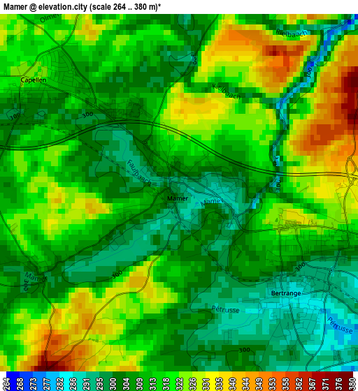
Below is the Elevation map of Mamer, which displays elevation range with different colors. Scale of the first map is from 264 to 380 m (866 to 1247 ft) with average elevation of 313.1 meters (=1027 ft) [note 1]
These maps also provides idea of topography and contour of this city, they are displayed at different zoom levels. More info about maps, scale and edge coordinates you can find below images.
| \ | Map #1 | Map #2 | Topo.Map |
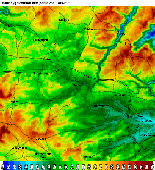
| Scale [m] | 264..380 m | 236..404 m | × |
| Scale [ft] | 866..1247 ft | 774..1325 ft | × |
| Average | 313.1 m = 1027 ft | 323 m = 1060 ft | × |
| Width | 6.33 km = 3.9 mi | 12.66 km = 7.9 mi | 202.6 km = 125.9 mi |
| Height | 6.33 km = 3.9 mi | 12.66 km = 7.9 mi | 202.6 km = 125.9 mi |
| ↑Max Latitude | 49.655957° | 49.684398° | 50.5299° |
| Latitude at center | 49.6275° | 49.6275° | 49.6275° |
| ↓Min Latitude | 49.599026° | 49.570535° | 48.70807° |
| ← Min Longitude | 5.979385° | 5.935439° | 4.61708° |
| Longitude center | 6.02333° | 6.02333° | 6.02333° |
| →Max Longitude | 6.067275° | 6.111221° | 7.42958° |
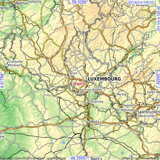
Nearby cities:
Cities around Mamer sort by population:
• Strassen elevation 309 m
3.7 km,  102°
102°
• Bertrange 287 m
2.6 km,  133°
133°
• Bridel 356 m
5.2 km,  52°
52°
• Leudelange 318 m
7.2 km,  155°
155°
• Kehlen 329 m
4.6 km,  11°
11°
• Olm 312 m
3.7 km,  333°
333°
• Capellen 316 m
3 km,  309°
309°
• Schouweiler 331 m
6.9 km,  223°
223°
• Koerich 299 m
7.1 km, 311°
• Garnich 339 m
5.2 km,  256°
256°
• Dippach 361 m
5.3 km,  212°
212°
• Kopstal 261 m
5.4 km,  41°
41°
Multilingual:
 En español:
Mamer elevación 294 m.
 En France:
Mamer élévation 294 m.


Sources and notes:
- [note 1] Map square and city borders are not equal. Map elevation data is calculated only from area inside that square.
- [src 1] Elevation data from geonames database provided with same terms of usage.
- [src 2] The elevation map of Mamer is generated using elevation data from NASA's 3 arcsec (90m) resolution SRTM data.
- [src 3] Base (background) map © OpenStreetMap contributors tiles are generated by Geofabrik and OpenTopoMap.
Copyright & License:
This Mamer Elevation Map is licensed under CC BY-SA. You may reuse any part from this page, if you give a proper credit by linking to this URL:
 More info on terms of use page.