Strassen elevation
Strassen (Luxembourg), Luxembourg elevation is 309 meters and Strassen elevation in feet is 1014 ft above sea level [src 1]. Strassen is a seat of a third-order administrative division (feature code) with elevation that is 21 meters (69 ft) bigger than average city elevation in Luxembourg.
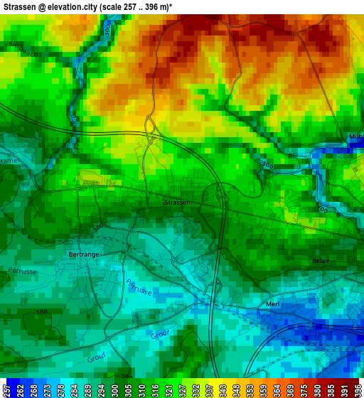
Below is the Elevation map of Strassen, which displays elevation range with different colors. Scale of the first map is from 257 to 396 m (843 to 1299 ft) with average elevation of 312.9 meters (=1027 ft) [note 1]
These maps also provides idea of topography and contour of this city, they are displayed at different zoom levels. More info about maps, scale and edge coordinates you can find below images.
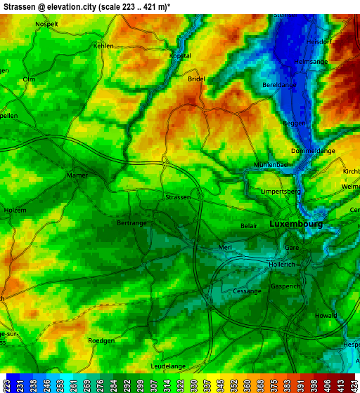
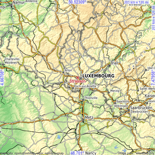
| \ | Map #1 | Map #2 | Topo.Map |
| Scale [m] | 257..396 m | 223..421 m | × |
| Scale [ft] | 843..1299 ft | 732..1381 ft | × |
| Average | 312.9 m = 1027 ft | 312 m = 1024 ft | × |
| Width | 6.33 km = 3.9 mi | 12.66 km = 7.9 mi | 202.6 km = 125.9 mi |
| Height | 6.33 km = 3.9 mi | 12.66 km = 7.9 mi | 202.6 km = 125.9 mi |
| ↑Max Latitude | 49.649022° | 49.677466° | 50.52309° |
| Latitude at center | 49.62056° | 49.62056° | 49.62056° |
| ↓Min Latitude | 49.592082° | 49.563587° | 48.701° |
| ← Min Longitude | 6.029385° | 5.985439° | 4.66708° |
| Longitude center | 6.07333° | 6.07333° | 6.07333° |
| →Max Longitude | 6.117275° | 6.161221° | 7.47958° |
Nearby cities:
Cities around Strassen sort by population:
• Luxembourg elevation 316 m
4.2 km,  103°
103°
• Bertrange 287 m
2 km,  237°
237°
• Mamer 294 m
3.7 km,  282°
282°
• Béreldange 252 m
5 km,  40°
40°
• Kirchberg 333 m
5.5 km,  86°
86°
• Bridel 356 m
3.9 km,  6°
6°
• Helmsange 307 m
6.1 km,  53°
53°
• Leudelange 318 m
5.8 km,  185°
185°
• Kehlen 329 m
6 km,  333°
333°
• Capellen 316 m
6.5 km,  294°
294°
• Walferdange 232 m
6.4 km, 41°
• Kopstal 261 m
4.9 km,  359°
359°
Multilingual:
 En español:
Strassen elevación 309 m.
 En France:
Strassen élévation 309 m.
 Auf Deutsch:
Strassen höhe über dem Meeresspiegel ist 309 m.

Sources and notes:
- [note 1] Map square and city borders are not equal. Map elevation data is calculated only from area inside that square.
- [src 1] Elevation data from geonames database provided with same terms of usage.
- [src 2] The elevation map of Strassen is generated using elevation data from NASA's 3 arcsec (90m) resolution SRTM data.
- [src 3] Base (background) map © OpenStreetMap contributors tiles are generated by Geofabrik and OpenTopoMap.
Copyright & License:
This Strassen Elevation Map is licensed under CC BY-SA. You may reuse any part from this page, if you give a proper credit by linking to this URL:
 More info on terms of use page.