Reckange-sur-Mess elevation
Reckange-sur-Mess (Esch-sur-Alzette), Luxembourg elevation is 319 meters and Reckange-sur-Mess elevation in feet is 1047 ft above sea level [src 1]. Reckange-sur-Mess is a seat of a third-order administrative division (feature code) with elevation that is 31 meters (102 ft) bigger than average city elevation in Luxembourg.
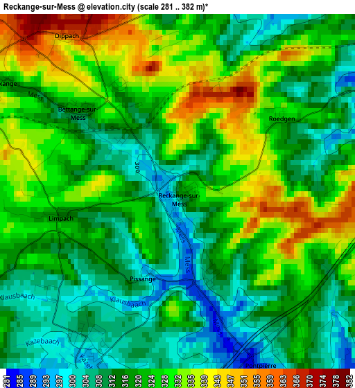
Below is the Elevation map of Reckange-sur-Mess, which displays elevation range with different colors. Scale of the first map is from 281 to 382 m (922 to 1253 ft) with average elevation of 320.9 meters (=1053 ft) [note 1]
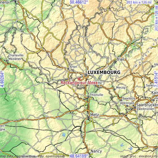
These maps also provides idea of topography and contour of this city, they are displayed at different zoom levels. More info about maps, scale and edge coordinates you can find below images.
| \ | Map #1 | Topo.Map |
| Scale [m] | 281..382 m | × |
| Scale [ft] | 922..1253 ft | × |
| Average | 320.9 m = 1053 ft | × |
| Width | 6.34 km = 3.9 mi | 202.8 km = 126 mi |
| Height | 6.34 km = 3.9 mi | 202.8 km = 126 mi |
| ↑Max Latitude | 49.590995° | 50.46612° |
| Latitude at center | 49.5625° | 49.5625° |
| ↓Min Latitude | 49.533988° | 48.64185° |
| ← Min Longitude | 5.964945° | 4.60264° |
| Longitude center | 6.00889° | 6.00889° |
| →Max Longitude | 6.052835° | 7.41514° |
Nearby cities:
Cities around Reckange-sur-Mess sort by population:
• Schifflange elevation 292 m
6.2 km,  177°
177°
• Bertrange 287 m
6.2 km,  28°
28°
• Mamer 294 m
7.3 km,  8°
8°
• Soleuvre 350 m
6.9 km,  228°
228°
• Bascharage 284 m
7.3 km,  274°
274°
• Mondercange 290 m
3.6 km,  204°
204°
• Sanem 303 m
6 km,  254°
254°
• Leudelange 318 m
4.1 km,  80°
80°
• Bergem 306 m
4.8 km,  150°
150°
• Schouweiler 331 m
4.4 km,  300°
300°
• Pontpierre 295 m
3.3 km, 152°
• Dippach 361 m
3.3 km,  325°
325°
Multilingual:
 En español:
Reckange-sur-Mess elevación 319 m.
 En France:
Reckange-sur-Mess élévation 319 m.
 Auf Deutsch:
Reckingen höhe über dem Meeresspiegel ist 319 m.

Sources and notes:
- [note 1] Map square and city borders are not equal. Map elevation data is calculated only from area inside that square.
- [src 1] Elevation data from geonames database provided with same terms of usage.
- [src 2] The elevation map of Reckange-sur-Mess is generated using elevation data from NASA's 3 arcsec (90m) resolution SRTM data.
- [src 3] Base (background) map © OpenStreetMap contributors tiles are generated by Geofabrik and OpenTopoMap.
Copyright & License:
This Reckange-sur-Mess Elevation Map is licensed under CC BY-SA. You may reuse any part from this page, if you give a proper credit by linking to this URL:
 More info on terms of use page.