Kuršėnai elevation
Kuršėnai (Siauliai, Šiaulių rajonas), Lithuania elevation is 104 meters and Kuršėnai elevation in feet is 341 ft above sea level [src 1]. Kuršėnai is a populated place (feature code) with elevation that is 11 meters (36 ft) bigger than average city elevation in Lithuania.
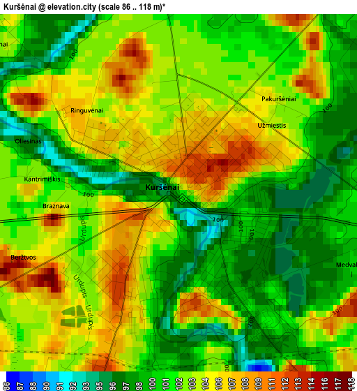
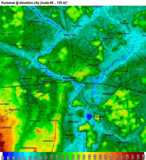
Below is the Elevation map of Kuršėnai, which displays elevation range with different colors. Scale of the first map is from 86 to 118 m (282 to 387 ft) with average elevation of 102.3 meters (=336 ft) [note 1]
These maps also provides idea of topography and contour of this city, they are displayed at different zoom levels. More info about maps, scale and edge coordinates you can find below images.
| \ | Map #1 | Map #2 | Topo.Map |
| Scale [m] | 86..118 m | 86..135 m | × |
| Scale [ft] | 282..387 ft | 282..443 ft | × |
| Average | 102.3 m = 336 ft | 103.3 m = 339 ft | × |
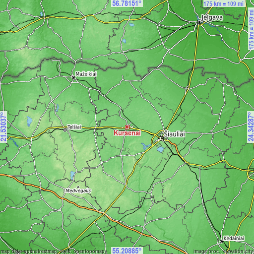
| Width | 5.46 km = 3.4 mi | 10.93 km = 6.8 mi | 174.9 km = 108.7 mi |
| Height | 5.46 km = 3.4 mi | 10.93 km = 6.8 mi | 174.8 km = 108.6 mi |
| ↑Max Latitude | 56.027744° | 56.052293° | 56.78151° |
| Latitude at center | 56.00318° | 56.00318° | 56.00318° |
| ↓Min Latitude | 55.9786° | 55.954005° | 55.20885° |
| ← Min Longitude | 22.892675° | 22.848729° | 21.53037° |
| Longitude center | 22.93662° | 22.93662° | 22.93662° |
| →Max Longitude | 22.980565° | 23.024511° | 24.34287° |
Nearby cities:
Cities around Kuršėnai sort by population:
• Šiauliai elevation 129 m
24.9 km,  108°
108°
• Telsiai 135 m
42.9 km,  266°
266°
• Radviliskis 124 m
42.6 km,  119°
119°
• Naujoji Akmene 79 m
34.9 km,  356°
356°
• Joniškis 50 m
49.6 km,  58°
58°
• Kelmė 131 m
41.5 km,  180°
180°
• Venta 72 m
25.7 km,  324°
324°
• Akmenė 73 m
29.8 km,  337°
337°
• Tytuvėnėliai 120 m
44.7 km,  160°
160°
• Viekšniai 65 m
36.7 km,  314°
314°
• Žagarė 66 m
44.3 km,  26°
26°
• Varniai 160 m
45.5 km,  230°
230°
Multilingual:
 En español:
Kuršėnai elevación 104 m.
 En France:
Kuršėnai élévation 104 m.
 Auf Deutsch:
Kuršėnai höhe über dem Meeresspiegel ist 104 m.

Sources and notes:
- [note 1] Map square and city borders are not equal. Map elevation data is calculated only from area inside that square.
- [src 1] Elevation data from geonames database provided with same terms of usage.
- [src 2] The elevation map of Kuršėnai is generated using elevation data from NASA's 3 arcsec (90m) resolution SRTM data.
- [src 3] Base (background) map © OpenStreetMap contributors tiles are generated by Geofabrik and OpenTopoMap.
Copyright & License:
This Kuršėnai Elevation Map is licensed under CC BY-SA. You may reuse any part from this page, if you give a proper credit by linking to this URL:
 More info on terms of use page.