Raseiniai elevation
Raseiniai (Kaunas), Lithuania elevation is 93 meters and Raseiniai elevation in feet is 305 ft above sea level [src 1]. Raseiniai is a seat of a second-order administrative division (feature code) with elevation that is 0 meters (0 ft) bigger than average city elevation in Lithuania.
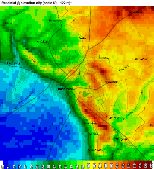
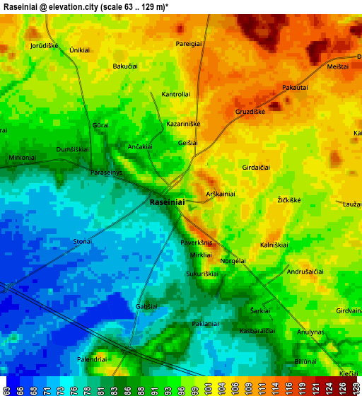
Below is the Elevation map of Raseiniai, which displays elevation range with different colors. Scale of the first map is from 69 to 122 m (226 to 400 ft) with average elevation of 92.6 meters (=304 ft) [note 1]
These maps also provides idea of topography and contour of this city, they are displayed at different zoom levels. More info about maps, scale and edge coordinates you can find below images.
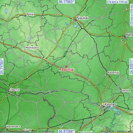
| \ | Map #1 | Map #2 | Topo.Map |
| Scale [m] | 69..122 m | 63..129 m | × |
| Scale [ft] | 226..400 ft | 207..423 ft | × |
| Average | 92.6 m = 304 ft | 92.7 m = 304 ft | × |
| Width | 5.55 km = 3.4 mi | 11.1 km = 6.9 mi | 177.7 km = 110.4 mi |
| Height | 5.55 km = 3.4 mi | 11.1 km = 6.9 mi | 177.7 km = 110.4 mi |
| ↑Max Latitude | 55.404689° | 55.429632° | 56.17063° |
| Latitude at center | 55.37973° | 55.37973° | 55.37973° |
| ↓Min Latitude | 55.354755° | 55.329765° | 54.57269° |
| ← Min Longitude | 23.079915° | 23.035969° | 21.71761° |
| Longitude center | 23.12386° | 23.12386° | 23.12386° |
| →Max Longitude | 23.167805° | 23.211751° | 24.53011° |
Nearby cities:
Cities around Raseiniai sort by population:
• Kėdainiai elevation 39 m
54.7 km,  100°
100°
• Taurage 36 m
54.6 km,  254°
254°
• Radviliskis 124 m
55 km,  27°
27°
• Jurbarkas 18 m
40.8 km,  213°
213°
• Kelmė 131 m
30.3 km,  336°
336°
• Šakiai 50 m
47.7 km,  185°
185°
• Ariogala 80 m
25.9 km,  120°
120°
• Šeduva 96 m
57.2 km,  44°
44°
• Tytuvėnėliai 120 m
27.3 km,  6°
6°
• Vilkija 81 m
47.3 km,  141°
141°
• Būgai 106 m
32.7 km,  276°
276°
• Gelgaudiškis 53 m
34.9 km,  195°
195°
Multilingual:
 En español:
Raseiniai elevación 93 m.
 En France:
Raseiniai élévation 93 m.


Sources and notes:
- [note 1] Map square and city borders are not equal. Map elevation data is calculated only from area inside that square.
- [src 1] Elevation data from geonames database provided with same terms of usage.
- [src 2] The elevation map of Raseiniai is generated using elevation data from NASA's 3 arcsec (90m) resolution SRTM data.
- [src 3] Base (background) map © OpenStreetMap contributors tiles are generated by Geofabrik and OpenTopoMap.
Copyright & License:
This Raseiniai Elevation Map is licensed under CC BY-SA. You may reuse any part from this page, if you give a proper credit by linking to this URL:
 More info on terms of use page.