Aktogay elevation
Aktogay (Karaganda), Kazakhstan elevation is 753 meters and Aktogay elevation in feet is 2470 ft above sea level [src 1]. Aktogay is a populated place (feature code) with elevation that is 395 meters (1296 ft) bigger than average city elevation in Kazakhstan.
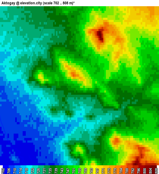
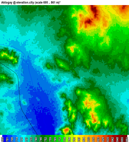
Below is the Elevation map of Aktogay, which displays elevation range with different colors. Scale of the first map is from 702 to 808 m (2303 to 2651 ft) with average elevation of 738.5 meters (=2423 ft) [note 1]
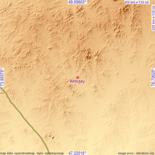
These maps also provides idea of topography and contour of this city, they are displayed at different zoom levels. More info about maps, scale and edge coordinates you can find below images.
| \ | Map #1 | Map #2 | Topo.Map |
| Scale [m] | 702..808 m | 695..861 m | × |
| Scale [ft] | 2303..2651 ft | 2280..2825 ft | × |
| Average | 738.5 m = 2423 ft | 743.1 m = 2438 ft | × |
| Width | 6.52 km = 4.1 mi | 13.04 km = 8.1 mi | 208.6 km = 129.6 mi |
| Height | 6.52 km = 4.1 mi | 13.04 km = 8.1 mi | 208.6 km = 129.6 mi |
| ↑Max Latitude | 48.195972° | 48.225257° | 49.09603° |
| Latitude at center | 48.16667° | 48.16667° | 48.16667° |
| ↓Min Latitude | 48.137352° | 48.108016° | 47.22016° |
| ← Min Longitude | 75.256055° | 75.212109° | 73.89375° |
| Longitude center | 75.3° | 75.3° | 75.3° |
| →Max Longitude | 75.343945° | 75.387891° | 76.70625° |
Nearby cities:
Cities around Aktogay sort by population:
• Balqash elevation 372 m
148.4 km,  188°
188°
• Aktau 765 m
183.8 km,  265°
265°
• Aqadyr 693 m
181.2 km, 273°
• Qarqaraly 849 m
139.1 km,  5°
5°
• Aqshataū 751 m
94.4 km,  257°
257°
• Aksu-Ayuly 729 m
137.3 km,  299°
299°
• Sayaq 593 m
196.4 km,  131°
131°
• Prigorodnoye 678 m
170.9 km, 6°
• Shashūbay 341 m
151.3 km, 187°
• Karabas 340 m
193.8 km,  159°
159°
• Moyynty 575 m
178.8 km,  233°
233°
• Verkhniye Kayrakty 803 m
159.5 km,  291°
291°
Multilingual:
 En español:
Aktogay elevación 753 m.
 En France:
Aktogay élévation 753 m.


Sources and notes:
- [note 1] Map square and city borders are not equal. Map elevation data is calculated only from area inside that square.
- [src 1] Elevation data from geonames database provided with same terms of usage.
- [src 2] The elevation map of Aktogay is generated using elevation data from NASA's 3 arcsec (90m) resolution SRTM data.
- [src 3] Base (background) map © OpenStreetMap contributors tiles are generated by Geofabrik and OpenTopoMap.
Copyright & License:
This Aktogay Elevation Map is licensed under CC BY-SA. You may reuse any part from this page, if you give a proper credit by linking to this URL:
 More info on terms of use page.