Chulakkurgan elevation
Chulakkurgan (South Kazakhstan), Kazakhstan elevation is 472 meters and Chulakkurgan elevation in feet is 1549 ft above sea level [src 1]. Chulakkurgan is a populated place (feature code) with elevation that is 114 meters (374 ft) bigger than average city elevation in Kazakhstan.
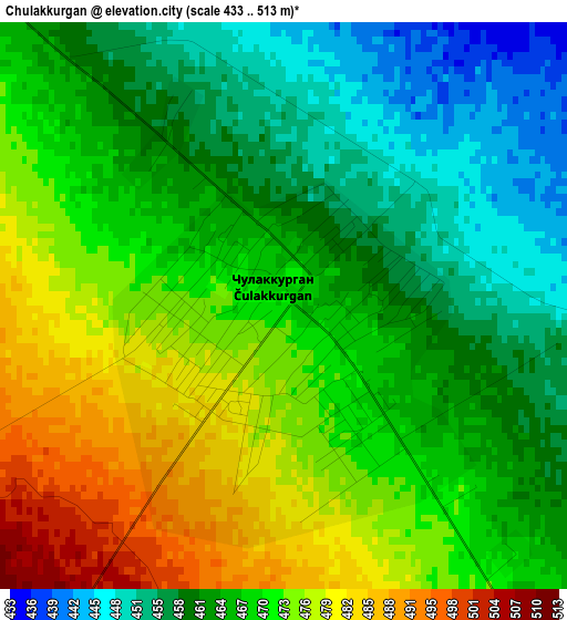
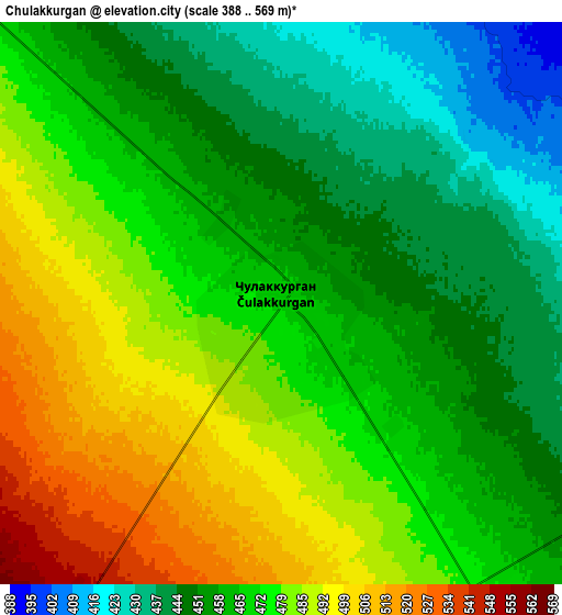
Below is the Elevation map of Chulakkurgan, which displays elevation range with different colors. Scale of the first map is from 433 to 513 m (1421 to 1683 ft) with average elevation of 467.3 meters (=1533 ft) [note 1]
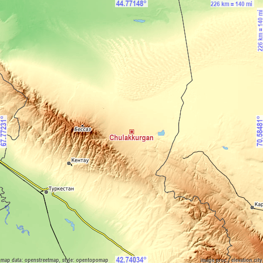
These maps also provides idea of topography and contour of this city, they are displayed at different zoom levels. More info about maps, scale and edge coordinates you can find below images.
| \ | Map #1 | Map #2 | Topo.Map |
| Scale [m] | 433..513 m | 388..569 m | × |
| Scale [ft] | 1421..1683 ft | 1273..1867 ft | × |
| Average | 467.3 m = 1533 ft | 468.4 m = 1537 ft | × |
| Width | 7.06 km = 4.4 mi | 14.12 km = 8.8 mi | 225.8 km = 140.3 mi |
| Height | 7.06 km = 4.4 mi | 14.12 km = 8.8 mi | 225.8 km = 140.3 mi |
| ↑Max Latitude | 43.796258° | 43.82797° | 44.77148° |
| Latitude at center | 43.76453° | 43.76453° | 43.76453° |
| ↓Min Latitude | 43.732785° | 43.701023° | 42.74034° |
| ← Min Longitude | 69.134615° | 69.090669° | 67.77231° |
| Longitude center | 69.17856° | 69.17856° | 69.17856° |
| →Max Longitude | 69.222505° | 69.266451° | 70.58481° |
Nearby cities:
Cities around Chulakkurgan sort by population:
• Turkestan elevation 214 m
91 km,  235°
235°
• Kentau 426 m
60.8 km, 243°
• Karatau 521 m
122.7 km,  122°
122°
• Zhangatas 511 m
50 km, 116°
• Temirlanovka 291 m
129.6 km,  177°
177°
• Kantagi 470 m
54.7 km, 241°
• Chayan 381 m
82.9 km,  168°
168°
• Ashchysay 816 m
32.5 km,  223°
223°
• Shalqīya 235 m
144.3 km,  280°
280°
• Shyghanaq 217 m
135.4 km,  28°
28°
• Bayzhansay 870 m
89.1 km,  138°
138°
• Qogham 195 m
127 km,  214°
214°
Multilingual:
 En español:
Chulakkurgan elevación 472 m.
 En France:
Chulakkurgan élévation 472 m.
 Auf Deutsch:
Chulakkurgan höhe über dem Meeresspiegel ist 472 m.

Sources and notes:
- [note 1] Map square and city borders are not equal. Map elevation data is calculated only from area inside that square.
- [src 1] Elevation data from geonames database provided with same terms of usage.
- [src 2] The elevation map of Chulakkurgan is generated using elevation data from NASA's 3 arcsec (90m) resolution SRTM data.
- [src 3] Base (background) map © OpenStreetMap contributors tiles are generated by Geofabrik and OpenTopoMap.
Copyright & License:
This Chulakkurgan Elevation Map is licensed under CC BY-SA. You may reuse any part from this page, if you give a proper credit by linking to this URL:
 More info on terms of use page.