Moyynkum elevation
Moyynkum (Zhambyl), Kazakhstan elevation is 352 meters and Moyynkum elevation in feet is 1155 ft above sea level [src 1]. Moyynkum is a populated place (feature code) with elevation that is 6 meters (20 ft) smaller than average city elevation in Kazakhstan.
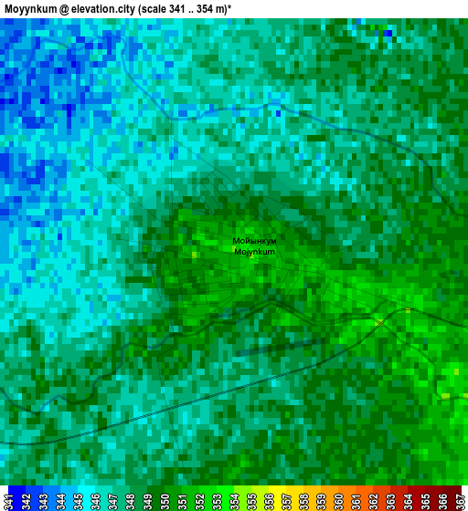
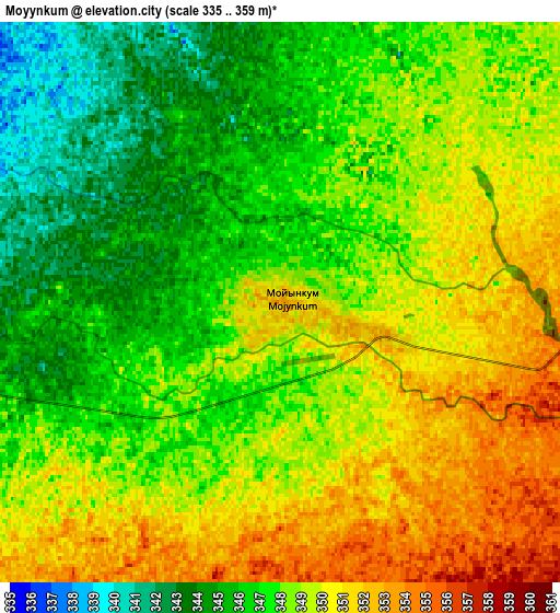
Below is the Elevation map of Moyynkum, which displays elevation range with different colors. Scale of the first map is from 341 to 354 m (1119 to 1161 ft) with average elevation of 347.5 meters (=1140 ft) [note 1]
These maps also provides idea of topography and contour of this city, they are displayed at different zoom levels. More info about maps, scale and edge coordinates you can find below images.
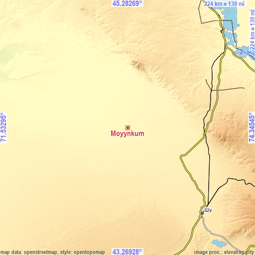
| \ | Map #1 | Map #2 | Topo.Map |
| Scale [m] | 341..354 m | 335..359 m | × |
| Scale [ft] | 1119..1161 ft | 1099..1178 ft | × |
| Average | 347.5 m = 1140 ft | 348 m = 1142 ft | × |
| Width | 7 km = 4.3 mi | 13.99 km = 8.7 mi | 223.9 km = 139.1 mi |
| Height | 7 km = 4.3 mi | 13.99 km = 8.7 mi | 223.9 km = 139.1 mi |
| ↑Max Latitude | 44.316061° | 44.347495° | 45.28269° |
| Latitude at center | 44.28461° | 44.28461° | 44.28461° |
| ↓Min Latitude | 44.253142° | 44.221657° | 43.26928° |
| ← Min Longitude | 72.895255° | 72.851309° | 71.53295° |
| Longitude center | 72.9392° | 72.9392° | 72.9392° |
| →Max Longitude | 72.983145° | 73.027091° | 74.34545° |
Nearby cities:
Cities around Moyynkum sort by population:
• Chu elevation 470 m
100.2 km,  139°
139°
• Merke 700 m
158.6 km,  172°
172°
• Sarykemer 552 m
183.9 km,  219°
219°
• Lugovoye 712 m
153.8 km,  186°
186°
• Lugovoy 687 m
150 km, 185°
• Georgiyevka 624 m
198.8 km,  134°
134°
• Oytal 675 m
155.6 km, 170°
• Ülken 339 m
131.8 km,  38°
38°
• Granitogorsk 1059 m
176.5 km, 166°
• Aqbaqay 474 m
80.5 km,  351°
351°
• Khantaū 548 m
68.5 km,  95°
95°
• Mynaral 347 m
138.8 km,  25°
25°
Multilingual:
 En español:
Moyynkum elevación 352 m.
 En France:
Moyynkum élévation 352 m.
 Auf Deutsch:
Moyynkum höhe über dem Meeresspiegel ist 352 m.

Sources and notes:
- [note 1] Map square and city borders are not equal. Map elevation data is calculated only from area inside that square.
- [src 1] Elevation data from geonames database provided with same terms of usage.
- [src 2] The elevation map of Moyynkum is generated using elevation data from NASA's 3 arcsec (90m) resolution SRTM data.
- [src 3] Base (background) map © OpenStreetMap contributors tiles are generated by Geofabrik and OpenTopoMap.
Copyright & License:
This Moyynkum Elevation Map is licensed under CC BY-SA. You may reuse any part from this page, if you give a proper credit by linking to this URL:
 More info on terms of use page.