Qazaly elevation
Qazaly (Qyzylorda), Kazakhstan elevation is 68 meters and Qazaly elevation in feet is 223 ft above sea level [src 1]. Qazaly is a populated place (feature code) with elevation that is 290 meters (951 ft) smaller than average city elevation in Kazakhstan.
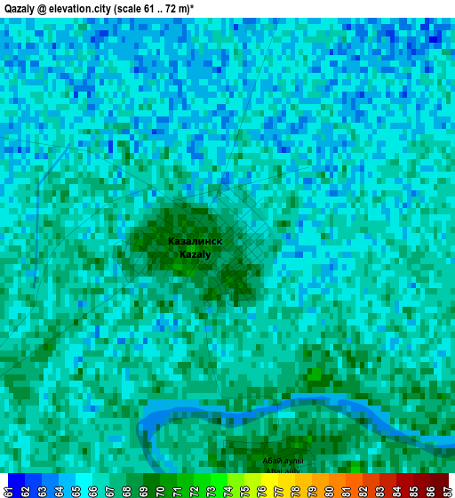
Below is the Elevation map of Qazaly, which displays elevation range with different colors. Scale of the first map is from 61 to 72 m (200 to 236 ft) with average elevation of 65.8 meters (=216 ft) [note 1]
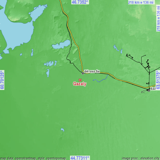
These maps also provides idea of topography and contour of this city, they are displayed at different zoom levels. More info about maps, scale and edge coordinates you can find below images.
| \ | Map #1 | Map #2 | Topo.Map |
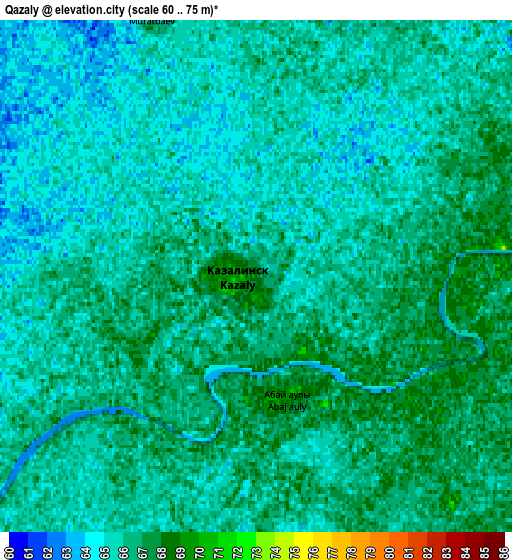
| Scale [m] | 61..72 m | 60..75 m | × |
| Scale [ft] | 200..236 ft | 197..246 ft | × |
| Average | 65.8 m = 216 ft | 65.5 m = 215 ft | × |
| Width | 6.82 km = 4.2 mi | 13.64 km = 8.5 mi | 218.2 km = 135.6 mi |
| Height | 6.82 km = 4.2 mi | 13.64 km = 8.5 mi | 218.2 km = 135.6 mi |
| ↑Max Latitude | 45.793429° | 45.824062° | 46.7352° |
| Latitude at center | 45.76278° | 45.76278° | 45.76278° |
| ↓Min Latitude | 45.732114° | 45.701431° | 44.77311° |
| ← Min Longitude | 62.063555° | 62.019609° | 60.70125° |
| Longitude center | 62.1075° | 62.1075° | 62.1075° |
| →Max Longitude | 62.151445° | 62.195391° | 63.51375° |
Nearby cities:
Cities around Qazaly sort by population:
• Kyzylorda elevation 128 m
284.6 km,  110°
110°
• Baikonur 91 m
95.3 km,  99°
99°
• Ayteke Bi 70 m
9.9 km,  20°
20°
• Aral 57 m
120.2 km,  343°
343°
• Shalqar 164 m
299 km,  320°
320°
• Zhosaly 100 m
156.2 km, 101°
• Tasböget 129 m
291.1 km, 112°
• Dzhalagash 111 m
213.5 km, 110°
• Terenozek 119 m
238.1 km, 109°
• Tyuratam 106 m
94.3 km, 97°
• Sekseūil 73 m
164.7 km,  333°
333°
• Belköl 128 m
292.1 km, 111°
Multilingual:
 En español:
Qazaly elevación 68 m.
 En France:
Qazaly élévation 68 m.


Sources and notes:
- [note 1] Map square and city borders are not equal. Map elevation data is calculated only from area inside that square.
- [src 1] Elevation data from geonames database provided with same terms of usage.
- [src 2] The elevation map of Qazaly is generated using elevation data from NASA's 3 arcsec (90m) resolution SRTM data.
- [src 3] Base (background) map © OpenStreetMap contributors tiles are generated by Geofabrik and OpenTopoMap.
Copyright & License:
This Qazaly Elevation Map is licensed under CC BY-SA. You may reuse any part from this page, if you give a proper credit by linking to this URL:
 More info on terms of use page.