Tsidjé elevation
Tsidjé (Grande Comore), Comoros elevation is 83 meters and Tsidjé elevation in feet is 272 ft above sea level [src 1]. Tsidjé is a populated place (feature code) with elevation that is 111 meters (364 ft) smaller than average city elevation in Comoros.
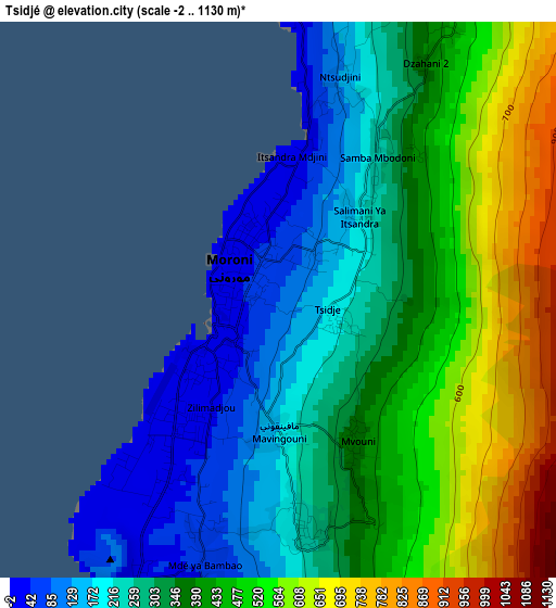
Below is the Elevation map of Tsidjé, which displays elevation range with different colors. Scale of the first map is from -2 to 1130 m (-7 to 3707 ft) with average elevation of 371.9 meters (=1220 ft) [note 1]
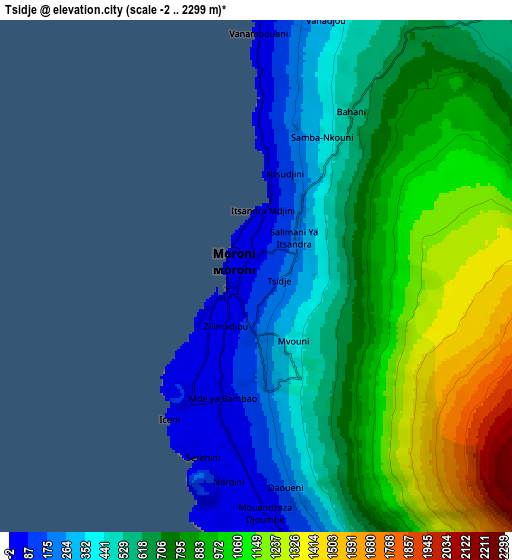
These maps also provides idea of topography and contour of this city, they are displayed at different zoom levels. More info about maps, scale and edge coordinates you can find below images.
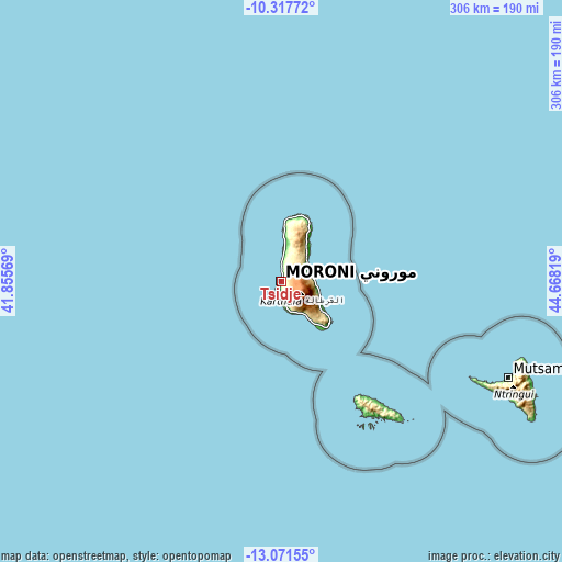
| \ | Map #1 | Map #2 | Topo.Map |
| Scale [m] | -2..1130 m | -2..2299 m | × |
| Scale [ft] | -7..3707 ft | -7..7543 ft | × |
| Average | 371.9 m = 1220 ft | 743 m = 2438 ft | × |
| Width | 9.57 km = 5.9 mi | 19.14 km = 11.9 mi | 306.2 km = 190.3 mi |
| Height | 9.57 km = 5.9 mi | 19.14 km = 11.9 mi | 306.2 km = 190.3 mi |
| ↑Max Latitude | -11.655024° | -11.611982° | -10.31772° |
| Latitude at center | -11.69806° | -11.69806° | -11.69806° |
| ↓Min Latitude | -11.741089° | -11.784112° | -13.07155° |
| ← Min Longitude | 43.217995° | 43.174049° | 41.85569° |
| Longitude center | 43.26194° | 43.26194° | 43.26194° |
| →Max Longitude | 43.305885° | 43.349831° | 44.66819° |
Nearby cities:
Cities around Tsidjé sort by population:
• Moroni elevation 27 m
0.9 km,  238°
238°
• Mitsoudjé 154 m
12.8 km,  170°
170°
• Mvouni 218 m
2 km, 171°
• Ntsoudjini 139 m
4.3 km,  359°
359°
• Itsandra 26 m
3.1 km,  345°
345°
• Vanadjou 182 m
10.2 km,  8°
8°
• Oussivo 35 m
12.6 km,  2°
2°
• Salimani 78 m
12.6 km,  176°
176°
• Séléa 24 m
9.6 km, 180°
• Vanambouani 76 m
9.7 km, 354°
• Mavingouni 43 m
2.3 km,  206°
206°
• Bahani 350 m
6.9 km,  20°
20°
Multilingual:
 En español:
Tsidjé elevación 83 m.
 En France:
Tsidjé élévation 83 m.


Sources and notes:
- [note 1] Map square and city borders are not equal. Map elevation data is calculated only from area inside that square.
- [src 1] Elevation data from geonames database provided with same terms of usage.
- [src 2] The elevation map of Tsidjé is generated using elevation data from NASA's 3 arcsec (90m) resolution SRTM data.
- [src 3] Base (background) map © OpenStreetMap contributors tiles are generated by Geofabrik and OpenTopoMap.
Copyright & License:
This Tsidjé Elevation Map is licensed under CC BY-SA. You may reuse any part from this page, if you give a proper credit by linking to this URL:
 More info on terms of use page.