Lumphat elevation
Lumphat (Ratanakiri), Cambodia elevation is 101 meters and Lumphat elevation in feet is 331 ft above sea level [src 1]. Lumphat is a seat of a second-order administrative division (feature code) with elevation that is 49 meters (161 ft) bigger than average city elevation in Cambodia.
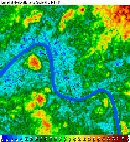
Below is the Elevation map of Lumphat, which displays elevation range with different colors. Scale of the first map is from 91 to 141 m (299 to 463 ft) with average elevation of 108 meters (=354 ft) [note 1]
These maps also provides idea of topography and contour of this city, they are displayed at different zoom levels. More info about maps, scale and edge coordinates you can find below images.
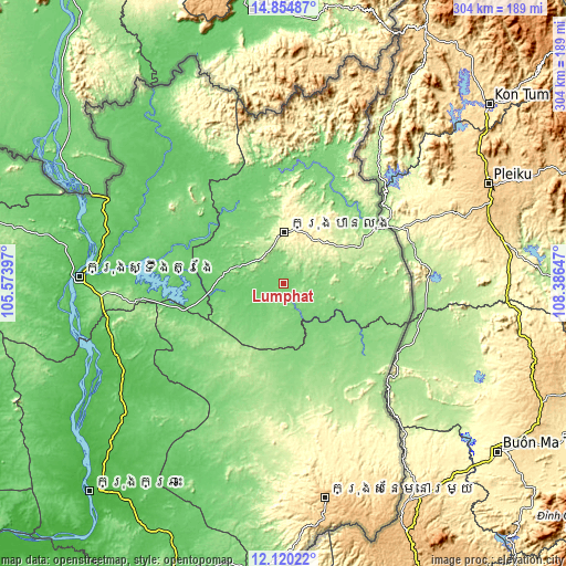
| \ | Map #1 | Map #2 | Topo.Map |
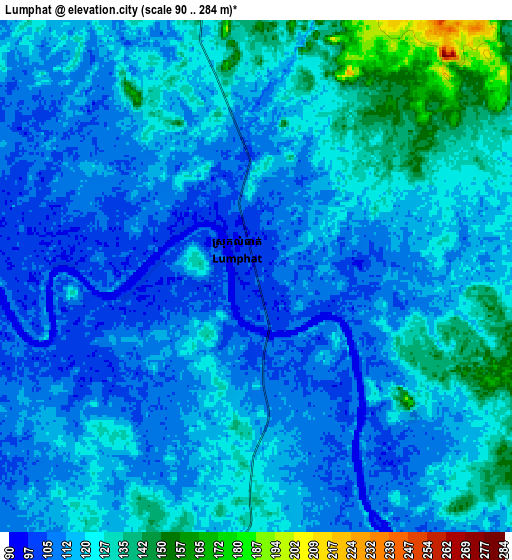
| Scale [m] | 91..141 m | 90..284 m | × |
| Scale [ft] | 299..463 ft | 295..932 ft | × |
| Average | 108 m = 354 ft | 118.2 m = 388 ft | × |
| Width | 9.5 km = 5.9 mi | 19.01 km = 11.8 mi | 304.1 km = 189 mi |
| Height | 9.5 km = 5.9 mi | 19.01 km = 11.8 mi | 304.1 km = 189 mi |
| ↑Max Latitude | 13.534189° | 13.57691° | 14.85487° |
| Latitude at center | 13.49146° | 13.49146° | 13.49146° |
| ↓Min Latitude | 13.448724° | 13.405979° | 12.12022° |
| ← Min Longitude | 106.936275° | 106.892329° | 105.57397° |
| Longitude center | 106.98022° | 106.98022° | 106.98022° |
| →Max Longitude | 107.024165° | 107.068111° | 108.38647° |
Nearby cities:
Cities around Lumphat sort by population:
• Stung Treng elevation 55 m
109.5 km,  272°
272°
• Banlung 316 m
27.6 km,  1°
1°
• Sen Monorom 678 m
117.3 km,  168°
168°
• Pechreada 522 m
114.9 km,  155°
155°
• Sesan 60 m
96.2 km, 274°
• Siem Pang 71 m
94.5 km,  317°
317°
• Veun Sai 93 m
56.9 km,  341°
341°
• Andoung Meas 120 m
54 km,  39°
39°
• Ou Ya Dav 225 m
44.4 km,  63°
63°
• Ou Chum 253 m
34.1 km, 2°
• Bar Kaev 299 m
33.3 km,  49°
49°
• Koun Mom 117 m
24.4 km,  293°
293°
Multilingual:
 En español:
Lumphat elevación 101 m.
 En France:
Lumphat élévation 101 m.


Sources and notes:
- [note 1] Map square and city borders are not equal. Map elevation data is calculated only from area inside that square.
- [src 1] Elevation data from geonames database provided with same terms of usage.
- [src 2] The elevation map of Lumphat is generated using elevation data from NASA's 3 arcsec (90m) resolution SRTM data.
- [src 3] Base (background) map © OpenStreetMap contributors tiles are generated by Geofabrik and OpenTopoMap.
Copyright & License:
This Lumphat Elevation Map is licensed under CC BY-SA. You may reuse any part from this page, if you give a proper credit by linking to this URL:
 More info on terms of use page.