Chayek elevation
Chayek (Naryn), Kyrgyzstan elevation is 1653 meters and Chayek elevation in feet is 5423 ft above sea level [src 1]. Chayek is a seat of a second-order administrative division (feature code) with elevation that is 457 meters (1499 ft) bigger than average city elevation in Kyrgyzstan.
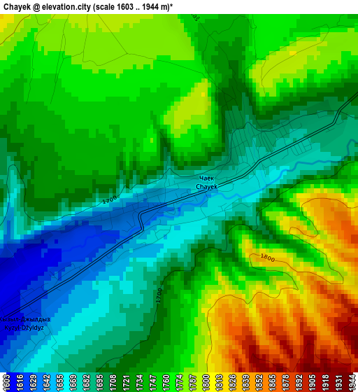
Below is the Elevation map of Chayek, which displays elevation range with different colors. Scale of the first map is from 1603 to 1944 m (5259 to 6378 ft) with average elevation of 1736.3 meters (=5697 ft) [note 1]
These maps also provides idea of topography and contour of this city, they are displayed at different zoom levels. More info about maps, scale and edge coordinates you can find below images.
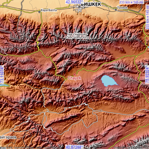
| \ | Map #1 | Topo.Map |
| Scale [m] | 1603..1944 m | × |
| Scale [ft] | 5259..6378 ft | × |
| Average | 1736.3 m = 5697 ft | × |
| Width | 7.27 km = 4.5 mi | 232.7 km = 144.6 mi |
| Height | 7.27 km = 4.5 mi | 232.7 km = 144.6 mi |
| ↑Max Latitude | 41.960366° | 42.96532° |
| Latitude at center | 41.92768° | 41.92768° |
| ↓Min Latitude | 41.894977° | 40.87288° |
| ← Min Longitude | 74.473045° | 73.11074° |
| Longitude center | 74.51699° | 74.51699° |
| →Max Longitude | 74.560935° | 75.92324° |
Nearby cities:
Cities around Chayek sort by population:
• Bishkek elevation 767 m
104.9 km,  3°
3°
• Kara-Balta 789 m
112.9 km,  330°
330°
• Kant 743 m
110.6 km,  14°
14°
• Sosnovka 1208 m
94 km, 327°
• Ivanovka 745 m
116.5 km,  23°
23°
• Üch-Terek 950 m
110.6 km,  260°
260°
• Kochkor 1808 m
107.2 km,  72°
72°
• Lebedinovka 732 m
107.2 km, 7°
• Belovodskoye 742 m
105.7 km,  341°
341°
• Sokuluk 742 m
104.5 km,  350°
350°
• Baetovo 1951 m
82.1 km,  153°
153°
• Kazarman 1269 m
70.9 km,  214°
214°
Multilingual:
 En español:
Chayek elevación 1653 m.
 En France:
Chayek élévation 1653 m.


Sources and notes:
- [note 1] Map square and city borders are not equal. Map elevation data is calculated only from area inside that square.
- [src 1] Elevation data from geonames database provided with same terms of usage.
- [src 2] The elevation map of Chayek is generated using elevation data from NASA's 3 arcsec (90m) resolution SRTM data.
- [src 3] Base (background) map © OpenStreetMap contributors tiles are generated by Geofabrik and OpenTopoMap.
Copyright & License:
This Chayek Elevation Map is licensed under CC BY-SA. You may reuse any part from this page, if you give a proper credit by linking to this URL:
 More info on terms of use page.