Mutsu elevation
Mutsu (Aomori, Mutsu-shi), Japan elevation is 6 meters and Mutsu elevation in feet is 20 ft above sea level [src 1]. Mutsu is a seat of a second-order administrative division (feature code) with elevation that is 79 meters (259 ft) smaller than average city elevation in Japan.
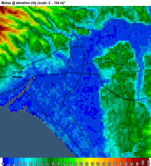
Below is the Elevation map of Mutsu, which displays elevation range with different colors. Scale of the first map is from -2 to 104 m (-7 to 341 ft) with average elevation of 20.4 meters (=67 ft) [note 1]
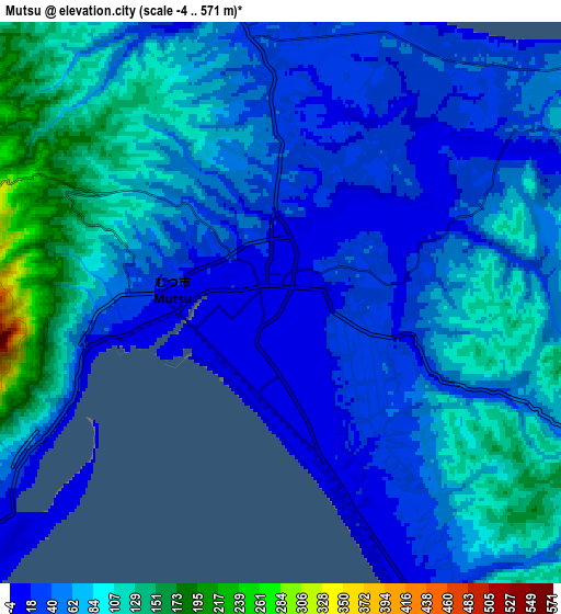
These maps also provides idea of topography and contour of this city, they are displayed at different zoom levels. More info about maps, scale and edge coordinates you can find below images.
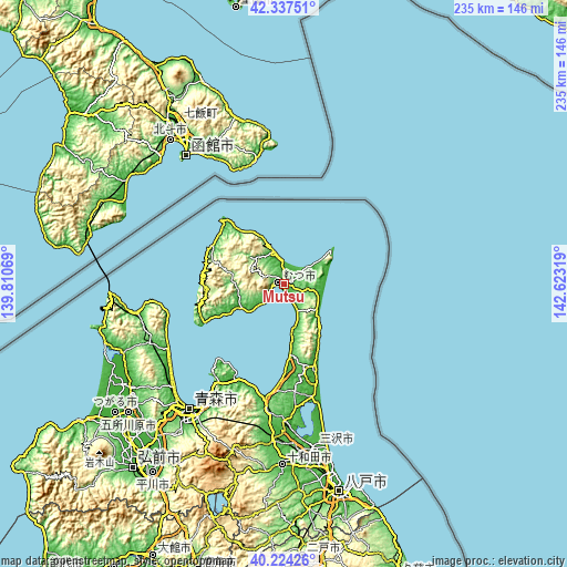
| \ | Map #1 | Map #2 | Topo.Map |
| Scale [m] | -2..104 m | -4..571 m | × |
| Scale [ft] | -7..341 ft | -13..1873 ft | × |
| Average | 20.4 m = 67 ft | 62.9 m = 206 ft | × |
| Width | 7.34 km = 4.6 mi | 14.69 km = 9.1 mi | 235 km = 146 mi |
| Height | 7.34 km = 4.6 mi | 14.69 km = 9.1 mi | 235 km = 146 mi |
| ↑Max Latitude | 41.322452° | 41.355446° | 42.33751° |
| Latitude at center | 41.28944° | 41.28944° | 41.28944° |
| ↓Min Latitude | 41.256412° | 41.223367° | 40.22426° |
| ← Min Longitude | 141.172995° | 141.129049° | 139.81069° |
| Longitude center | 141.21694° | 141.21694° | 141.21694° |
| →Max Longitude | 141.260885° | 141.304831° | 142.62319° |
Nearby cities:
Cities around Mutsu sort by population:
• Aomori elevation 7 m
66.4 km,  217°
217°
• Hakodate 5 m
67.3 km,  323°
323°
• Goshogawara 9 m
84.5 km,  230°
230°
• Misawa 37 m
68.6 km,  167°
167°
• Kamiiso 2 m
75.8 km, 321°
• Honchō 81 m
80.1 km,  327°
327°
• Namioka 28 m
83.1 km, 219°
• Kuroishi 285 m
86.5 km,  209°
209°
• Furudate 72 m
84.8 km, 174°
• Inuotose 16 m
77 km, 173°
• Hokuto 11 m
76 km, 320°
• Towada 74 m
74.4 km,  180°
180°
Multilingual:
 En español:
Mutsu elevación 6 m.
 En France:
Mutsu élévation 6 m.


Sources and notes:
- [note 1] Map square and city borders are not equal. Map elevation data is calculated only from area inside that square.
- [src 1] Elevation data from geonames database provided with same terms of usage.
- [src 2] The elevation map of Mutsu is generated using elevation data from NASA's 3 arcsec (90m) resolution SRTM data.
- [src 3] Base (background) map © OpenStreetMap contributors tiles are generated by Geofabrik and OpenTopoMap.
Copyright & License:
This Mutsu Elevation Map is licensed under CC BY-SA. You may reuse any part from this page, if you give a proper credit by linking to this URL:
 More info on terms of use page.