Okinawa elevation
Okinawa, Japan elevation is 112 meters and Okinawa elevation in feet is 367 ft above sea level [src 1]. Okinawa is a seat of a second-order administrative division (feature code) with elevation that is 27 meters (89 ft) bigger than average city elevation in Japan.
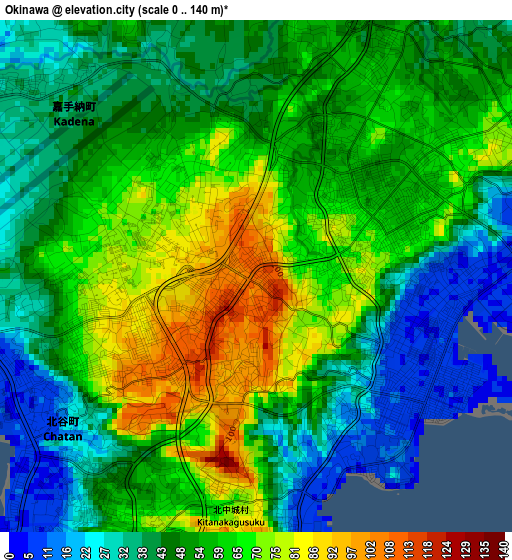
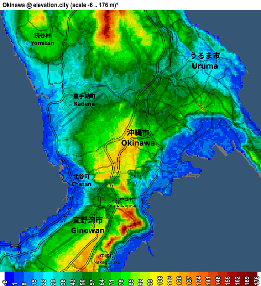
Below is the Elevation map of Okinawa, which displays elevation range with different colors. Scale of the first map is from 0 to 140 m (0 to 459 ft) with average elevation of 52.9 meters (=174 ft) [note 1]
These maps also provides idea of topography and contour of this city, they are displayed at different zoom levels. More info about maps, scale and edge coordinates you can find below images.
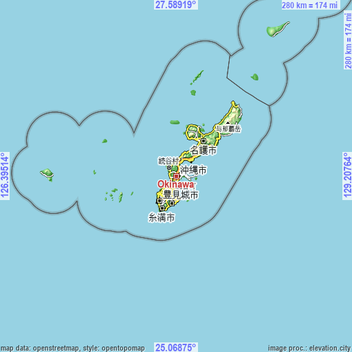
| \ | Map #1 | Map #2 | Topo.Map |
| Scale [m] | 0..140 m | -6..176 m | × |
| Scale [ft] | 0..459 ft | -20..577 ft | × |
| Average | 52.9 m = 174 ft | 51.6 m = 169 ft | × |
| Width | 8.76 km = 5.4 mi | 17.52 km = 10.9 mi | 280.2 km = 174.1 mi |
| Height | 8.76 km = 5.4 mi | 17.52 km = 10.9 mi | 280.3 km = 174.2 mi |
| ↑Max Latitude | 26.375207° | 26.414572° | 27.58919° |
| Latitude at center | 26.33583° | 26.33583° | 26.33583° |
| ↓Min Latitude | 26.296439° | 26.257035° | 25.06875° |
| ← Min Longitude | 127.757445° | 127.713499° | 126.39514° |
| Longitude center | 127.80139° | 127.80139° | 127.80139° |
| →Max Longitude | 127.845335° | 127.889281° | 129.20764° |
Nearby cities:
Cities around Okinawa sort by population:
• Naha elevation 12 m
17.7 km,  221°
221°
• Ginowan 105 m
9.1 km,  206°
206°
• Gushikawa 61 m
7.1 km,  68°
68°
• Nago 32 m
36 km,  30°
30°
• Itoman 5 m
26.8 km, 209°
• Tomigusuku 47 m
20.5 km, 215°
• Katsuren-haebaru 9 m
7.2 km,  92°
92°
• Chatan 27 m
4.3 km,  226°
226°
• Ishikawa 11 m
9.9 km,  11°
11°
• Nanjō 92 m
21.6 km,  189°
189°
• Urasoe 50 m
11.1 km, 219°
• Uruma 22 m
7.3 km,  52°
52°
Multilingual:
 En español:
Okinawa elevación 112 m.
 En France:
Okinawa élévation 112 m.


Sources and notes:
- [note 1] Map square and city borders are not equal. Map elevation data is calculated only from area inside that square.
- [src 1] Elevation data from geonames database provided with same terms of usage.
- [src 2] The elevation map of Okinawa is generated using elevation data from NASA's 3 arcsec (90m) resolution SRTM data.
- [src 3] Base (background) map © OpenStreetMap contributors tiles are generated by Geofabrik and OpenTopoMap.
Copyright & License:
This Okinawa Elevation Map is licensed under CC BY-SA. You may reuse any part from this page, if you give a proper credit by linking to this URL:
 More info on terms of use page.