Kan’onjichō elevation
Kan’onjichō (Kagawa, Kan’onji Shi), Japan elevation is 4 meters and Kan’onjichō elevation in feet is 13 ft above sea level [src 1]. Kan’onjichō is a populated place (feature code) with elevation that is 81 meters (266 ft) smaller than average city elevation in Japan.
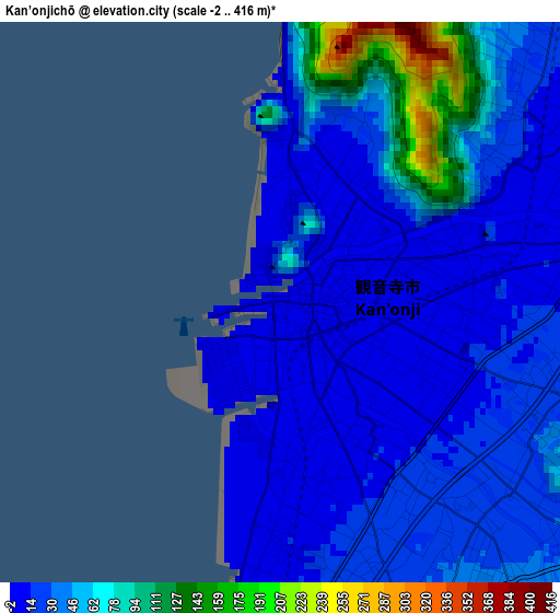
Below is the Elevation map of Kan’onjichō, which displays elevation range with different colors. Scale of the first map is from -2 to 416 m (-7 to 1365 ft) with average elevation of 37.6 meters (=123 ft) [note 1]
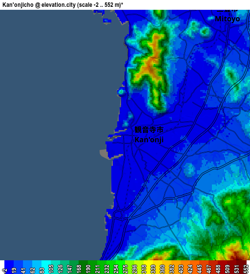
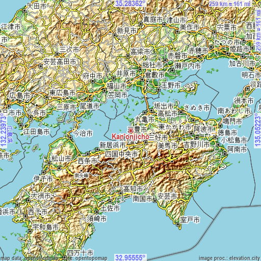
These maps also provides idea of topography and contour of this city, they are displayed at different zoom levels. More info about maps, scale and edge coordinates you can find below images.
| \ | Map #1 | Map #2 | Topo.Map |
| Scale [m] | -2..416 m | -2..552 m | × |
| Scale [ft] | -7..1365 ft | -7..1811 ft | × |
| Average | 37.6 m = 123 ft | 66.7 m = 219 ft | × |
| Width | 8.09 km = 5 mi | 16.18 km = 10.1 mi | 258.9 km = 160.9 mi |
| Height | 8.09 km = 5 mi | 16.18 km = 10.1 mi | 258.9 km = 160.9 mi |
| ↑Max Latitude | 34.16397° | 34.200324° | 35.28362° |
| Latitude at center | 34.1276° | 34.1276° | 34.1276° |
| ↓Min Latitude | 34.091215° | 34.054814° | 32.95555° |
| ← Min Longitude | 133.602035° | 133.558089° | 132.23973° |
| Longitude center | 133.64598° | 133.64598° | 133.64598° |
| →Max Longitude | 133.689925° | 133.733871° | 135.05223° |
Nearby cities:
Cities around Kan’onjichō sort by population:
• Takamatsu elevation 17 m
43.6 km,  58°
58°
• Niihama 13 m
36.5 km,  239°
239°
• Marugame 5 m
21.4 km,  36°
36°
• Sakaidechō 11 m
27.8 km, 38°
• Kawanoechō 13 m
13.8 km,  206°
206°
• Tadotsu 4 m
19 km,  30°
30°
• Ikedachō 120 m
18.4 km,  126°
126°
• Miyoshi 905 m
29.7 km,  139°
139°
• Shikokuchūō 41 m
19.1 km, 207°
• Zentsujichó 32 m
16.4 km,  47°
47°
• Mitoyo 67 m
9.6 km,  15°
15°
• Kan’onji 19 m
6.4 km,  177°
177°
Multilingual:
 En español:
Kan’onjichō elevación 4 m.
 En France:
Kan’onjichō élévation 4 m.
 Auf Deutsch:
Kan’onjichō höhe über dem Meeresspiegel ist 4 m.

Sources and notes:
- [note 1] Map square and city borders are not equal. Map elevation data is calculated only from area inside that square.
- [src 1] Elevation data from geonames database provided with same terms of usage.
- [src 2] The elevation map of Kan’onjichō is generated using elevation data from NASA's 3 arcsec (90m) resolution SRTM data.
- [src 3] Base (background) map © OpenStreetMap contributors tiles are generated by Geofabrik and OpenTopoMap.
Copyright & License:
This Kan’onjichō Elevation Map is licensed under CC BY-SA. You may reuse any part from this page, if you give a proper credit by linking to this URL:
 More info on terms of use page.