Kawasaki elevation
Kawasaki (Kanagawa, Kawasaki-shi), Japan elevation is 1 meters and Kawasaki elevation in feet is 3 ft above sea level [src 1]. Kawasaki is a seat of a second-order administrative division (feature code) with elevation that is 84 meters (276 ft) smaller than average city elevation in Japan.
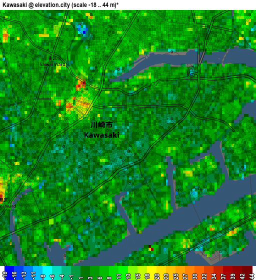
Below is the Elevation map of Kawasaki, which displays elevation range with different colors. Scale of the first map is from -18 to 44 m (-59 to 144 ft) with average elevation of 4.8 meters (=16 ft) [note 1]
These maps also provides idea of topography and contour of this city, they are displayed at different zoom levels. More info about maps, scale and edge coordinates you can find below images.
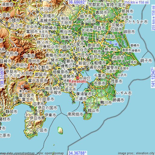
| \ | Map #1 | Map #2 | Topo.Map |
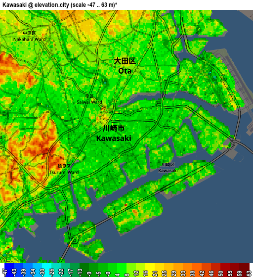
| Scale [m] | -18..44 m | -47..63 m | × |
| Scale [ft] | -59..144 ft | -154..207 ft | × |
| Average | 4.8 m = 16 ft | 9.1 m = 30 ft | × |
| Width | 7.95 km = 4.9 mi | 15.91 km = 9.9 mi | 254.5 km = 158.1 mi |
| Height | 7.95 km = 4.9 mi | 15.91 km = 9.9 mi | 254.5 km = 158.1 mi |
| ↑Max Latitude | 35.556319° | 35.592063° | 36.65692° |
| Latitude at center | 35.52056° | 35.52056° | 35.52056° |
| ↓Min Latitude | 35.484785° | 35.448993° | 34.36788° |
| ← Min Longitude | 139.673275° | 139.629329° | 138.31097° |
| Longitude center | 139.71722° | 139.71722° | 139.71722° |
| →Max Longitude | 139.761165° | 139.805111° | 141.12347° |
Nearby cities:
Cities around Kawasaki sort by population:
• Tokyo elevation 44 m
18.9 km,  353°
353°
• Yokohama 21 m
11.5 km,  212°
212°
• Machida 103 m
24.2 km,  275°
275°
• Chōfu 44 m
21.7 km,  315°
315°
• Kamirenjaku 59 m
24.3 km, 322°
• Urayasu 6 m
22.8 km,  42°
42°
• Kimitsu 4 m
23.5 km,  143°
143°
• Yamato 53 m
24.7 km,  257°
257°
• Inagi 96 m
23.3 km,  302°
302°
• Mitaka 52 m
23 km, 321°
• Urayasu 8 m
21.6 km,  51°
51°
• Komae 28 m
18 km,  314°
314°
Multilingual:
 En español:
Kawasaki elevación 1 m.
 En France:
Kawasaki élévation 1 m.


Sources and notes:
- [note 1] Map square and city borders are not equal. Map elevation data is calculated only from area inside that square.
- [src 1] Elevation data from geonames database provided with same terms of usage.
- [src 2] The elevation map of Kawasaki is generated using elevation data from NASA's 3 arcsec (90m) resolution SRTM data.
- [src 3] Base (background) map © OpenStreetMap contributors tiles are generated by Geofabrik and OpenTopoMap.
Copyright & License:
This Kawasaki Elevation Map is licensed under CC BY-SA. You may reuse any part from this page, if you give a proper credit by linking to this URL:
 More info on terms of use page.