Takatsuki elevation
Takatsuki (Ōsaka, Takatsuki Shi), Japan elevation is 14 meters and Takatsuki elevation in feet is 46 ft above sea level [src 1]. Takatsuki is a seat of a second-order administrative division (feature code) with elevation that is 71 meters (233 ft) smaller than average city elevation in Japan.
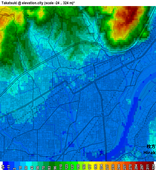
Below is the Elevation map of Takatsuki, which displays elevation range with different colors. Scale of the first map is from -24 to 324 m (-79 to 1063 ft) with average elevation of 41.3 meters (=135 ft) [note 1]
These maps also provides idea of topography and contour of this city, they are displayed at different zoom levels. More info about maps, scale and edge coordinates you can find below images.
| \ | Map #1 | Map #2 | Topo.Map |
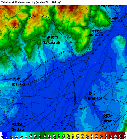
| Scale [m] | -24..324 m | -24..576 m | × |
| Scale [ft] | -79..1063 ft | -79..1890 ft | × |
| Average | 41.3 m = 135 ft | 90.3 m = 296 ft | × |
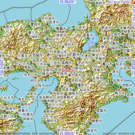
| Width | 8.02 km = 5 mi | 16.04 km = 10 mi | 256.6 km = 159.4 mi |
| Height | 8.02 km = 5 mi | 16.04 km = 10 mi | 256.6 km = 159.4 mi |
| ↑Max Latitude | 34.884387° | 34.920427° | 35.99426° |
| Latitude at center | 34.84833° | 34.84833° | 34.84833° |
| ↓Min Latitude | 34.812258° | 34.776169° | 33.68622° |
| ← Min Longitude | 135.572835° | 135.528889° | 134.21053° |
| Longitude center | 135.61678° | 135.61678° | 135.61678° |
| →Max Longitude | 135.660725° | 135.704671° | 137.02303° |
Nearby cities:
Cities around Takatsuki sort by population:
• Hirakata elevation 17 m
4.9 km,  142°
142°
• Suita 4 m
13.4 km,  223°
223°
• Ibaraki 18 m
5.7 km,  231°
231°
• Neyagawa 9 m
9.2 km,  173°
173°
• Moriguchi 3 m
13.6 km,  199°
199°
• Kadoma 8 m
12.9 km, 197°
• Mino 76 m
13.6 km,  259°
259°
• Yawata 17 m
8.2 km,  72°
72°
• Tanabe 31 m
13.9 km,  101°
101°
• Nagaoka 30 m
11.5 km,  36°
36°
• Katano 31 m
8.8 km,  134°
134°
• Settsu 11 m
8 km,  194°
194°
Multilingual:
 En español:
Takatsuki elevación 14 m.
 En France:
Takatsuki élévation 14 m.
 Auf Deutsch:
Takatsuki höhe über dem Meeresspiegel ist 14 m.

Sources and notes:
- [note 1] Map square and city borders are not equal. Map elevation data is calculated only from area inside that square.
- [src 1] Elevation data from geonames database provided with same terms of usage.
- [src 2] The elevation map of Takatsuki is generated using elevation data from NASA's 3 arcsec (90m) resolution SRTM data.
- [src 3] Base (background) map © OpenStreetMap contributors tiles are generated by Geofabrik and OpenTopoMap.
Copyright & License:
This Takatsuki Elevation Map is licensed under CC BY-SA. You may reuse any part from this page, if you give a proper credit by linking to this URL:
 More info on terms of use page.