Tanashichō elevation
Tanashichō (Tokyo, Nishitōkyō-shi), Japan elevation is 68 meters and Tanashichō elevation in feet is 223 ft above sea level [src 1]. Tanashichō is a section of populated place (feature code) with elevation that is 17 meters (56 ft) smaller than average city elevation in Japan.
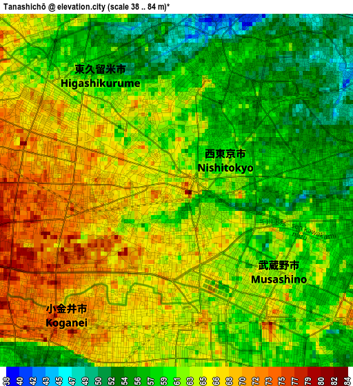
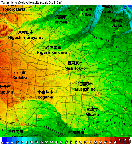
Below is the Elevation map of Tanashichō, which displays elevation range with different colors. Scale of the first map is from 38 to 84 m (125 to 276 ft) with average elevation of 62.1 meters (=204 ft) [note 1]
These maps also provides idea of topography and contour of this city, they are displayed at different zoom levels. More info about maps, scale and edge coordinates you can find below images.
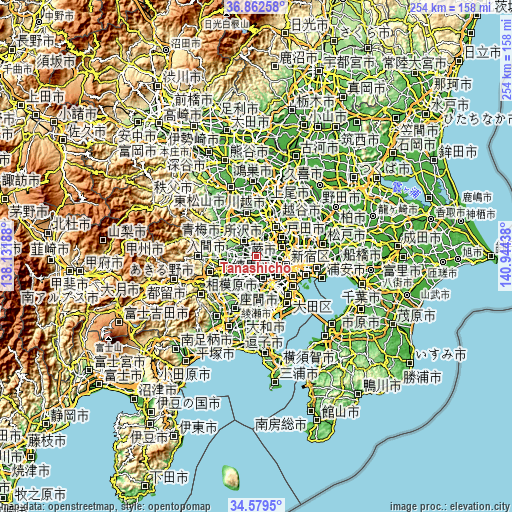
| \ | Map #1 | Map #2 | Topo.Map |
| Scale [m] | 38..84 m | 0..110 m | × |
| Scale [ft] | 125..276 ft | 0..361 ft | × |
| Average | 62.1 m = 204 ft | 57.8 m = 190 ft | × |
| Width | 7.93 km = 4.9 mi | 15.87 km = 9.9 mi | 253.9 km = 157.8 mi |
| Height | 7.93 km = 4.9 mi | 15.87 km = 9.9 mi | 253.9 km = 157.8 mi |
| ↑Max Latitude | 35.764886° | 35.800536° | 36.86258° |
| Latitude at center | 35.72922° | 35.72922° | 35.72922° |
| ↓Min Latitude | 35.693538° | 35.65784° | 34.5795° |
| ← Min Longitude | 139.494185° | 139.450239° | 138.13188° |
| Longitude center | 139.53813° | 139.53813° | 139.53813° |
| →Max Longitude | 139.582075° | 139.626021° | 140.94438° |
Nearby cities:
Cities around Tanashichō sort by population:
• Chōfu elevation 44 m
7.8 km,  173°
173°
• Nishi-Tokyo-shi 58 m
0.4 km,  178°
178°
• Kamirenjaku 59 m
4.2 km,  158°
158°
• Higashimurayama 82 m
6.9 km,  294°
294°
• Musashino 62 m
3.2 km,  143°
143°
• Kokubunji 78 m
6.4 km,  242°
242°
• Kiyose 53 m
5.6 km,  352°
352°
• Mitaka 52 m
5.4 km, 158°
• Kodaira 79 m
4.8 km,  265°
265°
• Koganei 80 m
4.1 km,  217°
217°
• Higashikurume 61 m
3.5 km,  316°
316°
• Nishitōkyō 58 m
1 km,  60°
60°
Multilingual:
 En español:
Tanashichō elevación 68 m.
 En France:
Tanashichō élévation 68 m.
 Auf Deutsch:
Tanashichō höhe über dem Meeresspiegel ist 68 m.

Sources and notes:
- [note 1] Map square and city borders are not equal. Map elevation data is calculated only from area inside that square.
- [src 1] Elevation data from geonames database provided with same terms of usage.
- [src 2] The elevation map of Tanashichō is generated using elevation data from NASA's 3 arcsec (90m) resolution SRTM data.
- [src 3] Base (background) map © OpenStreetMap contributors tiles are generated by Geofabrik and OpenTopoMap.
Copyright & License:
This Tanashichō Elevation Map is licensed under CC BY-SA. You may reuse any part from this page, if you give a proper credit by linking to this URL:
 More info on terms of use page.