Yugawara elevation
Yugawara (Kanagawa, Ashigarashimo-gun), Japan elevation is 204 meters and Yugawara elevation in feet is 669 ft above sea level [src 1]. Yugawara is a populated place (feature code) with elevation that is 119 meters (390 ft) bigger than average city elevation in Japan.
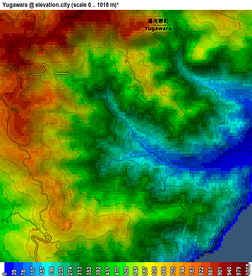
Below is the Elevation map of Yugawara, which displays elevation range with different colors. Scale of the first map is from 0 to 1018 m (0 to 3340 ft) with average elevation of 480.1 meters (=1575 ft) [note 1]
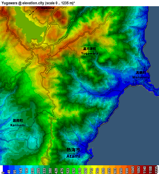
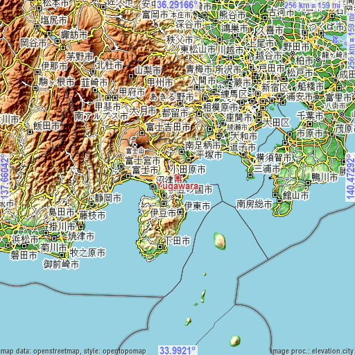
These maps also provides idea of topography and contour of this city, they are displayed at different zoom levels. More info about maps, scale and edge coordinates you can find below images.
| \ | Map #1 | Map #2 | Topo.Map |
| Scale [m] | 0..1018 m | 0..1235 m | × |
| Scale [ft] | 0..3340 ft | 0..4052 ft | × |
| Average | 480.1 m = 1575 ft | 489.5 m = 1606 ft | × |
| Width | 7.99 km = 5 mi | 15.98 km = 9.9 mi | 255.7 km = 158.9 mi |
| Height | 7.99 km = 5 mi | 15.98 km = 9.9 mi | 255.7 km = 158.9 mi |
| ↑Max Latitude | 35.185924° | 35.221832° | 36.29166° |
| Latitude at center | 35.15° | 35.15° | 35.15° |
| ↓Min Latitude | 35.11406° | 35.078105° | 33.9921° |
| ← Min Longitude | 139.022725° | 138.978779° | 137.66042° |
| Longitude center | 139.06667° | 139.06667° | 139.06667° |
| →Max Longitude | 139.110615° | 139.154561° | 140.47292° |
Nearby cities:
Cities around Yugawara sort by population:
• Numazu elevation 8 m
19 km,  253°
253°
• Odawara 15 m
14.5 km,  35°
35°
• Mishima 24 m
14.1 km, 254°
• Gotenba 446 m
21.8 km,  329°
329°
• Itō 92 m
20.4 km,  175°
175°
• Atami 230 m
7 km,  190°
190°
• Hakone 734 m
5.7 km,  320°
320°
• Yamakita 144 m
23.8 km,  2°
2°
• Izu 55 m
22.7 km,  208°
208°
• Minamiashigara 44 m
19.2 km,  11°
11°
• Izunokuni 17 m
16.2 km,  220°
220°
• Susono 133 m
14.8 km,  280°
280°
Multilingual:
 En español:
Yugawara elevación 204 m.
 En France:
Yugawara élévation 204 m.
 Auf Deutsch:
Yugawara höhe über dem Meeresspiegel ist 204 m.

Sources and notes:
- [note 1] Map square and city borders are not equal. Map elevation data is calculated only from area inside that square.
- [src 1] Elevation data from geonames database provided with same terms of usage.
- [src 2] The elevation map of Yugawara is generated using elevation data from NASA's 3 arcsec (90m) resolution SRTM data.
- [src 3] Base (background) map © OpenStreetMap contributors tiles are generated by Geofabrik and OpenTopoMap.
Copyright & License:
This Yugawara Elevation Map is licensed under CC BY-SA. You may reuse any part from this page, if you give a proper credit by linking to this URL:
 More info on terms of use page.