Al Hāshimīyah elevation
Al Hāshimīyah (Zarqa), Jordan elevation is 559 meters and Al Hāshimīyah elevation in feet is 1834 ft above sea level [src 1]. Al Hāshimīyah is a seat of a third-order administrative division (feature code) with elevation that is 133 meters (436 ft) smaller than average city elevation in Jordan.
Below is the Elevation map of Al Hāshimīyah, which displays elevation range with different colors. Scale of the first map is from 475 to 699 m (1558 to 2293 ft) with average elevation of 565.6 meters (=1856 ft) [note 1]
These maps also provides idea of topography and contour of this city, they are displayed at different zoom levels. More info about maps, scale and edge coordinates you can find below images.
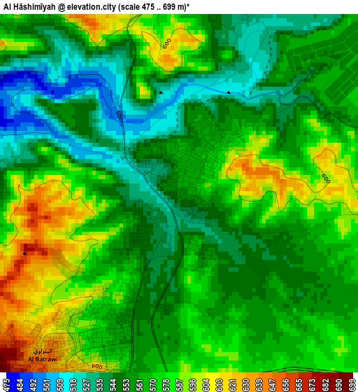
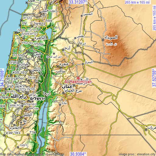
| \ | Map #1 | Topo.Map |
| Scale [m] | 475..699 m | × |
| Scale [ft] | 1558..2293 ft | × |
| Average | 565.6 m = 1856 ft | × |
| Width | 8.28 km = 5.1 mi | 264.8 km = 164.5 mi |
| Height | 8.28 km = 5.1 mi | 264.8 km = 164.5 mi |
| ↑Max Latitude | 32.166218° | 33.31207° |
| Latitude at center | 32.12901° | 32.12901° |
| ↓Min Latitude | 32.091787° | 30.9304° |
| ← Min Longitude | 36.077355° | 34.71505° |
| Longitude center | 36.1213° | 36.1213° |
| →Max Longitude | 36.165245° | 37.52755° |
Nearby cities:
Cities around Al Hāshimīyah sort by population:
• Amman elevation 757 m
25.5 km,  220°
220°
• Zarqa 625 m
7 km,  206°
206°
• Russeifa 614 m
14.2 km, 209°
• Mafraq 705 m
25.1 km,  18°
18°
• Al Jubayhah 989 m
24.8 km,  237°
237°
• Rehab 896 m
21.8 km,  352°
352°
• Al Maşţabah 573 m
25.7 km,  283°
283°
• Al Khālidīyah 605 m
18 km,  72°
72°
• Bīrayn 701 m
15.7 km,  257°
257°
• Ar Ruşayfah 671 m
15 km, 213°
• Az̧ Z̧ulayl 572 m
15 km,  93°
93°
• Bal‘amā 673 m
12.4 km, 345°
Multilingual:
 En español:
Al Hāshimīyah elevación 559 m.
 En France:
Al Hāshimīyah élévation 559 m.
 Auf Deutsch:
Al Hāshimīyah höhe über dem Meeresspiegel ist 559 m.

Sources and notes:
- [note 1] Map square and city borders are not equal. Map elevation data is calculated only from area inside that square.
- [src 1] Elevation data from geonames database provided with same terms of usage.
- [src 2] The elevation map of Al Hāshimīyah is generated using elevation data from NASA's 3 arcsec (90m) resolution SRTM data.
- [src 3] Base (background) map © OpenStreetMap contributors tiles are generated by Geofabrik and OpenTopoMap.
Copyright & License:
This Al Hāshimīyah Elevation Map is licensed under CC BY-SA. You may reuse any part from this page, if you give a proper credit by linking to this URL:
 More info on terms of use page.