Bluefields elevation
Bluefields (Westmoreland), Jamaica elevation is 18 meters and Bluefields elevation in feet is 59 ft above sea level [src 1]. Bluefields is a populated place (feature code) with elevation that is 197 meters (646 ft) smaller than average city elevation in Jamaica.
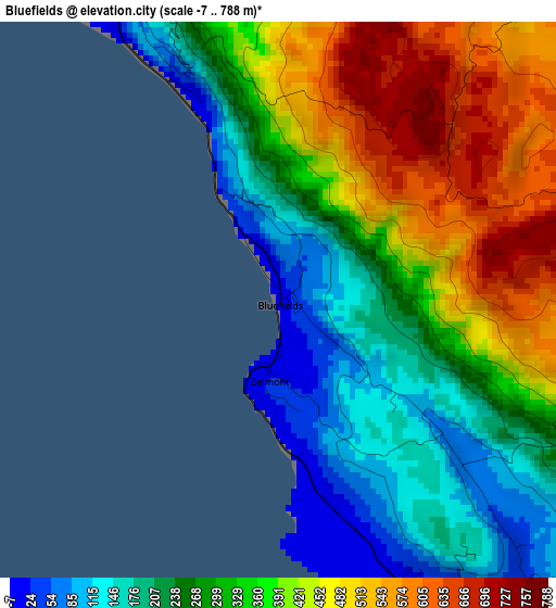
Below is the Elevation map of Bluefields, which displays elevation range with different colors. Scale of the first map is from -7 to 788 m (-23 to 2585 ft) with average elevation of 334 meters (=1096 ft) [note 1]
These maps also provides idea of topography and contour of this city, they are displayed at different zoom levels. More info about maps, scale and edge coordinates you can find below images.
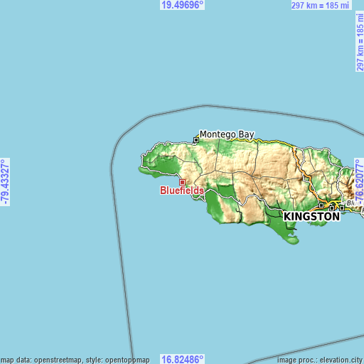
| \ | Map #1 | Topo.Map |
| Scale [m] | -7..788 m | × |
| Scale [ft] | -23..2585 ft | × |
| Average | 334 m = 1096 ft | × |
| Width | 9.29 km = 5.8 mi | 297.1 km = 184.6 mi |
| Height | 9.29 km = 5.8 mi | 297.1 km = 184.6 mi |
| ↑Max Latitude | 18.20777° | 19.49696° |
| Latitude at center | 18.16602° | 18.16602° |
| ↓Min Latitude | 18.12426° | 16.82486° |
| ← Min Longitude | -78.070965° | -79.43327° |
| Longitude center | -78.02702° | -78.02702° |
| →Max Longitude | -77.983075° | -76.62077° |
Nearby cities:
Cities around Bluefields sort by population:
• Savanna-la-Mar elevation 7 m
12.7 km,  297°
297°
• Black River 5 m
24.4 km,  129°
129°
• Anchovy 214 m
29 km,  20°
20°
• Cambridge 181 m
21 km,  38°
38°
• Lacovia 110 m
31 km,  109°
109°
• Maroon Town 441 m
31.5 km,  50°
50°
• Bethel Town 292 m
16.4 km,  29°
29°
• Petersfield 50 m
11.6 km,  336°
336°
• Darliston 422 m
9.6 km, 34°
• Maggotty 117 m
27.8 km,  91°
91°
• Cascade 329 m
27 km, 342°
• Mt Peto 328 m
22 km,  357°
357°
Multilingual:
 En español:
Bluefields elevación 18 m.
 En France:
Bluefields élévation 18 m.
 Auf Deutsch:
Bluefields höhe über dem Meeresspiegel ist 18 m.

Sources and notes:
- [note 1] Map square and city borders are not equal. Map elevation data is calculated only from area inside that square.
- [src 1] Elevation data from geonames database provided with same terms of usage.
- [src 2] The elevation map of Bluefields is generated using elevation data from NASA's 3 arcsec (90m) resolution SRTM data.
- [src 3] Base (background) map © OpenStreetMap contributors tiles are generated by Geofabrik and OpenTopoMap.
Copyright & License:
This Bluefields Elevation Map is licensed under CC BY-SA. You may reuse any part from this page, if you give a proper credit by linking to this URL:
 More info on terms of use page.