May Pen elevation
May Pen (Clarendon, May Pen Proper), Jamaica elevation is 81 meters and May Pen elevation in feet is 266 ft above sea level [src 1]. May Pen is a seat of a first-order administrative division (feature code) with elevation that is 134 meters (440 ft) smaller than average city elevation in Jamaica.
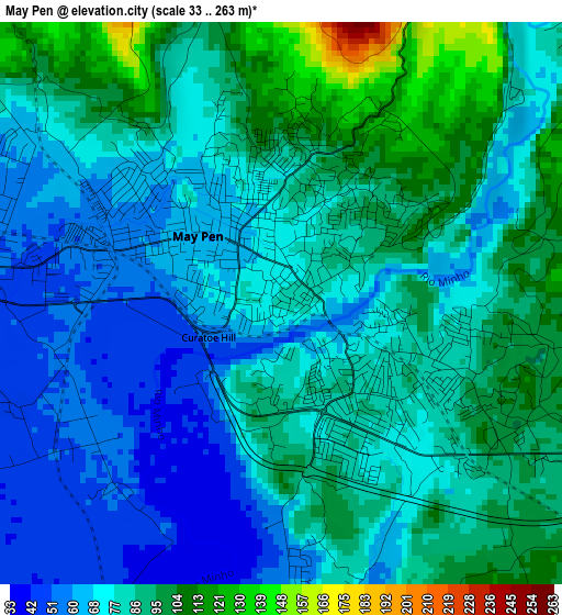
Below is the Elevation map of May Pen, which displays elevation range with different colors. Scale of the first map is from 33 to 263 m (108 to 863 ft) with average elevation of 80.2 meters (=263 ft) [note 1]
These maps also provides idea of topography and contour of this city, they are displayed at different zoom levels. More info about maps, scale and edge coordinates you can find below images.
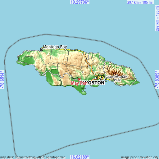
| \ | Map #1 | Map #2 | Topo.Map |
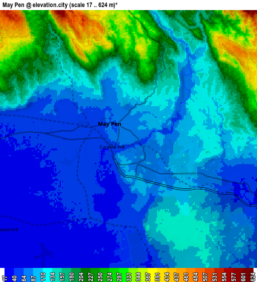
| Scale [m] | 33..263 m | 17..624 m | × |
| Scale [ft] | 108..863 ft | 56..2047 ft | × |
| Average | 80.2 m = 263 ft | 128.7 m = 422 ft | × |
| Width | 9.3 km = 5.8 mi | 18.59 km = 11.6 mi | 297.5 km = 184.9 mi |
| Height | 9.3 km = 5.8 mi | 18.59 km = 11.6 mi | 297.5 km = 184.9 mi |
| ↑Max Latitude | 18.006338° | 18.048126° | 19.29706° |
| Latitude at center | 17.96454° | 17.96454° | 17.96454° |
| ↓Min Latitude | 17.922732° | 17.880915° | 16.62189° |
| ← Min Longitude | -77.289095° | -77.333041° | -78.6514° |
| Longitude center | -77.24515° | -77.24515° | -77.24515° |
| →Max Longitude | -77.201205° | -77.157259° | -75.8389° |
Nearby cities:
Cities around May Pen sort by population:
• Old Harbour elevation 30 m
14.6 km,  100°
100°
• Hayes 38 m
9.9 km,  175°
175°
• Old Harbour Bay 5 m
16.8 km,  111°
111°
• Porus 128 m
19.3 km,  294°
294°
• Lionel Town 11 m
17.2 km, 178°
• Point Hill 613 m
20.1 km,  46°
46°
• Chapelton 271 m
13.4 km,  350°
350°
• Lluidas Vale 387 m
20.7 km,  29°
29°
• Rocky Point 1 m
21.3 km, 184°
• Race Course 20 m
14.4 km,  195°
195°
• Kellits 721 m
22.1 km, 353°
• Mocho 469 m
12.3 km,  313°
313°
Multilingual:
 En español:
May Pen elevación 81 m.
 En France:
May Pen élévation 81 m.


Sources and notes:
- [note 1] Map square and city borders are not equal. Map elevation data is calculated only from area inside that square.
- [src 1] Elevation data from geonames database provided with same terms of usage.
- [src 2] The elevation map of May Pen is generated using elevation data from NASA's 3 arcsec (90m) resolution SRTM data.
- [src 3] Base (background) map © OpenStreetMap contributors tiles are generated by Geofabrik and OpenTopoMap.
Copyright & License:
This May Pen Elevation Map is licensed under CC BY-SA. You may reuse any part from this page, if you give a proper credit by linking to this URL:
 More info on terms of use page.