Pendino elevation
Pendino (Campania, Napoli), Italy elevation is 21 meters and Pendino elevation in feet is 69 ft above sea level [src 1]. Pendino is a section of populated place (feature code) with elevation that is 301 meters (988 ft) smaller than average city elevation in Italy.
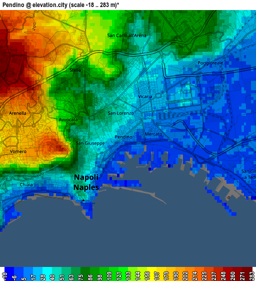
Below is the Elevation map of Pendino, which displays elevation range with different colors. Scale of the first map is from -18 to 283 m (-59 to 928 ft) with average elevation of 78.8 meters (=259 ft) [note 1]
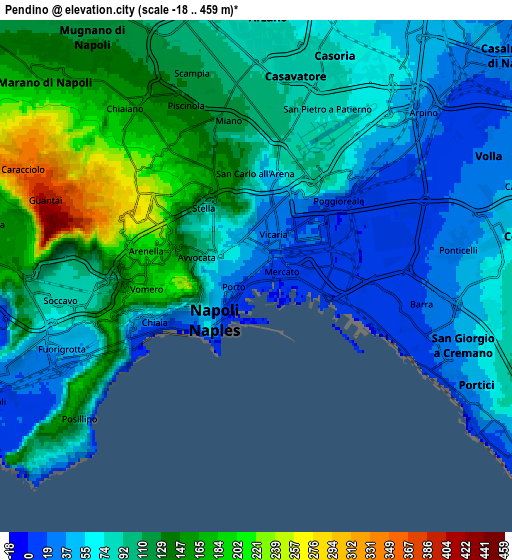
These maps also provides idea of topography and contour of this city, they are displayed at different zoom levels. More info about maps, scale and edge coordinates you can find below images.
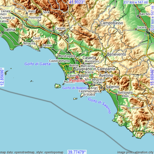
| \ | Map #1 | Map #2 | Topo.Map |
| Scale [m] | -18..283 m | -18..459 m | × |
| Scale [ft] | -59..928 ft | -59..1506 ft | × |
| Average | 78.8 m = 259 ft | 95.4 m = 313 ft | × |
| Width | 7.39 km = 4.6 mi | 14.79 km = 9.2 mi | 236.6 km = 147 mi |
| Height | 7.39 km = 4.6 mi | 14.78 km = 9.2 mi | 236.5 km = 147 mi |
| ↑Max Latitude | 40.880314° | 40.913532° | 41.9023° |
| Latitude at center | 40.84708° | 40.84708° | 40.84708° |
| ↓Min Latitude | 40.813829° | 40.780561° | 39.77479° |
| ← Min Longitude | 14.219265° | 14.175319° | 12.85696° |
| Longitude center | 14.26321° | 14.26321° | 14.26321° |
| →Max Longitude | 14.307155° | 14.351101° | 15.66946° |
Nearby cities:
Cities around Pendino sort by population:
• Naples elevation 14 m
0.7 km,  36°
36°
• San Carlo All'Arena 49 m
2 km,  359°
359°
• San Lorenzo 29 m
1.1 km,  7°
7°
• Avvocata 104 m
1.9 km,  295°
295°
• Stella 65 m
1.7 km,  327°
327°
• Montecalvario 74 m
1.5 km,  258°
258°
• San Ferdinando 53 m
2 km,  221°
221°
• Vicaria 21 m
1.8 km,  27°
27°
• Mercato 3 m
0.8 km,  105°
105°
• Zona Industriale 7 m
1.7 km,  87°
87°
• San Giuseppe 35 m
1 km, 257°
• Porto 14 m
0.6 km,  235°
235°
Multilingual:
 En español:
Pendino elevación 21 m.
 En France:
Pendino élévation 21 m.


Sources and notes:
- [note 1] Map square and city borders are not equal. Map elevation data is calculated only from area inside that square.
- [src 1] Elevation data from geonames database provided with same terms of usage.
- [src 2] The elevation map of Pendino is generated using elevation data from NASA's 3 arcsec (90m) resolution SRTM data.
- [src 3] Base (background) map © OpenStreetMap contributors tiles are generated by Geofabrik and OpenTopoMap.
Copyright & License:
This Pendino Elevation Map is licensed under CC BY-SA. You may reuse any part from this page, if you give a proper credit by linking to this URL:
 More info on terms of use page.