Aurogna elevation
Aurogna (Lombardy, Provincia di Como), Italy elevation is 391 meters and Aurogna elevation in feet is 1283 ft above sea level [src 1]. Aurogna is a seat of a third-order administrative division (feature code) with elevation that is 69 meters (226 ft) bigger than average city elevation in Italy.
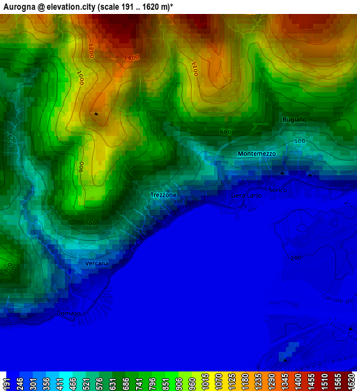
Below is the Elevation map of Aurogna, which displays elevation range with different colors. Scale of the first map is from 191 to 1620 m (627 to 5315 ft) with average elevation of 571 meters (=1873 ft) [note 1]
These maps also provides idea of topography and contour of this city, they are displayed at different zoom levels. More info about maps, scale and edge coordinates you can find below images.
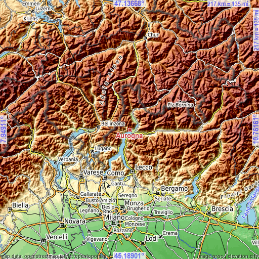
| \ | Map #1 | Topo.Map |
| Scale [m] | 191..1620 m | × |
| Scale [ft] | 627..5315 ft | × |
| Average | 571 m = 1873 ft | × |
| Width | 6.77 km = 4.2 mi | 216.6 km = 134.6 mi |
| Height | 6.77 km = 4.2 mi | 216.5 km = 134.5 mi |
| ↑Max Latitude | 46.201894° | 47.13668° |
| Latitude at center | 46.17147° | 46.17147° |
| ↓Min Latitude | 46.141029° | 45.18901° |
| ← Min Longitude | 9.311415° | 7.94911° |
| Longitude center | 9.35536° | 9.35536° |
| →Max Longitude | 9.399305° | 10.76161° |
Nearby cities:
Cities around Aurogna sort by population:
• Colico Piano elevation 266 m
4.7 km,  159°
159°
• Gravedona-San Gregorio 234 m
5 km,  236°
236°
• Dubino 202 m
5.8 km,  94°
94°
• Domaso 204 m
2.8 km,  221°
221°
• Consiglio di Rumo 239 m
5.7 km, 236°
• Vercana 333 m
2 km,  229°
229°
• Gera Lario 224 m
0.9 km,  99°
99°
• Sorico 207 m
2.2 km, 86°
• Montemezzo 563 m
1.4 km,  55°
55°
• Livo 648 m
4 km,  265°
265°
• Trezzone 454 m
0.3 km, 272°
• Peglio 623 m
4.8 km,  255°
255°
Multilingual:
 En español:
Aurogna elevación 391 m.
 En France:
Aurogna élévation 391 m.


Sources and notes:
- [note 1] Map square and city borders are not equal. Map elevation data is calculated only from area inside that square.
- [src 1] Elevation data from geonames database provided with same terms of usage.
- [src 2] The elevation map of Aurogna is generated using elevation data from NASA's 3 arcsec (90m) resolution SRTM data.
- [src 3] Base (background) map © OpenStreetMap contributors tiles are generated by Geofabrik and OpenTopoMap.
Copyright & License:
This Aurogna Elevation Map is licensed under CC BY-SA. You may reuse any part from this page, if you give a proper credit by linking to this URL:
 More info on terms of use page.