San Giovanni elevation
San Giovanni (Liguria, Provincia di Savona), Italy elevation is 209 meters and San Giovanni elevation in feet is 686 ft above sea level [src 1]. San Giovanni is a seat of a third-order administrative division (feature code) with elevation that is 113 meters (371 ft) smaller than average city elevation in Italy.
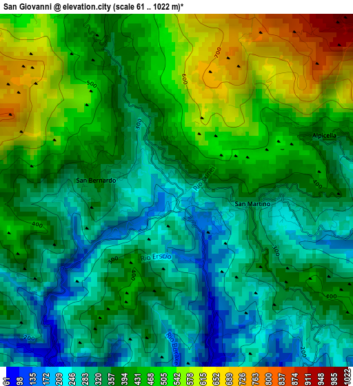
Below is the Elevation map of San Giovanni, which displays elevation range with different colors. Scale of the first map is from 61 to 1022 m (200 to 3353 ft) with average elevation of 390.9 meters (=1282 ft) [note 1]
These maps also provides idea of topography and contour of this city, they are displayed at different zoom levels. More info about maps, scale and edge coordinates you can find below images.
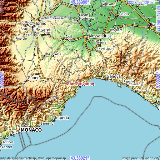
| \ | Map #1 | Topo.Map |
| Scale [m] | 61..1022 m | × |
| Scale [ft] | 200..3353 ft | × |
| Average | 390.9 m = 1282 ft | × |
| Width | 6.98 km = 4.3 mi | 223.5 km = 138.9 mi |
| Height | 6.98 km = 4.3 mi | 223.4 km = 138.8 mi |
| ↑Max Latitude | 44.425063° | 45.38988° |
| Latitude at center | 44.39367° | 44.39367° |
| ↓Min Latitude | 44.36226° | 43.38021° |
| ← Min Longitude | 8.453065° | 7.09076° |
| Longitude center | 8.49701° | 8.49701° |
| →Max Longitude | 8.540955° | 9.90326° |
Nearby cities:
Cities around San Giovanni sort by population:
• Savona elevation 15 m
9.5 km,  189°
189°
• Varazze 73 m
8.5 km,  112°
112°
• Albisola Superiore 12 m
6.2 km,  170°
170°
• Cogoleto 11 m
11.9 km,  91°
91°
• Albisola Marina 3 m
7.1 km, 171°
• Celle Ligure 44 m
6.7 km,  143°
143°
• Sciarborasca 198 m
9.4 km,  84°
84°
• Sassello 390 m
9.6 km,  358°
358°
• Urbe 562 m
12.6 km,  34°
34°
• Pontinvrea 443 m
7.2 km,  318°
318°
• Osteria dei Cacciatori-Stella 506 m
4.6 km,  333°
333°
• Giusvalla 454 m
10.2 km,  306°
306°
Multilingual:
 En español:
San Giovanni elevación 209 m.
 En France:
San Giovanni élévation 209 m.
 Auf Deutsch:
San Giovanni höhe über dem Meeresspiegel ist 209 m.

Sources and notes:
- [note 1] Map square and city borders are not equal. Map elevation data is calculated only from area inside that square.
- [src 1] Elevation data from geonames database provided with same terms of usage.
- [src 2] The elevation map of San Giovanni is generated using elevation data from NASA's 3 arcsec (90m) resolution SRTM data.
- [src 3] Base (background) map © OpenStreetMap contributors tiles are generated by Geofabrik and OpenTopoMap.
Copyright & License:
This San Giovanni Elevation Map is licensed under CC BY-SA. You may reuse any part from this page, if you give a proper credit by linking to this URL:
 More info on terms of use page.