Plan d'Introd elevation
Plan d'Introd (Aosta Valley, Valle d'Aosta), Italy elevation is 871 meters and Plan d'Introd elevation in feet is 2858 ft above sea level [src 1]. Plan d'Introd is a seat of a third-order administrative division (feature code) with elevation that is 549 meters (1801 ft) bigger than average city elevation in Italy.
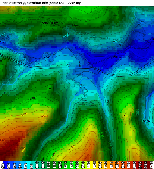
Below is the Elevation map of Plan d'Introd, which displays elevation range with different colors. Scale of the first map is from 630 to 2246 m (2067 to 7369 ft) with average elevation of 1145 meters (=3757 ft) [note 1]
These maps also provides idea of topography and contour of this city, they are displayed at different zoom levels. More info about maps, scale and edge coordinates you can find below images.
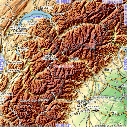
| \ | Map #1 | Topo.Map |
| Scale [m] | 630..2246 m | × |
| Scale [ft] | 2067..7369 ft | × |
| Average | 1145 m = 3757 ft | × |
| Width | 6.83 km = 4.2 mi | 218.4 km = 135.7 mi |
| Height | 6.83 km = 4.2 mi | 218.4 km = 135.7 mi |
| ↑Max Latitude | 45.722718° | 46.66569° |
| Latitude at center | 45.69203° | 45.69203° |
| ↓Min Latitude | 45.661325° | 44.70112° |
| ← Min Longitude | 7.139335° | 5.77703° |
| Longitude center | 7.18328° | 7.18328° |
| →Max Longitude | 7.227225° | 8.58953° |
Nearby cities:
Cities around Plan d'Introd sort by population:
• Saint-Pierre elevation 713 m
4 km,  57°
57°
• Montan-Angelin-Arensod 614 m
8.3 km, 60°
• Saint Maurice 640 m
6.3 km, 63°
• Aymavilles 699 m
5 km,  78°
78°
• Arvier 752 m
2 km,  304°
304°
• Jovencan 606 m
7.4 km,  69°
69°
• Introd 855 m
0.1 km,  329°
329°
• Villeneuve 667 m
2.1 km, 58°
• Saint-Nicolas 1208 m
3 km, 334°
• Rhemes-Saint-Georges 1171 m
5 km,  206°
206°
• Avise 794 m
3.9 km, 299°
• Ville Sur Sarre 1207 m
7.4 km,  51°
51°
Multilingual:
 En español:
Plan d'Introd elevación 871 m.
 En France:
Plan d'Introd élévation 871 m.
 Auf Deutsch:
Plan d'Introd höhe über dem Meeresspiegel ist 871 m.

Sources and notes:
- [note 1] Map square and city borders are not equal. Map elevation data is calculated only from area inside that square.
- [src 1] Elevation data from geonames database provided with same terms of usage.
- [src 2] The elevation map of Plan d'Introd is generated using elevation data from NASA's 3 arcsec (90m) resolution SRTM data.
- [src 3] Base (background) map © OpenStreetMap contributors tiles are generated by Geofabrik and OpenTopoMap.
Copyright & License:
This Plan d'Introd Elevation Map is licensed under CC BY-SA. You may reuse any part from this page, if you give a proper credit by linking to this URL:
 More info on terms of use page.