Novoledo elevation
Novoledo (Veneto, Provincia di Vicenza), Italy elevation is 61 meters and Novoledo elevation in feet is 200 ft above sea level [src 1]. Novoledo is a populated place (feature code) with elevation that is 261 meters (856 ft) smaller than average city elevation in Italy.
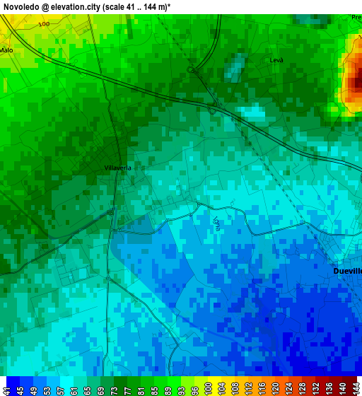
Below is the Elevation map of Novoledo, which displays elevation range with different colors. Scale of the first map is from 41 to 144 m (135 to 472 ft) with average elevation of 67.4 meters (=221 ft) [note 1]
These maps also provides idea of topography and contour of this city, they are displayed at different zoom levels. More info about maps, scale and edge coordinates you can find below images.
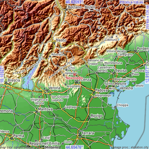
| \ | Map #1 | Topo.Map |
| Scale [m] | 41..144 m | × |
| Scale [ft] | 135..472 ft | × |
| Average | 67.4 m = 221 ft | × |
| Width | 6.83 km = 4.2 mi | 218.6 km = 135.8 mi |
| Height | 6.83 km = 4.2 mi | 218.6 km = 135.8 mi |
| ↑Max Latitude | 45.677183° | 46.62093° |
| Latitude at center | 45.64647° | 45.64647° |
| ↓Min Latitude | 45.61574° | 44.65476° |
| ← Min Longitude | 11.465575° | 10.10327° |
| Longitude center | 11.50952° | 11.50952° |
| →Max Longitude | 11.553465° | 12.91577° |
Nearby cities:
Cities around Novoledo sort by population:
• Dueville elevation 55 m
3.5 km,  110°
110°
• Caldogno-Rettorgole-Cresole 49 m
4.3 km,  186°
186°
• Monticello Conte Otto 43 m
7.3 km,  137°
137°
• Sandrigo 68 m
6.4 km,  75°
75°
• Villaverla 71 m
1.4 km,  283°
283°
• Isola Vicentina 75 m
5.3 km,  248°
248°
• Sarcedo 112 m
6.3 km,  14°
14°
• Castelnovo 65 m
5.2 km,  228°
228°
• Preara-Moraro-Levà Nord 93 m
4.5 km,  34°
34°
• Motta 46 m
5.7 km, 188°
• Crispi Cavour 43 m
7.2 km, 185°
• Montecchio Precalcino 80 m
4.7 km,  63°
63°
Multilingual:
 En español:
Novoledo elevación 61 m.
 En France:
Novoledo élévation 61 m.


Sources and notes:
- [note 1] Map square and city borders are not equal. Map elevation data is calculated only from area inside that square.
- [src 1] Elevation data from geonames database provided with same terms of usage.
- [src 2] The elevation map of Novoledo is generated using elevation data from NASA's 3 arcsec (90m) resolution SRTM data.
- [src 3] Base (background) map © OpenStreetMap contributors tiles are generated by Geofabrik and OpenTopoMap.
Copyright & License:
This Novoledo Elevation Map is licensed under CC BY-SA. You may reuse any part from this page, if you give a proper credit by linking to this URL:
 More info on terms of use page.