Forche elevation
Forche (Emilia-Romagna, Provincia di Reggio Emilia), Italy elevation is 147 meters and Forche elevation in feet is 482 ft above sea level [src 1]. Forche is a populated place (feature code) with elevation that is 175 meters (574 ft) smaller than average city elevation in Italy.
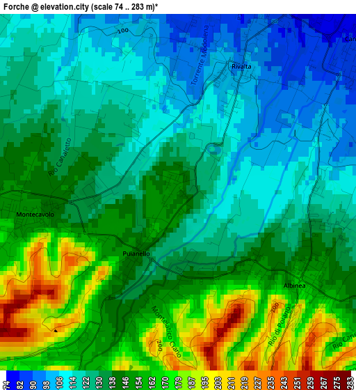
Below is the Elevation map of Forche, which displays elevation range with different colors. Scale of the first map is from 74 to 283 m (243 to 928 ft) with average elevation of 138.6 meters (=455 ft) [note 1]
These maps also provides idea of topography and contour of this city, they are displayed at different zoom levels. More info about maps, scale and edge coordinates you can find below images.
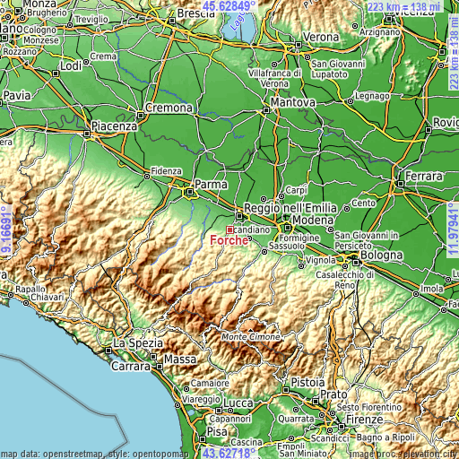
| \ | Map #1 | Topo.Map |
| Scale [m] | 74..283 m | × |
| Scale [ft] | 243..928 ft | × |
| Average | 138.6 m = 455 ft | × |
| Width | 6.95 km = 4.3 mi | 222.5 km = 138.3 mi |
| Height | 6.95 km = 4.3 mi | 222.5 km = 138.3 mi |
| ↑Max Latitude | 44.667722° | 45.62849° |
| Latitude at center | 44.63646° | 44.63646° |
| ↓Min Latitude | 44.605181° | 43.62718° |
| ← Min Longitude | 10.529215° | 9.16691° |
| Longitude center | 10.57316° | 10.57316° |
| →Max Longitude | 10.617105° | 11.97941° |
Nearby cities:
Cities around Forche sort by population:
• Reggio nell'Emilia elevation 69 m
8.3 km,  33°
33°
• Cavriago 83 m
7.5 km,  329°
329°
• Bibbiano 127 m
8.4 km,  290°
290°
• Albinea 132 m
3.1 km,  106°
106°
• Montecavolo 143 m
2.4 km,  260°
260°
• Quattro Castella 167 m
7.8 km,  268°
268°
• Fogliano 71 m
5.8 km,  77°
77°
• Vezzano sul Crostolo 188 m
4.4 km,  210°
210°
• Puianello 143 m
1.3 km, 212°
• Borzano 162 m
6.2 km,  125°
125°
• Codemondo-Quaresimo 65 m
6.3 km,  343°
343°
• San Bartolomeo 107 m
5 km, 327°
Multilingual:
 En español:
Forche elevación 147 m.
 En France:
Forche élévation 147 m.


Sources and notes:
- [note 1] Map square and city borders are not equal. Map elevation data is calculated only from area inside that square.
- [src 1] Elevation data from geonames database provided with same terms of usage.
- [src 2] The elevation map of Forche is generated using elevation data from NASA's 3 arcsec (90m) resolution SRTM data.
- [src 3] Base (background) map © OpenStreetMap contributors tiles are generated by Geofabrik and OpenTopoMap.
Copyright & License:
This Forche Elevation Map is licensed under CC BY-SA. You may reuse any part from this page, if you give a proper credit by linking to this URL:
 More info on terms of use page.