Villapinta elevation
Villapinta (Lombardy, Provincia di Sondrio), Italy elevation is 272 meters and Villapinta elevation in feet is 892 ft above sea level [src 1]. Villapinta is a populated place (feature code) with elevation that is 50 meters (164 ft) smaller than average city elevation in Italy.
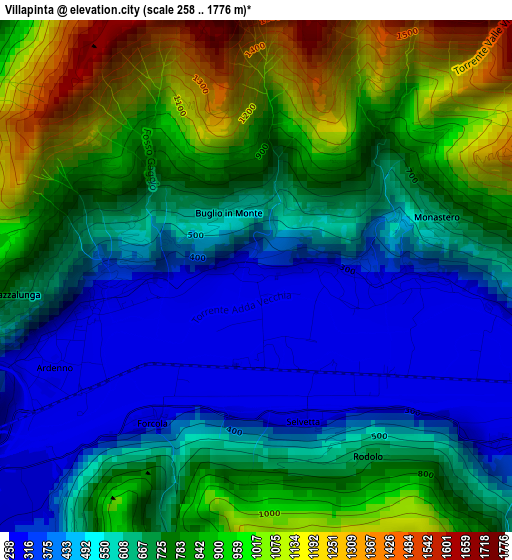
Below is the Elevation map of Villapinta, which displays elevation range with different colors. Scale of the first map is from 258 to 1776 m (846 to 5827 ft) with average elevation of 704.7 meters (=2312 ft) [note 1]
These maps also provides idea of topography and contour of this city, they are displayed at different zoom levels. More info about maps, scale and edge coordinates you can find below images.
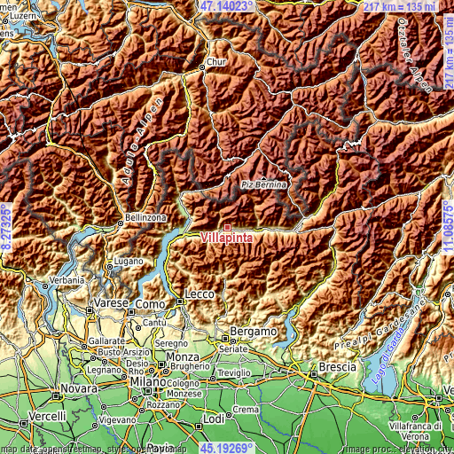
| \ | Map #1 | Topo.Map |
| Scale [m] | 258..1776 m | × |
| Scale [ft] | 846..5827 ft | × |
| Average | 704.7 m = 2312 ft | × |
| Width | 6.77 km = 4.2 mi | 216.5 km = 134.5 mi |
| Height | 6.77 km = 4.2 mi | 216.5 km = 134.5 mi |
| ↑Max Latitude | 46.205502° | 47.14023° |
| Latitude at center | 46.17508° | 46.17508° |
| ↓Min Latitude | 46.144641° | 45.19269° |
| ← Min Longitude | 9.635555° | 8.27325° |
| Longitude center | 9.6795° | 9.6795° |
| →Max Longitude | 9.723445° | 11.08575° |
Nearby cities:
Cities around Villapinta sort by population:
• Talamona elevation 282 m
6.5 km,  231°
231°
• Berbenno di Valtellina 344 m
5.3 km,  100°
100°
• Ardenno 268 m
2.6 km,  250°
250°
• Val Masino 824 m
5.5 km,  324°
324°
• Colorina 313 m
4.5 km,  121°
121°
• Forcola 267 m
2.4 km,  218°
218°
• Buglio in Monte 589 m
1 km,  341°
341°
• Cataeggio 813 m
5.4 km, 323°
• Fusine 293 m
6.1 km, 117°
• Sirta 269 m
2.3 km, 217°
• Cedrasco 295 m
7.4 km,  112°
112°
• Dazio 588 m
6.3 km,  255°
255°
Multilingual:
 En español:
Villapinta elevación 272 m.
 En France:
Villapinta élévation 272 m.
 Auf Deutsch:
Villapinta höhe über dem Meeresspiegel ist 272 m.

Sources and notes:
- [note 1] Map square and city borders are not equal. Map elevation data is calculated only from area inside that square.
- [src 1] Elevation data from geonames database provided with same terms of usage.
- [src 2] The elevation map of Villapinta is generated using elevation data from NASA's 3 arcsec (90m) resolution SRTM data.
- [src 3] Base (background) map © OpenStreetMap contributors tiles are generated by Geofabrik and OpenTopoMap.
Copyright & License:
This Villapinta Elevation Map is licensed under CC BY-SA. You may reuse any part from this page, if you give a proper credit by linking to this URL:
 More info on terms of use page.