Villanova elevation
Villanova (Lombardy, Provincia di Monza e della Brianza), Italy elevation is 224 meters and Villanova elevation in feet is 735 ft above sea level [src 1]. Villanova is a populated place (feature code) with elevation that is 98 meters (322 ft) smaller than average city elevation in Italy.
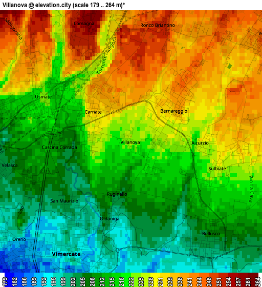
Below is the Elevation map of Villanova, which displays elevation range with different colors. Scale of the first map is from 179 to 264 m (587 to 866 ft) with average elevation of 220.8 meters (=724 ft) [note 1]
These maps also provides idea of topography and contour of this city, they are displayed at different zoom levels. More info about maps, scale and edge coordinates you can find below images.
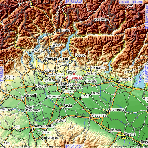
| \ | Map #1 | Topo.Map |
| Scale [m] | 179..264 m | × |
| Scale [ft] | 587..866 ft | × |
| Average | 220.8 m = 724 ft | × |
| Width | 6.83 km = 4.2 mi | 218.6 km = 135.8 mi |
| Height | 6.83 km = 4.2 mi | 218.6 km = 135.8 mi |
| ↑Max Latitude | 45.670986° | 46.61484° |
| Latitude at center | 45.64027° | 45.64027° |
| ↓Min Latitude | 45.609537° | 44.64845° |
| ← Min Longitude | 9.347925° | 7.98562° |
| Longitude center | 9.39187° | 9.39187° |
| →Max Longitude | 9.435815° | 10.79812° |
Nearby cities:
Cities around Villanova sort by population:
• Vimercate elevation 197 m
3.3 km,  213°
213°
• Bernareggio 234 m
1.3 km,  50°
50°
• Usmate-Velate 221 m
2.4 km,  290°
290°
• Carnate 236 m
1.4 km,  310°
310°
• Bellusco 209 m
3.1 km,  137°
137°
• Lomagna 258 m
3.1 km,  337°
337°
• Osnago 247 m
3.9 km,  0°
0°
• Sulbiate 238 m
2.8 km,  89°
89°
• Ronco Briantino 246 m
3.1 km,  19°
19°
• Verderio Inferiore 242 m
4.3 km, 48°
• Aicurzio 232 m
1.8 km, 91°
• Velasca 211 m
3 km,  251°
251°
Multilingual:
 En español:
Villanova elevación 224 m.
 En France:
Villanova élévation 224 m.
 Auf Deutsch:
Villanova höhe über dem Meeresspiegel ist 224 m.

Sources and notes:
- [note 1] Map square and city borders are not equal. Map elevation data is calculated only from area inside that square.
- [src 1] Elevation data from geonames database provided with same terms of usage.
- [src 2] The elevation map of Villanova is generated using elevation data from NASA's 3 arcsec (90m) resolution SRTM data.
- [src 3] Base (background) map © OpenStreetMap contributors tiles are generated by Geofabrik and OpenTopoMap.
Copyright & License:
This Villanova Elevation Map is licensed under CC BY-SA. You may reuse any part from this page, if you give a proper credit by linking to this URL:
 More info on terms of use page.