Regoledo elevation
Regoledo (Lombardy, Provincia di Sondrio), Italy elevation is 219 meters and Regoledo elevation in feet is 719 ft above sea level [src 1]. Regoledo is a seat of a third-order administrative division (feature code) with elevation that is 103 meters (338 ft) smaller than average city elevation in Italy.
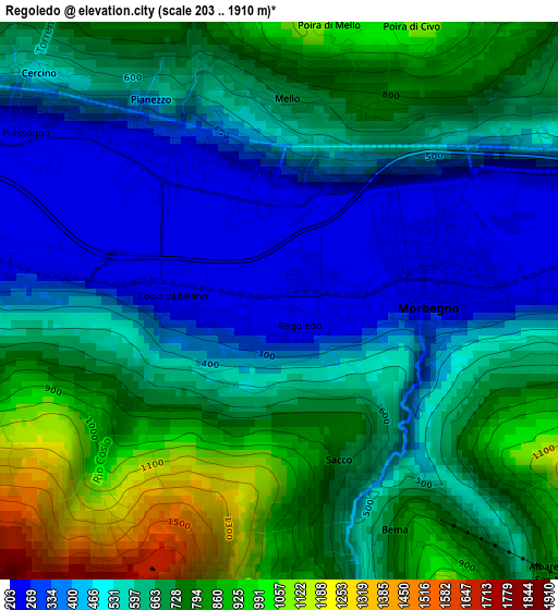
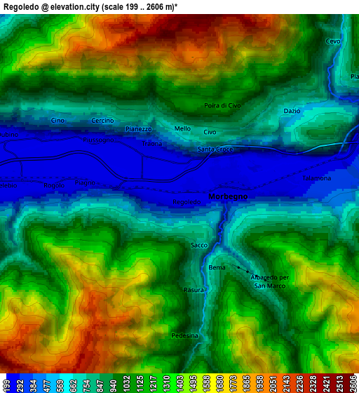
Below is the Elevation map of Regoledo, which displays elevation range with different colors. Scale of the first map is from 203 to 1910 m (666 to 6266 ft) with average elevation of 618.4 meters (=2029 ft) [note 1]
These maps also provides idea of topography and contour of this city, they are displayed at different zoom levels. More info about maps, scale and edge coordinates you can find below images.
| \ | Map #1 | Map #2 | Topo.Map |
| Scale [m] | 203..1910 m | 199..2606 m | × |
| Scale [ft] | 666..6266 ft | 653..8550 ft | × |
| Average | 618.4 m = 2029 ft | 1054.6 m = 3460 ft | × |
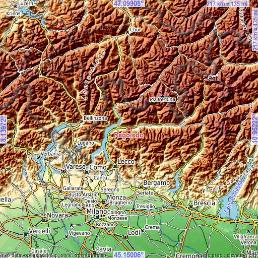
| Width | 6.77 km = 4.2 mi | 13.54 km = 8.4 mi | 216.7 km = 134.7 mi |
| Height | 6.77 km = 4.2 mi | 13.54 km = 8.4 mi | 216.7 km = 134.7 mi |
| ↑Max Latitude | 46.163635° | 46.194063° | 47.09908° |
| Latitude at center | 46.13319° | 46.13319° | 46.13319° |
| ↓Min Latitude | 46.102728° | 46.072249° | 45.15006° |
| ← Min Longitude | 9.502025° | 9.458079° | 8.13972° |
| Longitude center | 9.54597° | 9.54597° | 9.54597° |
| →Max Longitude | 9.589915° | 9.633861° | 10.95222° |
Nearby cities:
Cities around Regoledo sort by population:
• Morbegno elevation 241 m
2.2 km,  78°
78°
• Cosio Valtellino 227 m
0.5 km,  64°
64°
• Traona 226 m
1.9 km,  326°
326°
• Mello 698 m
2.4 km,  2°
2°
• Mantello 216 m
4.9 km,  296°
296°
• Rogolo 207 m
4.7 km,  275°
275°
• Dazio 588 m
5.2 km,  53°
53°
• Albaredo 928 m
4.8 km,  134°
134°
• Rasura 823 m
3.7 km,  171°
171°
• Cercino 526 m
4 km,  313°
313°
• Bema 795 m
3.1 km,  153°
153°
• Serone 724 m
3.8 km, 47°
Multilingual:
 En español:
Regoledo elevación 219 m.
 En France:
Regoledo élévation 219 m.
 Auf Deutsch:
Regoledo höhe über dem Meeresspiegel ist 219 m.

Sources and notes:
- [note 1] Map square and city borders are not equal. Map elevation data is calculated only from area inside that square.
- [src 1] Elevation data from geonames database provided with same terms of usage.
- [src 2] The elevation map of Regoledo is generated using elevation data from NASA's 3 arcsec (90m) resolution SRTM data.
- [src 3] Base (background) map © OpenStreetMap contributors tiles are generated by Geofabrik and OpenTopoMap.
Copyright & License:
This Regoledo Elevation Map is licensed under CC BY-SA. You may reuse any part from this page, if you give a proper credit by linking to this URL:
 More info on terms of use page.