Roveleto elevation
Roveleto (Emilia-Romagna, Provincia di Piacenza), Italy elevation is 67 meters and Roveleto elevation in feet is 220 ft above sea level [src 1]. Roveleto is a seat of a third-order administrative division (feature code) with elevation that is 255 meters (837 ft) smaller than average city elevation in Italy.
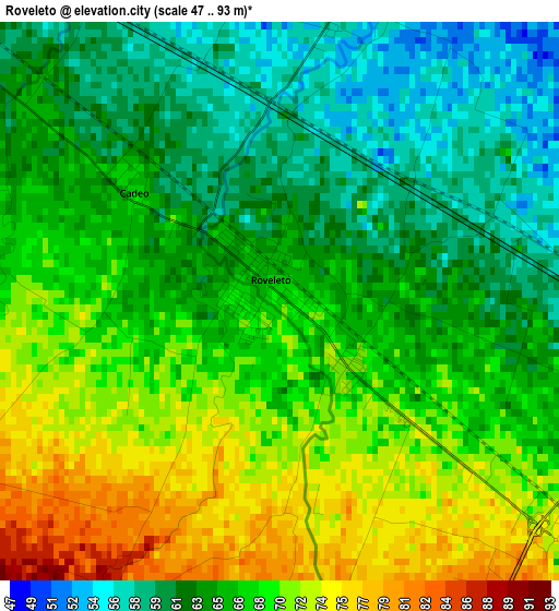
Below is the Elevation map of Roveleto, which displays elevation range with different colors. Scale of the first map is from 47 to 93 m (154 to 305 ft) with average elevation of 66.3 meters (=218 ft) [note 1]
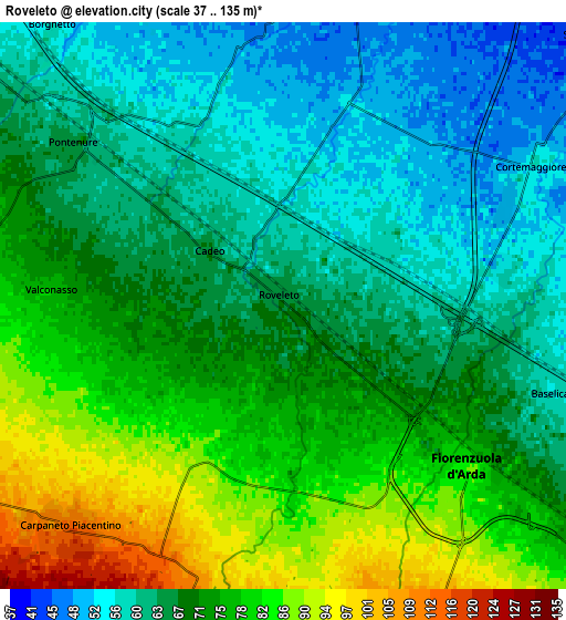
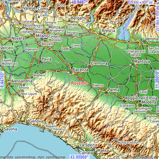
These maps also provides idea of topography and contour of this city, they are displayed at different zoom levels. More info about maps, scale and edge coordinates you can find below images.
| \ | Map #1 | Map #2 | Topo.Map |
| Scale [m] | 47..93 m | 37..135 m | × |
| Scale [ft] | 154..305 ft | 121..443 ft | × |
| Average | 66.3 m = 218 ft | 69.8 m = 229 ft | × |
| Width | 6.91 km = 4.3 mi | 13.83 km = 8.6 mi | 221.3 km = 137.5 mi |
| Height | 6.91 km = 4.3 mi | 13.83 km = 8.6 mi | 221.3 km = 137.5 mi |
| ↑Max Latitude | 44.994405° | 45.025474° | 45.9497° |
| Latitude at center | 44.96332° | 44.96332° | 44.96332° |
| ↓Min Latitude | 44.932218° | 44.901098° | 43.95969° |
| ← Min Longitude | 9.809955° | 9.766009° | 8.44765° |
| Longitude center | 9.8539° | 9.8539° | 9.8539° |
| →Max Longitude | 9.897845° | 9.941791° | 11.26015° |
Nearby cities:
Cities around Roveleto sort by population:
• Fiorenzuola d'Arda elevation 82 m
6.4 km,  132°
132°
• Pontenure 63 m
6.3 km,  308°
308°
• Carpaneto Piacentino 115 m
7.6 km,  223°
223°
• San Giorgio Piacentino 104 m
9.2 km,  262°
262°
• Cortemaggiore 53 m
6.7 km,  61°
61°
• Caorso 48 m
9.7 km,  9°
9°
• Castell'Arquato 154 m
12.2 km,  172°
172°
• Alseno 82 m
11.3 km, 130°
• San Polo 87 m
9.1 km,  280°
280°
• Villanova 43 m
13.3 km, 58°
• Besenzone 52 m
8.5 km,  71°
71°
• San Pietro in Cerro 52 m
9.9 km,  49°
49°
Multilingual:
 En español:
Roveleto elevación 67 m.
 En France:
Roveleto élévation 67 m.


Sources and notes:
- [note 1] Map square and city borders are not equal. Map elevation data is calculated only from area inside that square.
- [src 1] Elevation data from geonames database provided with same terms of usage.
- [src 2] The elevation map of Roveleto is generated using elevation data from NASA's 3 arcsec (90m) resolution SRTM data.
- [src 3] Base (background) map © OpenStreetMap contributors tiles are generated by Geofabrik and OpenTopoMap.
Copyright & License:
This Roveleto Elevation Map is licensed under CC BY-SA. You may reuse any part from this page, if you give a proper credit by linking to this URL:
 More info on terms of use page.