Ranica elevation
Ranica (Lombardy, Provincia di Bergamo), Italy elevation is 287 meters and Ranica elevation in feet is 942 ft above sea level [src 1]. Ranica is a seat of a third-order administrative division (feature code) with elevation that is 35 meters (115 ft) smaller than average city elevation in Italy.
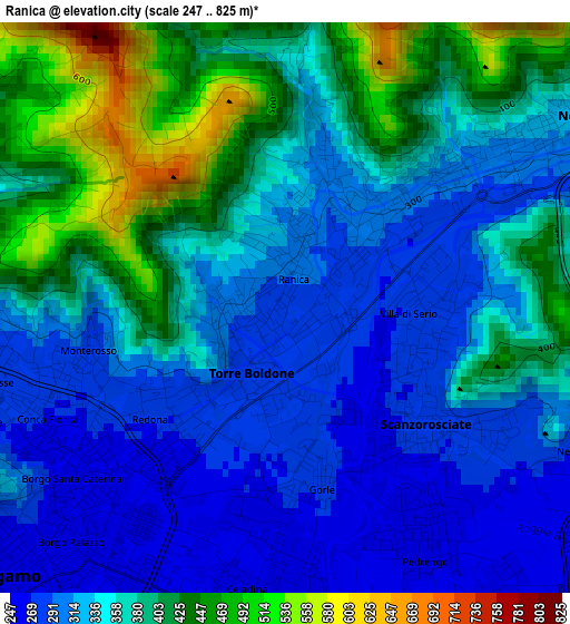
Below is the Elevation map of Ranica, which displays elevation range with different colors. Scale of the first map is from 247 to 825 m (810 to 2707 ft) with average elevation of 355.9 meters (=1168 ft) [note 1]
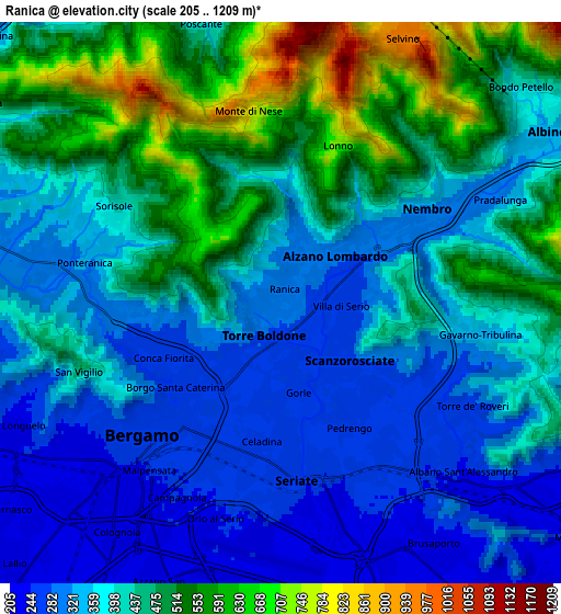
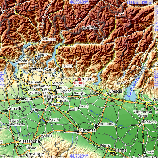
These maps also provides idea of topography and contour of this city, they are displayed at different zoom levels. More info about maps, scale and edge coordinates you can find below images.
| \ | Map #1 | Map #2 | Topo.Map |
| Scale [m] | 247..825 m | 205..1209 m | × |
| Scale [ft] | 810..2707 ft | 673..3967 ft | × |
| Average | 355.9 m = 1168 ft | 411.5 m = 1350 ft | × |
| Width | 6.82 km = 4.2 mi | 13.64 km = 8.5 mi | 218.3 km = 135.6 mi |
| Height | 6.82 km = 4.2 mi | 13.64 km = 8.5 mi | 218.3 km = 135.6 mi |
| ↑Max Latitude | 45.753951° | 45.784605° | 46.69639° |
| Latitude at center | 45.72328° | 45.72328° | 45.72328° |
| ↓Min Latitude | 45.692592° | 45.661888° | 44.73291° |
| ← Min Longitude | 9.669405° | 9.625459° | 8.3071° |
| Longitude center | 9.71335° | 9.71335° | 9.71335° |
| →Max Longitude | 9.757295° | 9.801241° | 11.1196° |
Nearby cities:
Cities around Ranica sort by population:
• Bergamo elevation 260 m
4.7 km,  229°
229°
• Seriate 249 m
4.3 km,  168°
168°
• Alzano Lombardo 335 m
1.8 km,  33°
33°
• Nembro 319 m
4.4 km,  58°
58°
• Torre Boldone 286 m
0.8 km,  212°
212°
• Gorle 270 m
2.4 km,  179°
179°
• Villa di Serio 280 m
1.7 km,  92°
92°
• Scanzo-Rosciate 276 m
2.2 km,  129°
129°
• Pedrengo 259 m
3.5 km,  151°
151°
• Gavarno-Tribulina 343 m
4.8 km,  97°
97°
• Negrone 278 m
3.8 km,  112°
112°
• Gavarno Rinnovata 317 m
3.9 km, 87°
Multilingual:
 En español:
Ranica elevación 287 m.
 En France:
Ranica élévation 287 m.


Sources and notes:
- [note 1] Map square and city borders are not equal. Map elevation data is calculated only from area inside that square.
- [src 1] Elevation data from geonames database provided with same terms of usage.
- [src 2] The elevation map of Ranica is generated using elevation data from NASA's 3 arcsec (90m) resolution SRTM data.
- [src 3] Base (background) map © OpenStreetMap contributors tiles are generated by Geofabrik and OpenTopoMap.
Copyright & License:
This Ranica Elevation Map is licensed under CC BY-SA. You may reuse any part from this page, if you give a proper credit by linking to this URL:
 More info on terms of use page.