Castelletto d'Erro elevation
Castelletto d'Erro (Piedmont, Provincia di Alessandria), Italy elevation is 528 meters and Castelletto d'Erro elevation in feet is 1732 ft above sea level [src 1]. Castelletto d'Erro is a seat of a third-order administrative division (feature code) with elevation that is 206 meters (676 ft) bigger than average city elevation in Italy.
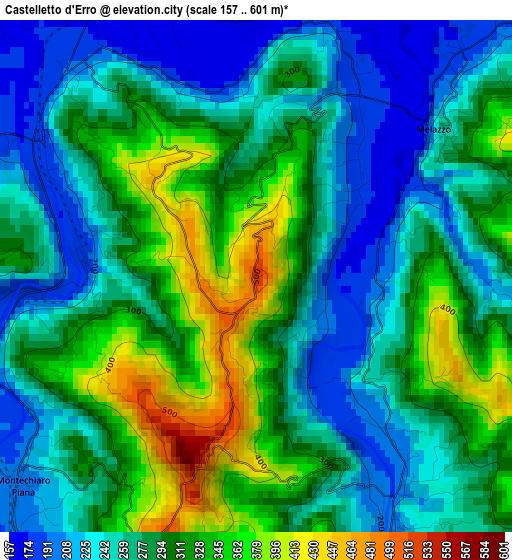
Below is the Elevation map of Castelletto d'Erro, which displays elevation range with different colors. Scale of the first map is from 157 to 601 m (515 to 1972 ft) with average elevation of 285.5 meters (=937 ft) [note 1]
These maps also provides idea of topography and contour of this city, they are displayed at different zoom levels. More info about maps, scale and edge coordinates you can find below images.
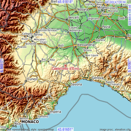
| \ | Map #1 | Topo.Map |
| Scale [m] | 157..601 m | × |
| Scale [ft] | 515..1972 ft | × |
| Average | 285.5 m = 937 ft | × |
| Width | 6.96 km = 4.3 mi | 222.6 km = 138.3 mi |
| Height | 6.96 km = 4.3 mi | 222.6 km = 138.3 mi |
| ↑Max Latitude | 44.657238° | 45.61818° |
| Latitude at center | 44.62597° | 44.62597° |
| ↓Min Latitude | 44.594685° | 43.61651° |
| ← Min Longitude | 8.350475° | 6.98817° |
| Longitude center | 8.39442° | 8.39442° |
| →Max Longitude | 8.438365° | 9.80067° |
Nearby cities:
Cities around Castelletto d'Erro sort by population:
• Bistagno elevation 178 m
4.3 km,  334°
334°
• Monastero Bormida 195 m
5.9 km,  295°
295°
• Terzo 212 m
5.4 km,  23°
23°
• Cartosio 249 m
4.5 km,  152°
152°
• Ponti 188 m
2.4 km,  276°
276°
• Melazzo 236 m
3.1 km,  50°
50°
• Ponzone 602 m
6.6 km,  129°
129°
• Sessame 320 m
6.7 km,  317°
317°
• Cavatore 512 m
4.7 km,  83°
83°
• Denice 375 m
5.7 km,  238°
238°
• Montechiaro d'Acqui 529 m
3.7 km,  199°
199°
• Malvicino 437 m
7.6 km,  168°
168°
Multilingual:
 En español:
Castelletto d'Erro elevación 528 m.
 En France:
Castelletto d'Erro élévation 528 m.
 Auf Deutsch:
Castelletto d'Erro höhe über dem Meeresspiegel ist 528 m.
 На русском:
Castelletto d'Erro высота над уровнем моря 528 м
Sources and notes:
- [note 1] Map square and city borders are not equal. Map elevation data is calculated only from area inside that square.
- [src 1] Elevation data from geonames database provided with same terms of usage.
- [src 2] The elevation map of Castelletto d'Erro is generated using elevation data from NASA's 3 arcsec (90m) resolution SRTM data.
- [src 3] Base (background) map © OpenStreetMap contributors tiles are generated by Geofabrik and OpenTopoMap.
Copyright & License:
This Castelletto d'Erro Elevation Map is licensed under CC BY-SA. You may reuse any part from this page, if you give a proper credit by linking to this URL:
 More info on terms of use page.