Montaldo Roero elevation
Montaldo Roero (Piedmont, Provincia di Cuneo), Italy elevation is 358 meters and Montaldo Roero elevation in feet is 1175 ft above sea level [src 1]. Montaldo Roero is a seat of a third-order administrative division (feature code) with elevation that is 36 meters (118 ft) bigger than average city elevation in Italy.
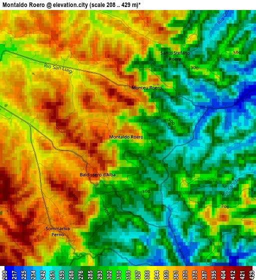
Below is the Elevation map of Montaldo Roero, which displays elevation range with different colors. Scale of the first map is from 208 to 429 m (682 to 1407 ft) with average elevation of 318.5 meters (=1045 ft) [note 1]
These maps also provides idea of topography and contour of this city, they are displayed at different zoom levels. More info about maps, scale and edge coordinates you can find below images.
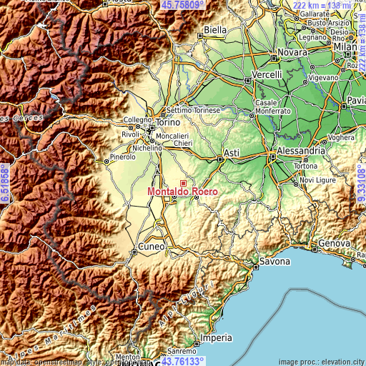
| \ | Map #1 | Topo.Map |
| Scale [m] | 208..429 m | × |
| Scale [ft] | 682..1407 ft | × |
| Average | 318.5 m = 1045 ft | × |
| Width | 6.94 km = 4.3 mi | 222 km = 137.9 mi |
| Height | 6.94 km = 4.3 mi | 222 km = 137.9 mi |
| ↑Max Latitude | 44.799531° | 45.75809° |
| Latitude at center | 44.76834° | 44.76834° |
| ↓Min Latitude | 44.737132° | 43.76133° |
| ← Min Longitude | 7.880885° | 6.51858° |
| Longitude center | 7.92483° | 7.92483° |
| →Max Longitude | 7.968775° | 9.33108° |
Nearby cities:
Cities around Montaldo Roero sort by population:
• Canale elevation 191 m
6.2 km,  61°
61°
• Montà 310 m
5.7 km,  24°
24°
• Sommariva Perno 372 m
3.2 km,  217°
217°
• Monticello d'Alba 341 m
5.7 km,  165°
165°
• Corneliano d'Alba 209 m
4.4 km,  144°
144°
• Vezza d'Alba 204 m
6.6 km,  95°
95°
• Villa 372 m
3.1 km, 217°
• Piobesi d'Alba 197 m
5.7 km,  131°
131°
• Baldissero d'Alba 375 m
1.5 km,  240°
240°
• Villa 358 m
5.6 km, 166°
• Monteu Roero 363 m
1.5 km,  27°
27°
• Santo Stefano Roero 325 m
2.6 km, 29°
Multilingual:
 En español:
Montaldo Roero elevación 358 m.
 En France:
Montaldo Roero élévation 358 m.
 Auf Deutsch:
Montaldo Roero höhe über dem Meeresspiegel ist 358 m.

Sources and notes:
- [note 1] Map square and city borders are not equal. Map elevation data is calculated only from area inside that square.
- [src 1] Elevation data from geonames database provided with same terms of usage.
- [src 2] The elevation map of Montaldo Roero is generated using elevation data from NASA's 3 arcsec (90m) resolution SRTM data.
- [src 3] Base (background) map © OpenStreetMap contributors tiles are generated by Geofabrik and OpenTopoMap.
Copyright & License:
This Montaldo Roero Elevation Map is licensed under CC BY-SA. You may reuse any part from this page, if you give a proper credit by linking to this URL:
 More info on terms of use page.