Pratiglione elevation
Pratiglione (Piedmont, Torino), Italy elevation is 615 meters and Pratiglione elevation in feet is 2018 ft above sea level [src 1]. Pratiglione is a seat of a third-order administrative division (feature code) with elevation that is 293 meters (961 ft) bigger than average city elevation in Italy.
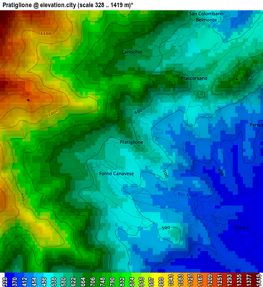
Below is the Elevation map of Pratiglione, which displays elevation range with different colors. Scale of the first map is from 328 to 1419 m (1076 to 4656 ft) with average elevation of 653.9 meters (=2145 ft) [note 1]
These maps also provides idea of topography and contour of this city, they are displayed at different zoom levels. More info about maps, scale and edge coordinates you can find below images.
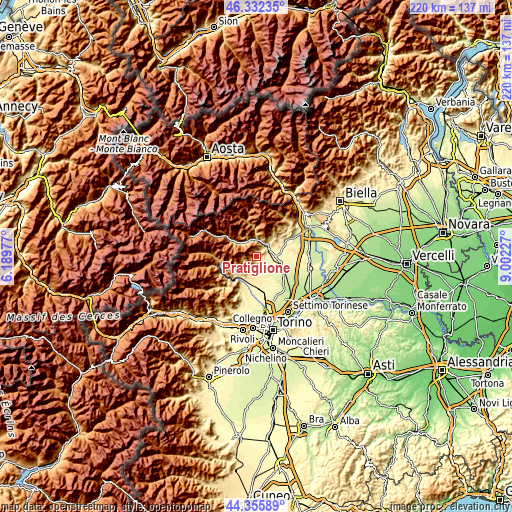
| \ | Map #1 | Topo.Map |
| Scale [m] | 328..1419 m | × |
| Scale [ft] | 1076..4656 ft | × |
| Average | 653.9 m = 2145 ft | × |
| Width | 6.87 km = 4.3 mi | 219.8 km = 136.6 mi |
| Height | 6.87 km = 4.3 mi | 219.8 km = 136.6 mi |
| ↑Max Latitude | 45.383624° | 46.33235° |
| Latitude at center | 45.35275° | 45.35275° |
| ↓Min Latitude | 45.321859° | 44.35589° |
| ← Min Longitude | 7.552075° | 6.18977° |
| Longitude center | 7.59602° | 7.59602° |
| →Max Longitude | 7.639965° | 9.00227° |
Nearby cities:
Cities around Pratiglione sort by population:
• Cuorgnè elevation 399 m
6.2 km,  43°
43°
• Forno Canavese 516 m
1.2 km,  204°
204°
• Valperga 380 m
5.4 km,  69°
69°
• Rivara 319 m
4.8 km,  120°
120°
• Busano 320 m
5.3 km, 116°
• Rocca Canavese 411 m
5.1 km, 195°
• Pertusio 371 m
3.6 km,  84°
84°
• Levone 350 m
4.1 km,  168°
168°
• Canischio 668 m
2.5 km,  0°
0°
• Prascorsano 594 m
2.3 km,  45°
45°
• San Ponso 346 m
5.9 km,  91°
91°
• San Colombano Belmonte 526 m
3.8 km,  30°
30°
Multilingual:
 En español:
Pratiglione elevación 615 m.
 En France:
Pratiglione élévation 615 m.
 Auf Deutsch:
Pratiglione höhe über dem Meeresspiegel ist 615 m.

Sources and notes:
- [note 1] Map square and city borders are not equal. Map elevation data is calculated only from area inside that square.
- [src 1] Elevation data from geonames database provided with same terms of usage.
- [src 2] The elevation map of Pratiglione is generated using elevation data from NASA's 3 arcsec (90m) resolution SRTM data.
- [src 3] Base (background) map © OpenStreetMap contributors tiles are generated by Geofabrik and OpenTopoMap.
Copyright & License:
This Pratiglione Elevation Map is licensed under CC BY-SA. You may reuse any part from this page, if you give a proper credit by linking to this URL:
 More info on terms of use page.