Bondo elevation
Bondo (Trentino-Alto Adige, Provincia autonoma di Trento), Italy elevation is 820 meters and Bondo elevation in feet is 2690 ft above sea level [src 1]. Bondo is a seat of a third-order administrative division (feature code) with elevation that is 498 meters (1634 ft) bigger than average city elevation in Italy.
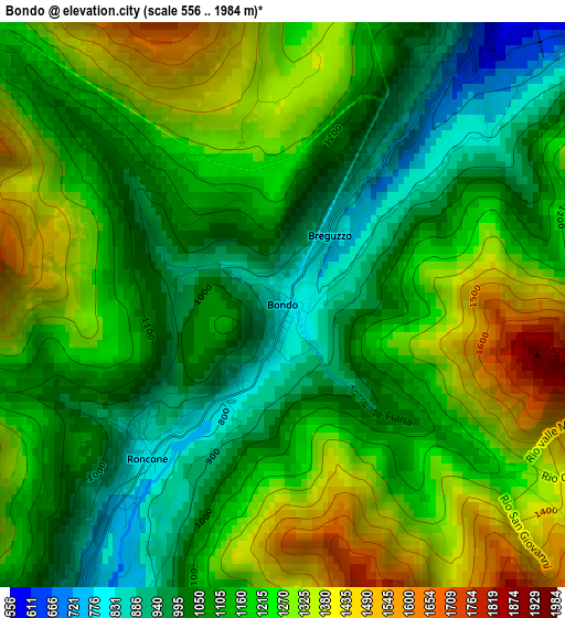
Below is the Elevation map of Bondo, which displays elevation range with different colors. Scale of the first map is from 556 to 1984 m (1824 to 6509 ft) with average elevation of 1166 meters (=3825 ft) [note 1]
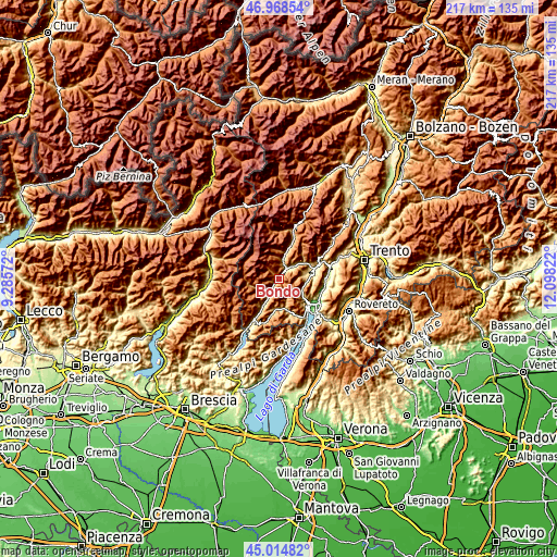
These maps also provides idea of topography and contour of this city, they are displayed at different zoom levels. More info about maps, scale and edge coordinates you can find below images.
| \ | Map #1 | Topo.Map |
| Scale [m] | 556..1984 m | × |
| Scale [ft] | 1824..6509 ft | × |
| Average | 1166 m = 3825 ft | × |
| Width | 6.79 km = 4.2 mi | 217.2 km = 135 mi |
| Height | 6.79 km = 4.2 mi | 217.2 km = 135 mi |
| ↑Max Latitude | 46.030818° | 46.96854° |
| Latitude at center | 46.0003° | 46.0003° |
| ↓Min Latitude | 45.969765° | 45.01482° |
| ← Min Longitude | 10.648025° | 9.28572° |
| Longitude center | 10.69197° | 10.69197° |
| →Max Longitude | 10.735915° | 12.09822° |
Nearby cities:
Cities around Bondo sort by population:
• Tione di Trento elevation 568 m
4.7 km,  34°
34°
• Pieve di Bono 539 m
7.6 km,  211°
211°
• Roncone 806 m
2.7 km,  223°
223°
• Creto 523 m
7.7 km, 211°
• Breguzzo 810 m
0.8 km, 31°
• Villa Rendena 610 m
7.1 km,  12°
12°
• Preore 529 m
7.3 km,  45°
45°
• Zuclo 596 m
5.9 km, 50°
• Bolbeno 574 m
5 km,  44°
44°
• Praso 795 m
7.1 km, 217°
• Bersone 621 m
7.7 km, 216°
• Lardaro 724 m
4.2 km, 214°
Multilingual:
 En español:
Bondo elevación 820 m.
 En France:
Bondo élévation 820 m.


Sources and notes:
- [note 1] Map square and city borders are not equal. Map elevation data is calculated only from area inside that square.
- [src 1] Elevation data from geonames database provided with same terms of usage.
- [src 2] The elevation map of Bondo is generated using elevation data from NASA's 3 arcsec (90m) resolution SRTM data.
- [src 3] Base (background) map © OpenStreetMap contributors tiles are generated by Geofabrik and OpenTopoMap.
Copyright & License:
This Bondo Elevation Map is licensed under CC BY-SA. You may reuse any part from this page, if you give a proper credit by linking to this URL:
 More info on terms of use page.